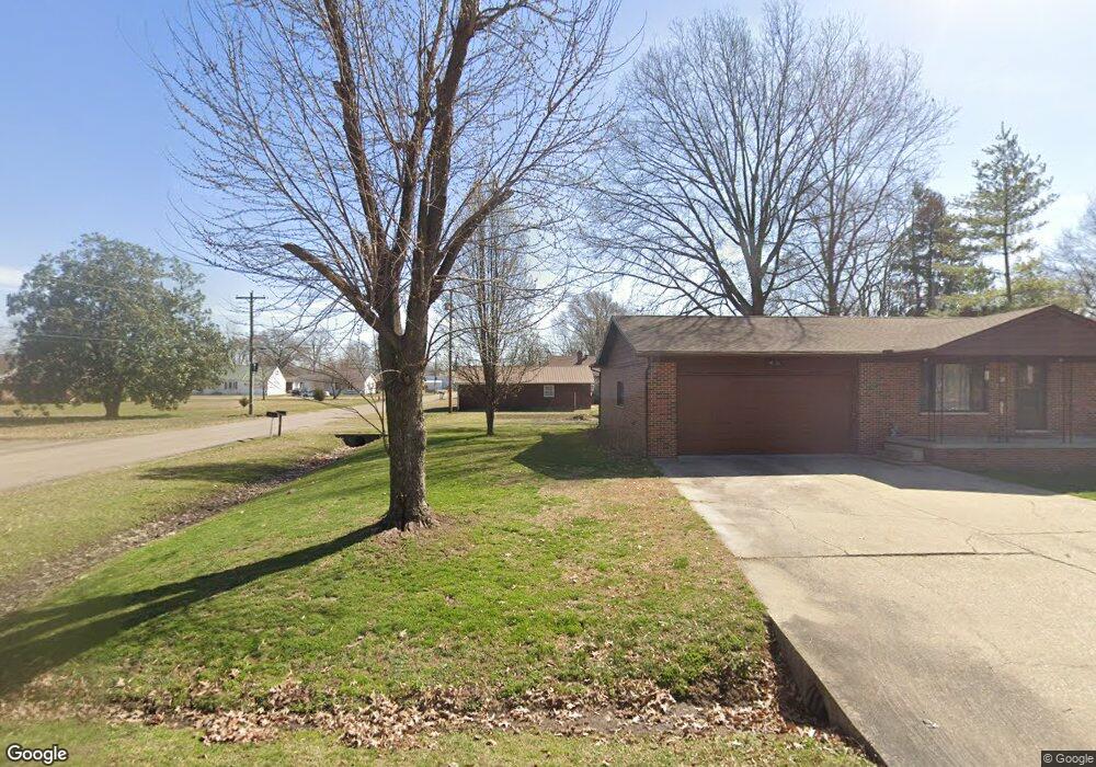
500 Poplar St Advance, MO 63730
Estimated Value: $187,000 - $197,292
3
Beds
2
Baths
1,602
Sq Ft
$119/Sq Ft
Est. Value
About This Home
This home is located at 500 Poplar St, Advance, MO 63730 and is currently estimated at $191,431, approximately $119 per square foot. 500 Poplar St is a home with nearby schools including Advance Elementary School, Advance High School, and Crowley Ridge Mennonite School.
Ownership History
Date
Name
Owned For
Owner Type
Purchase Details
Closed on
Jan 22, 2022
Sold by
Campbell J W & L L Tr
Bought by
Mayberry Todd
Current Estimated Value
Home Financials for this Owner
Home Financials are based on the most recent Mortgage that was taken out on this home.
Original Mortgage
$120,500
Outstanding Balance
$111,541
Interest Rate
3.45%
Mortgage Type
Construction
Estimated Equity
$79,890
Purchase Details
Closed on
Apr 20, 2018
Sold by
Landing Timothy S and Landing Victoria N
Bought by
Georger Eric L
Home Financials for this Owner
Home Financials are based on the most recent Mortgage that was taken out on this home.
Original Mortgage
$70,000
Interest Rate
4.46%
Mortgage Type
New Conventional
Create a Home Valuation Report for This Property
The Home Valuation Report is an in-depth analysis detailing your home's value as well as a comparison with similar homes in the area
Purchase History
| Date | Buyer | Sale Price | Title Company |
|---|---|---|---|
| Mayberry Todd | $150,625 | National Title & Escrow Inc | |
| Georger Eric L | $87,500 | United Land Title |
Source: Public Records
Mortgage History
| Date | Status | Borrower | Loan Amount |
|---|---|---|---|
| Open | Mayberry Todd | $120,500 | |
| Previous Owner | Georger Eric L | $70,000 |
Source: Public Records
Tax History
| Year | Tax Paid | Tax Assessment Tax Assessment Total Assessment is a certain percentage of the fair market value that is determined by local assessors to be the total taxable value of land and additions on the property. | Land | Improvement |
|---|---|---|---|---|
| 2025 | $854 | $20,577 | $0 | $0 |
| 2024 | $9 | $19,057 | $0 | $0 |
| 2023 | $750 | $16,815 | $0 | $0 |
| 2022 | $701 | $15,732 | $0 | $0 |
| 2021 | $700 | $15,732 | $0 | $0 |
| 2020 | $657 | $14,307 | $0 | $0 |
| 2019 | $653 | $14,554 | $0 | $0 |
| 2018 | $640 | $14,307 | $0 | $0 |
| 2016 | $566 | $12,996 | $0 | $0 |
| 2015 | -- | $3,553 | $0 | $0 |
| 2014 | -- | $3,458 | $0 | $0 |
| 2013 | -- | $0 | $0 | $0 |
Source: Public Records
Map
Nearby Homes
- 306 E South St
- 1028 W Old Highway C
- 524 Bcr
- 11604 Kel Tec Ln
- 33445 Maple St
- 20768 County Road 310
- 21212 State Highway O
- 30913 State Highway 25
- 17251 County Road 214
- 188 County Road 273
- 27859 State Highway K
- 826 Bcr 636
- 000 State Highway K
- 16314 State Highway K Unit SY
- 0 County Road 261
- 27726 Babler Rd
- 0 Tract 5 County Road 260 262
- 0 Tract 3 County Road 260 262
- 0 Tract 2 County Road 260 262
- 0 Tract 4 County Road 260 262
- 500 W Whitwell St
- 501 W Sturdivant St
- 108 N Poplar
- 505 W Sturdivant St
- 503 W Whitwell St
- 202 N Poplar St
- 406 W Whitwell St
- 202 N Vine St
- 405 W Whitwell St
- 403 W Sturdivant St
- 404 W Whitwell St
- 502 W Sturdivant St
- 403 W Whitwell St
- 102 S Vine St
- 502 W Maple St
- 204 Poplar St
- 504 W Maple St
- 408 W Sturdivant St
- 107 N Cypress St
- 401 W Sturdivant St
Your Personal Tour Guide
Ask me questions while you tour the home.