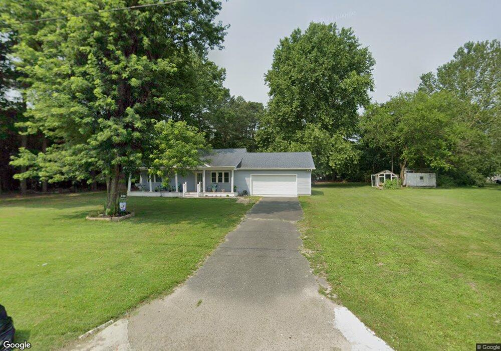
500 Railroad Ave Hurlock, MD 21643
Estimated Value: $197,451 - $277,000
--
Bed
1
Bath
1,212
Sq Ft
$195/Sq Ft
Est. Value
About This Home
This home is located at 500 Railroad Ave, Hurlock, MD 21643 and is currently estimated at $236,363, approximately $195 per square foot. 500 Railroad Ave is a home located in Dorchester County with nearby schools including Hurlock Elementary School, North Dorchester Middle School, and North Dorchester High School.
Ownership History
Date
Name
Owned For
Owner Type
Purchase Details
Closed on
Mar 11, 2016
Sold by
Dorchester County
Bought by
Sosa Eduardo and Garrido Aspron Ivonne
Current Estimated Value
Purchase Details
Closed on
Jul 6, 2015
Sold by
Spears Michael J
Bought by
Dorchester County Maryland
Purchase Details
Closed on
Sep 2, 1986
Sold by
Sappington Emma L
Bought by
Forkum Keith L and Forkum Carol S
Home Financials for this Owner
Home Financials are based on the most recent Mortgage that was taken out on this home.
Original Mortgage
$39,000
Interest Rate
9.93%
Purchase Details
Closed on
Oct 31, 1983
Sold by
Harvey Clarence Ben And
Bought by
Sappington Emma L
Create a Home Valuation Report for This Property
The Home Valuation Report is an in-depth analysis detailing your home's value as well as a comparison with similar homes in the area
Home Values in the Area
Average Home Value in this Area
Purchase History
| Date | Buyer | Sale Price | Title Company |
|---|---|---|---|
| Sosa Eduardo | $10,000 | Attorney | |
| Dorchester County Maryland | $7,374 | Attorney | |
| Forkum Keith L | $39,000 | -- | |
| Sappington Emma L | $32,000 | -- |
Source: Public Records
Mortgage History
| Date | Status | Borrower | Loan Amount |
|---|---|---|---|
| Previous Owner | Forkum Keith L | $39,000 |
Source: Public Records
Tax History Compared to Growth
Tax History
| Year | Tax Paid | Tax Assessment Tax Assessment Total Assessment is a certain percentage of the fair market value that is determined by local assessors to be the total taxable value of land and additions on the property. | Land | Improvement |
|---|---|---|---|---|
| 2025 | $401 | $162,867 | $0 | $0 |
| 2024 | $2,543 | $149,700 | $28,500 | $121,200 |
| 2023 | $2,543 | $142,267 | $0 | $0 |
| 2022 | $2,456 | $134,833 | $0 | $0 |
| 2021 | $1,756 | $127,400 | $23,500 | $103,900 |
| 2020 | $1,756 | $94,733 | $0 | $0 |
| 2019 | $1,150 | $62,067 | $0 | $0 |
| 2018 | $544 | $29,400 | $23,500 | $5,900 |
| 2017 | $546 | $29,400 | $0 | $0 |
| 2016 | -- | $29,400 | $0 | $0 |
| 2015 | -- | $81,600 | $0 | $0 |
| 2014 | -- | $81,600 | $0 | $0 |
Source: Public Records
Map
Nearby Homes
- 101 Thompson St
- 311 Prospect St
- 404 S Main St
- 101 Martin Dr
- 312 Charles St
- 309 S Main St
- 305 S Main St
- 202 Railroad Ave
- 212 S Main St
- 200 Railroad Ave
- 207 S Main St
- 200 Hurlock Ave
- 207 Broad St
- 101 Commerce St
- 401 N Main St
- 405 Collins Ave
- 302 Glen Oak Cir
- 4903 Harrison Ferry Rd
- 100 Barnes Ct
- 108 Montana Ct
- 117 Thompson St
- 115 Thompson St
- 118 Dorchester Ave
- 113 Thompson St
- 116 Dorchester Ave
- 112 Dorchester Ave
- 111 Thompson St
- 206 Thompson St
- 204 Thompson St
- 117 Dorchester Ave
- 110 Dorchester Ave
- 0 Main St Unit MDDO2003530
- 202 Thompson St
- 109 Thompson St
- 115 Dorchester Ave
- 113 Dorchester Ave
- 119 Dorchester Ave
- 111 Dorchester Ave
- 200 Thompson St
- 121 Dorchester Ave