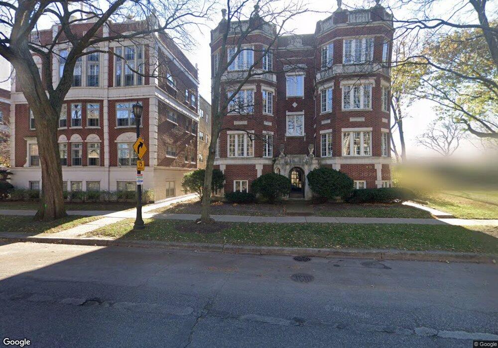
500 Sheridan Rd Unit 1W Evanston, IL 60202
Southeast Evanston NeighborhoodEstimated Value: $410,000 - $470,000
3
Beds
--
Bath
1,600
Sq Ft
$275/Sq Ft
Est. Value
About This Home
This home is located at 500 Sheridan Rd Unit 1W, Evanston, IL 60202 and is currently estimated at $440,321, approximately $275 per square foot. 500 Sheridan Rd Unit 1W is a home located in Cook County with nearby schools including Lincoln Elementary School, Washington Elementary School, and Nichols Middle School.
Ownership History
Date
Name
Owned For
Owner Type
Purchase Details
Closed on
May 19, 2025
Sold by
Hinde Deborah R
Bought by
Johnsen Margaret A
Current Estimated Value
Purchase Details
Closed on
Jun 14, 2023
Sold by
Hinde Deborah R
Bought by
Hinde Deborah R and Deborah R Hinde Revocable Trust
Purchase Details
Closed on
Sep 27, 1997
Sold by
Chilstrom Marne
Bought by
Hinde Deborah
Home Financials for this Owner
Home Financials are based on the most recent Mortgage that was taken out on this home.
Original Mortgage
$117,000
Interest Rate
7.54%
Mortgage Type
Purchase Money Mortgage
Create a Home Valuation Report for This Property
The Home Valuation Report is an in-depth analysis detailing your home's value as well as a comparison with similar homes in the area
Home Values in the Area
Average Home Value in this Area
Purchase History
| Date | Buyer | Sale Price | Title Company |
|---|---|---|---|
| Johnsen Margaret A | $489,000 | None Listed On Document | |
| Hinde Deborah R | -- | None Listed On Document | |
| Hinde Deborah | $118,000 | -- |
Source: Public Records
Mortgage History
| Date | Status | Borrower | Loan Amount |
|---|---|---|---|
| Previous Owner | Hinde Deborah | $117,000 |
Source: Public Records
Tax History Compared to Growth
Tax History
| Year | Tax Paid | Tax Assessment Tax Assessment Total Assessment is a certain percentage of the fair market value that is determined by local assessors to be the total taxable value of land and additions on the property. | Land | Improvement |
|---|---|---|---|---|
| 2024 | $6,426 | $32,510 | $3,216 | $29,294 |
| 2023 | $6,122 | $32,510 | $3,216 | $29,294 |
| 2022 | $6,122 | $32,510 | $3,216 | $29,294 |
| 2021 | $4,819 | $24,155 | $1,715 | $22,440 |
| 2020 | $6,385 | $29,970 | $1,715 | $28,255 |
| 2019 | $6,812 | $32,501 | $1,715 | $30,786 |
| 2018 | $4,910 | $21,356 | $1,447 | $19,909 |
| 2017 | $4,798 | $21,356 | $1,447 | $19,909 |
| 2016 | $4,773 | $21,356 | $1,447 | $19,909 |
| 2015 | $4,464 | $19,271 | $1,206 | $18,065 |
| 2014 | $4,436 | $19,271 | $1,206 | $18,065 |
| 2013 | $4,318 | $19,271 | $1,206 | $18,065 |
Source: Public Records
Map
Nearby Homes
- 530 Sheridan Rd Unit 2B
- 548 Sheridan Rd Unit 2N
- 530 Michigan Ave Unit 3E
- 616 Michigan Ave Unit G
- 318 South Blvd
- 711 Michigan Ave
- 1628 W Juneway Terrace Unit 1
- 623 Judson Ave
- 7756 N Sheridan Rd Unit 16
- 7730 N Paulina St Unit 1
- 7711 N Marshfield Ave Unit 1
- 7708 N Ashland Ave
- 608 Hinman Ave Unit 4S
- 7637 N Bosworth Ave Unit 2N
- 7637 N Bosworth Ave Unit 3S
- 7639 N Greenview Ave Unit 1E
- 826 Michigan Ave Unit 2B
- 319 Kedzie St Unit 3E
- 321 Kedzie St Unit GND
- 606B South Blvd
- 500 Sheridan Rd Unit P3
- 500 Sheridan Rd Unit 1P
- 500 Sheridan Rd Unit P2
- 500 Sheridan Rd Unit BE
- 500 Sheridan Rd Unit 1E
- 500 Sheridan Rd Unit 3E
- 500 Sheridan Rd Unit 2E
- 500 Sheridan Rd Unit 2W
- 500 Sheridan Rd Unit 3W
- 500 Sheridan Rd Unit BW
- 500 Sheridan Rd Unit GE
- 502 Sheridan Rd Unit 3W
- 494 Sheridan Rd Unit 4943
- 494 Sheridan Rd Unit 4942
- 494 Sheridan Rd Unit 4941
- 494 Sheridan Rd Unit 1
- 496 Sheridan Rd Unit 4963
- 496 Sheridan Rd Unit 4961
- 496 Sheridan Rd Unit 4962
- 496 Sheridan Rd Unit 3