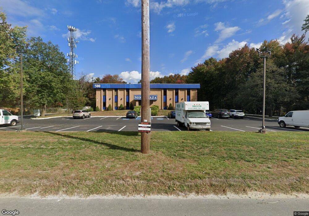
500 State Route 33 Unit 2 A Millstone Township, NJ 08535
Estimated Value: $2,052,705
--
Bed
--
Bath
6,000
Sq Ft
$342/Sq Ft
Est. Value
About This Home
This home is located at 500 State Route 33 Unit 2 A, Millstone Township, NJ 08535 and is currently estimated at $2,052,705, approximately $342 per square foot. 500 State Route 33 Unit 2 A is a home located in Monmouth County with nearby schools including Millstone Township Primary School, Millstone Township Elementary School, and Millstone Township Middle School.
Ownership History
Date
Name
Owned For
Owner Type
Purchase Details
Closed on
Apr 9, 2012
Sold by
Scrm Llc
Bought by
Sidd & Associates Llc
Current Estimated Value
Purchase Details
Closed on
Jun 13, 2001
Sold by
Ferraro Thomas
Bought by
Scrm Llc
Home Financials for this Owner
Home Financials are based on the most recent Mortgage that was taken out on this home.
Original Mortgage
$350,000
Interest Rate
7.09%
Mortgage Type
Commercial
Purchase Details
Closed on
Nov 29, 1994
Sold by
Levton Inc
Bought by
Blue Line Drywall & Bldrs
Create a Home Valuation Report for This Property
The Home Valuation Report is an in-depth analysis detailing your home's value as well as a comparison with similar homes in the area
Home Values in the Area
Average Home Value in this Area
Purchase History
| Date | Buyer | Sale Price | Title Company |
|---|---|---|---|
| Sidd & Associates Llc | $900,000 | None Available | |
| Scrm Llc | $500,000 | -- | |
| Blue Line Drywall & Bldrs | $70,000 | -- |
Source: Public Records
Mortgage History
| Date | Status | Borrower | Loan Amount |
|---|---|---|---|
| Previous Owner | Scrm Llc | $350,000 |
Source: Public Records
Tax History Compared to Growth
Tax History
| Year | Tax Paid | Tax Assessment Tax Assessment Total Assessment is a certain percentage of the fair market value that is determined by local assessors to be the total taxable value of land and additions on the property. | Land | Improvement |
|---|---|---|---|---|
| 2025 | $19,251 | $912,200 | $239,400 | $672,800 |
| 2024 | $19,974 | $803,800 | $297,000 | $506,800 |
| 2023 | $19,974 | $803,800 | $297,000 | $506,800 |
| 2022 | $19,404 | $803,800 | $297,000 | $506,800 |
| 2021 | $19,404 | $803,800 | $297,000 | $506,800 |
| 2020 | $19,187 | $803,800 | $297,000 | $506,800 |
| 2019 | $18,825 | $803,800 | $297,000 | $506,800 |
| 2018 | $18,359 | $803,800 | $297,000 | $506,800 |
| 2017 | $18,278 | $803,800 | $297,000 | $506,800 |
| 2016 | $18,142 | $803,800 | $297,000 | $506,800 |
| 2015 | $19,082 | $803,800 | $297,000 | $506,800 |
| 2014 | $15,947 | $613,100 | $265,800 | $347,300 |
Source: Public Records
Map
Nearby Homes
- 491 State Route 33
- 12 Dugans Grove Rd
- 12 Dugans Grove
- Calder Plan at Canter Square
- Mueller Plan at Canter Square
- Mueller Elite Plan at Canter Square
- Coleston Plan at Canter Square
- Bradfield Plan at Canter Square
- 172 Mustang Dr
- 45 Iron Ore Rd
- 146 Mustang Dr
- 6 Colt Ln
- 12 Colt Ln
- 5 Colt Ln
- 13 Indian Path
- 130 Mustang Dr
- 49 Mustang Dr
- 47 Mustang Dr
- 45 Mustang Dr
- 23 Mustang Dr
- 500 State Route 33
- 500 New Jersey 33
- 500 New Jersey 33 Unit 2 I
- 500 New Jersey 33 Unit 2 A
- 490 33 Unit 1
- 490 New Jersey 33 Unit 1
- 506 State Route 33
- 490 Highway 33 Unit 3
- 490 State Route 33 Unit 3
- 490 State Route 33 Unit 6
- 490 State Route 33 Unit Building 2 Unit 3
- 480 State Route 33 Unit 5 & 6
- 480 State Route 33 Unit 4
- 480 State Route 33
- 514 New Jersey 33
- 17 Iron Ore Rd
- 21 Iron Ore Rd
- 19 Iron Ore Rd
- 16 Dugans Grove
- 23 Iron Ore Rd