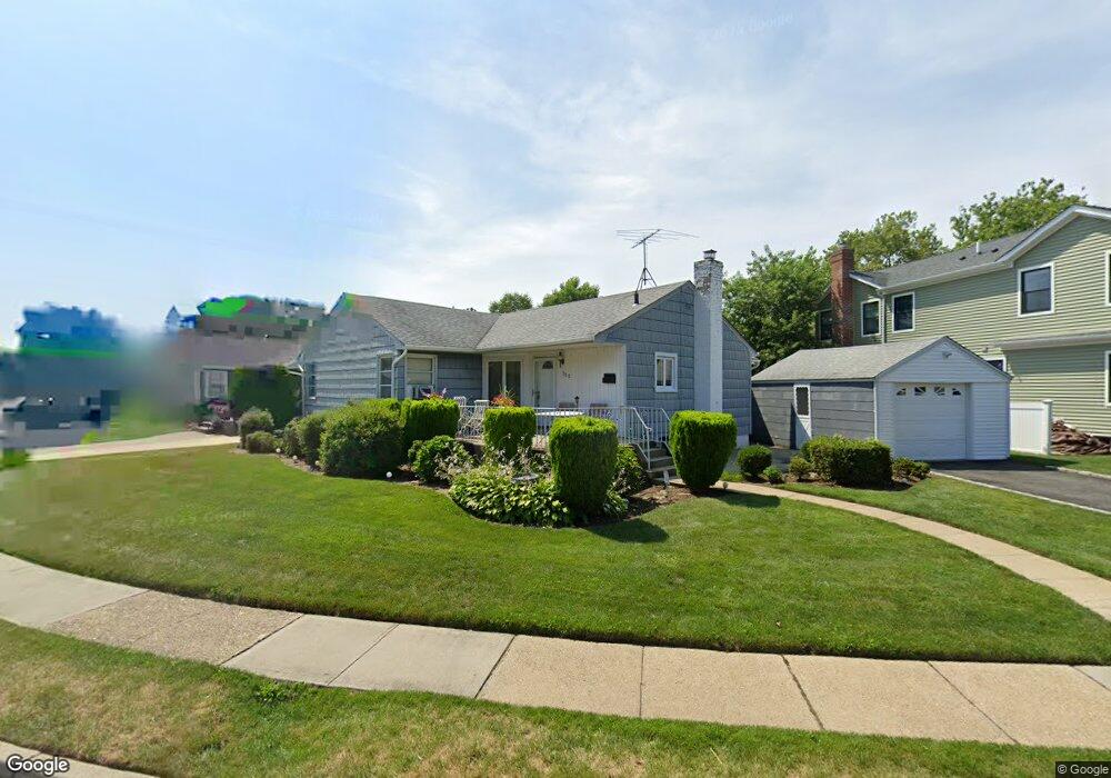
500 Steven Ave West Hempstead, NY 11552
Estimated Value: $711,543 - $801,000
--
Bed
2
Baths
1,465
Sq Ft
$516/Sq Ft
Est. Value
About This Home
This home is located at 500 Steven Ave, West Hempstead, NY 11552 and is currently estimated at $756,272, approximately $516 per square foot. 500 Steven Ave is a home located in Nassau County with nearby schools including Hebrew Academy of Nassau County (HANC).
Ownership History
Date
Name
Owned For
Owner Type
Purchase Details
Closed on
May 20, 2025
Sold by
Pompei Jean M and Caroline C Palladino Fam Irrevocable Tr
Bought by
Pompei Jean M and Descendants Separate Trust
Current Estimated Value
Purchase Details
Closed on
Aug 24, 2016
Sold by
Palladino Caroline and Florence Newman Family Trust
Bought by
Pompei Jean M
Create a Home Valuation Report for This Property
The Home Valuation Report is an in-depth analysis detailing your home's value as well as a comparison with similar homes in the area
Home Values in the Area
Average Home Value in this Area
Purchase History
| Date | Buyer | Sale Price | Title Company |
|---|---|---|---|
| Pompei Jean M | -- | Metropolitan Abstract Corp | |
| Pompei Jean M | -- | Stewart Title | |
| Pompei Jean M | -- | Stewart Title | |
| Pompei Jean M | -- | Stewart Title | |
| Pompei Jean M | -- | Stewart Title |
Source: Public Records
Tax History Compared to Growth
Tax History
| Year | Tax Paid | Tax Assessment Tax Assessment Total Assessment is a certain percentage of the fair market value that is determined by local assessors to be the total taxable value of land and additions on the property. | Land | Improvement |
|---|---|---|---|---|
| 2025 | $10,376 | $515 | $304 | $211 |
| 2024 | $3,953 | $510 | $301 | $209 |
| 2023 | $7,110 | $534 | $315 | $219 |
| 2022 | $7,110 | $534 | $315 | $219 |
| 2021 | $7,709 | $536 | $316 | $220 |
| 2020 | $5,476 | $509 | $445 | $64 |
| 2019 | $4,903 | $545 | $446 | $99 |
| 2018 | $4,957 | $582 | $0 | $0 |
| 2017 | $2,491 | $618 | $449 | $169 |
| 2016 | $5,371 | $655 | $430 | $225 |
| 2015 | $2,869 | $691 | $454 | $237 |
| 2014 | $2,869 | $691 | $454 | $237 |
| 2013 | $2,804 | $725 | $476 | $249 |
Source: Public Records
Map
Nearby Homes
- 518 Nassau Blvd
- 350 Paul Place
- 576 Western Park Dr
- 600 Dogwood Ave
- 582 Gaynor Place
- 613 Adams Ave
- 635 Hempstead Ave
- 19 Richard St
- 590 Langley Ave
- 303 Nassau Blvd
- 757 Marion St
- 686 Tanwood Dr
- 537 Madison Ave
- 791 Caryl St
- 708 Anderson Ave
- 279 Semton Blvd
- 231 Dogwood Ave
- 198 Guildford Ct
- 726 Meisser St
- 249 Grange St
- 542 Buxton Ave
- 490 Steven Ave
- 484 Steven Ave
- 485 Dunster Dr
- 550 Buxton Ave
- 537 Buxton Ave
- 495 Steven Ave
- 501 Steven Ave
- 566 Edward Terrace
- 505 Steven Ave
- 543 Buxton Ave
- 537 Steven Ave
- 481 Dunster Dr
- 489 Steven Ave
- 478 Steven Ave
- 549 Buxton Ave
- 495 Dunster Dr
- 475 Dunster Dr
- 483 Steven Ave
- 555 Buxton Ave