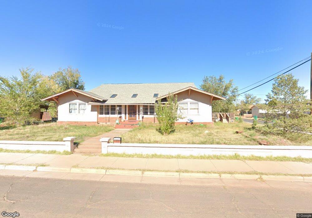
500 W Aspinwall St Winslow, AZ 86047
Estimated Value: $368,000 - $534,000
--
Bed
--
Bath
4,911
Sq Ft
$95/Sq Ft
Est. Value
About This Home
This home is located at 500 W Aspinwall St, Winslow, AZ 86047 and is currently estimated at $468,501, approximately $95 per square foot. 500 W Aspinwall St is a home located in Navajo County with nearby schools including Winslow High School and Red Sands Christian School.
Ownership History
Date
Name
Owned For
Owner Type
Purchase Details
Closed on
Aug 21, 2007
Sold by
First American Title Insurance Company
Bought by
Spann Donald G and Mccoy Christine
Current Estimated Value
Home Financials for this Owner
Home Financials are based on the most recent Mortgage that was taken out on this home.
Original Mortgage
$22,500
Interest Rate
6.46%
Mortgage Type
Seller Take Back
Purchase Details
Closed on
Dec 15, 2006
Sold by
Baker Ursula P and Hawley Ursula P
Bought by
Baker Ursula P and Ursula P Baker Revocable Trust
Create a Home Valuation Report for This Property
The Home Valuation Report is an in-depth analysis detailing your home's value as well as a comparison with similar homes in the area
Home Values in the Area
Average Home Value in this Area
Purchase History
| Date | Buyer | Sale Price | Title Company |
|---|---|---|---|
| Spann Donald G | $30,000 | Landamerica Transnation Titl | |
| Baker Ursula P | -- | None Available |
Source: Public Records
Mortgage History
| Date | Status | Borrower | Loan Amount |
|---|---|---|---|
| Previous Owner | Spann Donald G | $22,500 |
Source: Public Records
Tax History Compared to Growth
Tax History
| Year | Tax Paid | Tax Assessment Tax Assessment Total Assessment is a certain percentage of the fair market value that is determined by local assessors to be the total taxable value of land and additions on the property. | Land | Improvement |
|---|---|---|---|---|
| 2026 | $2,640 | -- | -- | -- |
| 2025 | $2,515 | $76,531 | $1,410 | $75,121 |
| 2024 | $2,479 | $66,742 | $1,192 | $65,550 |
| 2023 | $2,515 | $51,545 | $1,192 | $50,353 |
| 2022 | $2,399 | $0 | $0 | $0 |
| 2021 | $2,413 | $0 | $0 | $0 |
| 2020 | $2,342 | $0 | $0 | $0 |
| 2019 | $2,254 | $0 | $0 | $0 |
| 2018 | $1,766 | $0 | $0 | $0 |
| 2017 | $2,159 | $0 | $0 | $0 |
| 2016 | $2,074 | $0 | $0 | $0 |
| 2015 | $2,531 | $23,310 | $811 | $22,499 |
Source: Public Records
Map
Nearby Homes
- 510 W Aspinwall St
- 601 N Berry Ave
- 307 W Oak St
- 219 W Elm St
- 1498 N Prairie Ave
- 113 W Fourth St
- 901 N Prairie Ave
- 401 N Kinsley Ave
- 100 E Aspinwall St
- 212 W First St
- Mp 56.5 Arizona 99
- 1001 N Winslow Ave
- 108 E 2nd St
- 108 W 1st St
- 1100 W 2nd St Unit 23
- 1100 W 2nd St
- 806 W Henderson St
- 004a Parcel 40669004a
- 415 S Edwin Ave
- 601 N Cottonwood Ave
- 420 W Aspinwall St
- 512 W Aspinwall St
- 480 W Aspinwall St
- 505 W Oak St
- 501 W Oak St
- 501 W Aspinwall St
- 415 N Hicks Ave
- 518 W Aspinwall St
- 509 W Oak St
- 418 W Aspinwall St
- 505 W Aspinwall St
- 515 W Oak St
- 417 W Oak St
- 513 W Oak St
- 417 1/2 W Oak St
- 509 W Aspinwall St
- 421 W Oak St
- 421 W Oak St
- 522 W Aspinwall St
- 511 W Aspinwall St