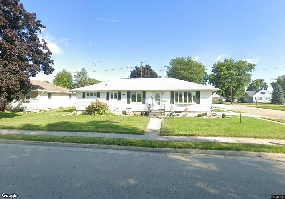
500 W Lincoln St Waupun, WI 53963
Estimated Value: $203,490 - $242,000
3
Beds
1
Bath
1,204
Sq Ft
$186/Sq Ft
Est. Value
About This Home
This home is located at 500 W Lincoln St, Waupun, WI 53963 and is currently estimated at $223,373, approximately $185 per square foot. 500 W Lincoln St is a home located in Dodge County with nearby schools including Meadow View Primary School, Rock River Intermediate School, and Waupun Area Junior High School.
Ownership History
Date
Name
Owned For
Owner Type
Purchase Details
Closed on
Feb 24, 2021
Sold by
Roger W Carolyn J Kilam Family Trust
Bought by
South Berm Property Trust
Current Estimated Value
Purchase Details
Closed on
Feb 9, 2010
Sold by
Killam Roger W and Killam Carolyn J
Bought by
Killam Roger W and Killam Carolyn J
Purchase Details
Closed on
Aug 3, 2009
Sold by
Greenfield Mitchell L and Greenfield Terri A
Bought by
Killam Roger W and Killam Carolyn J
Purchase Details
Closed on
Jul 1, 2007
Sold by
Greenfield Mitchell L
Bought by
Greenfeild Mithcell L and Greenfeild Terri A
Create a Home Valuation Report for This Property
The Home Valuation Report is an in-depth analysis detailing your home's value as well as a comparison with similar homes in the area
Home Values in the Area
Average Home Value in this Area
Purchase History
| Date | Buyer | Sale Price | Title Company |
|---|---|---|---|
| South Berm Property Trust | $114,400 | Town N County Title Llc | |
| Killam Roger W | -- | None Available | |
| Killam Roger W | $118,000 | None Available | |
| Greenfeild Mithcell L | -- | None Available |
Source: Public Records
Tax History Compared to Growth
Tax History
| Year | Tax Paid | Tax Assessment Tax Assessment Total Assessment is a certain percentage of the fair market value that is determined by local assessors to be the total taxable value of land and additions on the property. | Land | Improvement |
|---|---|---|---|---|
| 2024 | $2,347 | $146,700 | $17,000 | $129,700 |
| 2023 | $2,204 | $146,700 | $17,000 | $129,700 |
| 2022 | $2,159 | $146,700 | $17,000 | $129,700 |
| 2021 | $1,838 | $98,100 | $13,500 | $84,600 |
| 2020 | $1,940 | $98,100 | $13,500 | $84,600 |
| 2019 | $1,850 | $98,100 | $13,500 | $84,600 |
| 2018 | $1,875 | $98,100 | $13,500 | $84,600 |
| 2017 | $2,052 | $99,500 | $12,800 | $86,700 |
| 2016 | $1,941 | $99,500 | $12,800 | $86,700 |
Source: Public Records
Map
Nearby Homes
- 17.92 Ac Pattee Dr
- 517 W Jefferson St
- 25 W Franklin St
- 806 Rock River Ave
- 614 Carrington St
- 315 E Main St
- 327 Carrington St
- 516 E Lincoln St
- 736 Fern St
- 295 Harmsen Ave
- 516 Doty St
- 608 Beekman St
- 134 N Watertown St
- 231 Woodland Dr
- 18 Pluim Dr Unit 16
- 18 Pluim Dr Unit 13
- 380 Fond du Lac St
- 395 Fond du Lac St
- 12649 W State Road 49 Rd
- 307 E Washington St
- 522 W Lincoln St
- 523 Pleasant Ave
- 422 W Lincoln St
- 526 W Lincoln St
- 425 Pleasant Ave
- 526 Waubun Ave
- 531 Pleasant Ave
- 418 W Lincoln St
- 530 W Lincoln St
- 420 Pleasant Ave
- 520 Pleasant Ave
- 421 Pleasant Ave
- 525 Waubun Ave
- 535 Pleasant Ave
- 416 W Lincoln St
- 524 Pleasant Ave
- 521 Waubun Ave
- 417 Pleasant Ave
- 536 Pleasant Ave
- 541 Pleasant Ave