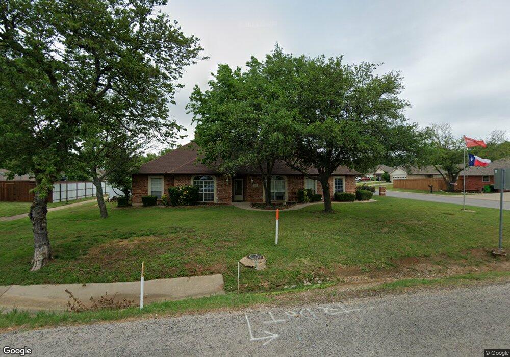
500 W Sherman Dr Aubrey, TX 76227
Estimated Value: $454,000 - $580,000
4
Beds
4
Baths
3,188
Sq Ft
$158/Sq Ft
Est. Value
About This Home
This home is located at 500 W Sherman Dr, Aubrey, TX 76227 and is currently estimated at $502,143, approximately $157 per square foot. 500 W Sherman Dr is a home located in Denton County with nearby schools including HL Brockett Elementary School, Aubrey Middle School, and Aubrey High School.
Ownership History
Date
Name
Owned For
Owner Type
Purchase Details
Closed on
Mar 3, 2017
Sold by
Moody Judith A
Bought by
Garcia Minerva and Garcia Jaime
Current Estimated Value
Home Financials for this Owner
Home Financials are based on the most recent Mortgage that was taken out on this home.
Original Mortgage
$304,385
Outstanding Balance
$256,375
Interest Rate
4.75%
Mortgage Type
FHA
Estimated Equity
$245,768
Purchase Details
Closed on
Jul 16, 2003
Sold by
Moody Rex and Moody Judy
Bought by
Coffey Billy E
Create a Home Valuation Report for This Property
The Home Valuation Report is an in-depth analysis detailing your home's value as well as a comparison with similar homes in the area
Home Values in the Area
Average Home Value in this Area
Purchase History
| Date | Buyer | Sale Price | Title Company |
|---|---|---|---|
| Garcia Minerva | -- | None Available | |
| Coffey Billy E | -- | -- |
Source: Public Records
Mortgage History
| Date | Status | Borrower | Loan Amount |
|---|---|---|---|
| Open | Garcia Minerva | $304,385 |
Source: Public Records
Tax History Compared to Growth
Tax History
| Year | Tax Paid | Tax Assessment Tax Assessment Total Assessment is a certain percentage of the fair market value that is determined by local assessors to be the total taxable value of land and additions on the property. | Land | Improvement |
|---|---|---|---|---|
| 2025 | $7,580 | $422,000 | $83,324 | $338,676 |
| 2024 | $8,868 | $465,000 | $92,582 | $372,418 |
| 2023 | $6,988 | $433,180 | $92,582 | $395,418 |
| 2022 | $8,370 | $393,800 | $77,964 | $397,036 |
| 2021 | $8,145 | $358,000 | $58,473 | $299,527 |
| 2020 | $8,360 | $358,000 | $58,473 | $299,527 |
| 2019 | $9,045 | $383,672 | $58,473 | $325,199 |
| 2018 | $8,423 | $367,834 | $58,473 | $309,361 |
| 2017 | $6,600 | $284,431 | $58,473 | $258,747 |
| 2016 | $4,561 | $258,574 | $58,473 | $216,974 |
| 2015 | $4,435 | $235,067 | $38,982 | $196,085 |
| 2013 | -- | $219,450 | $29,237 | $190,213 |
Source: Public Records
Map
Nearby Homes
- 732 Dressage Ln
- 728 Dressage Ln
- 712 Dressage Ln
- 7521 Bird Cherry Ln
- 7313 Bird Cherry Ln
- 509 Amy jo Cir
- 3529 Maple St
- 506 Caddell St
- 3616 Barrel Ln
- 3612 Barrel Ln
- 3617 Barrel Ln
- 506 N Main St
- 105 E North St
- 309 W Sherman Dr
- 604 N Cherry St
- TBD Rock Hill Rd
- TBD Farm To Market Road 428
- TBD De Moye Ln
- 10100 Breezeway Dr
- 4004 Horsemint Rd
- 502 W Sherman Dr
- 501 Amy jo Cir
- 404 W Sherman Dr
- 503 Amy jo Cir
- 504 W Sherman Dr
- 402 W Sherman Dr
- 200 Linda St
- 505 Amy jo Cir
- 202 Linda St
- 700 W Sherman Dr
- 207 Linda St
- 204 Linda St
- 208 D Lynne St
- 507 Amy jo Cir
- 706 W Sherman Dr
- 206 Linda St
- 209 Linda St
- 7525 Bird Cherry Ln
- 7312 Snapdragon Ct
- 1105 Ginger Rd