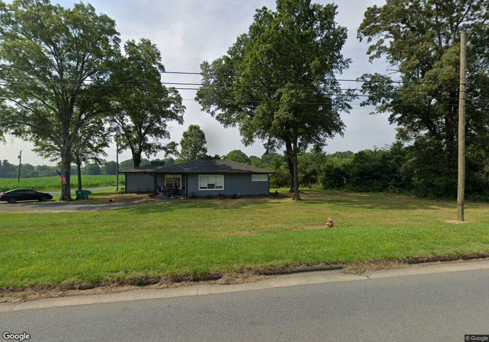
5000 Highway 24 27 E Midland, NC 28107
Estimated Value: $316,000 - $353,000
3
Beds
2
Baths
1,587
Sq Ft
$209/Sq Ft
Est. Value
About This Home
This home is located at 5000 Highway 24 27 E, Midland, NC 28107 and is currently estimated at $331,591, approximately $208 per square foot. 5000 Highway 24 27 E is a home located in Cabarrus County with nearby schools including Bethel Elementary School, C.C. Griffin Middle School, and Central Cabarrus High School.
Ownership History
Date
Name
Owned For
Owner Type
Purchase Details
Closed on
Sep 4, 2020
Sold by
Hinson Willie G and Hinson Connie L
Bought by
Martin Shelley F and Helms Garrette B
Current Estimated Value
Purchase Details
Closed on
Jun 12, 2007
Sold by
Burris Ervin C
Bought by
Hinson Willie G and Hinson Connie L
Purchase Details
Closed on
Mar 1, 1987
Bought by
Burris Ii Ervin C
Create a Home Valuation Report for This Property
The Home Valuation Report is an in-depth analysis detailing your home's value as well as a comparison with similar homes in the area
Home Values in the Area
Average Home Value in this Area
Purchase History
| Date | Buyer | Sale Price | Title Company |
|---|---|---|---|
| Martin Shelley F | $220,000 | None Available | |
| Hinson Willie G | $205,000 | None Available | |
| Burris Ii Ervin C | $61,500 | -- |
Source: Public Records
Tax History Compared to Growth
Tax History
| Year | Tax Paid | Tax Assessment Tax Assessment Total Assessment is a certain percentage of the fair market value that is determined by local assessors to be the total taxable value of land and additions on the property. | Land | Improvement |
|---|---|---|---|---|
| 2025 | $1,917 | $247,080 | $105,850 | $141,230 |
| 2024 | $1,917 | $247,080 | $105,850 | $141,230 |
| 2023 | $1,628 | $169,630 | $86,030 | $83,600 |
| 2022 | $1,628 | $169,630 | $86,030 | $83,600 |
| 2021 | $1,628 | $169,630 | $86,030 | $83,600 |
| 2020 | $1,628 | $169,630 | $86,030 | $83,600 |
| 2019 | $1,098 | $114,420 | $108,060 | $6,360 |
| 2018 | $1,053 | $114,420 | $108,060 | $6,360 |
| 2017 | $1,030 | $114,420 | $108,060 | $6,360 |
| 2016 | $1,030 | $62,620 | $56,980 | $5,640 |
| 2015 | $564 | $62,620 | $56,980 | $5,640 |
| 2014 | $564 | $62,620 | $56,980 | $5,640 |
Source: Public Records
Map
Nearby Homes
- 4245 Wesley Dr
- 11824 Paver Ln
- 11818 Paver Ln
- 4200 Wesley Dr
- 4200 Nc Hwy 24 27 Hwy
- 11790 Thurber Place
- 12560 Highway 601
- 3578 Saddlebrook Dr
- 3987 Tersk Dr
- 0000 U S 601
- 4207 Amanda Dr
- 11060 Teresia Ln
- 0000 Nc Hwy 24 27 None
- 12320 U S 601
- 6168 Busch Way
- The Benson II Plan at Pine Bluff
- The McGinnis Plan at Pine Bluff
- The James Plan at Pine Bluff
- The Langford Plan at Pine Bluff
- The Lancaster Plan at Pine Bluff
- 5071 Highway 24 27 E
- 5120 Highway 24 27 E
- 4929 Highway 24 27 E
- 4820 Highway 24 27 E
- 5140 Highway 24 27 E
- 12082 Loving Rd
- 12084 Loving Rd
- 4901 Highway 24 27 E
- 4780 Highway 24 27 E
- 5226 Highway 24 27 E
- 5220 Highway 24 27 E
- 4771 Nc 27 Hwy
- 12094 Loving Rd
- 0000 Hwy 24 27 Hwy
- 12701 Loving Rd
- 00 Wesley Dr
- 11801 Widenhouse Rd
- 5280 Highway 24 27 E
- 12090 Loving Rd
- 12095 Loving Rd