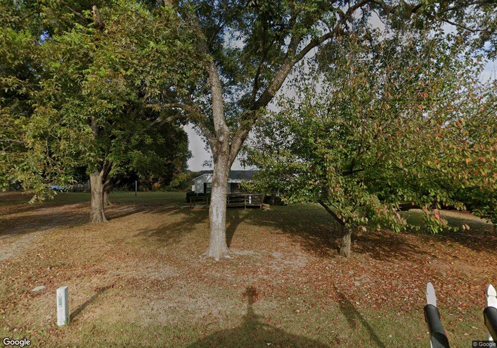
5002 Lancaster Hwy Monroe, NC 28112
Estimated Value: $183,755 - $393,000
--
Bed
1
Bath
1,680
Sq Ft
$168/Sq Ft
Est. Value
About This Home
This home is located at 5002 Lancaster Hwy, Monroe, NC 28112 and is currently estimated at $282,689, approximately $168 per square foot. 5002 Lancaster Hwy is a home located in Union County with nearby schools including Prospect Elementary School, Parkwood Middle School, and Parkwood High School.
Ownership History
Date
Name
Owned For
Owner Type
Purchase Details
Closed on
Oct 26, 1998
Sold by
Cullars Don R and Cullars Elaine N
Bought by
Estridge Randy E and Estridge Debra H
Current Estimated Value
Home Financials for this Owner
Home Financials are based on the most recent Mortgage that was taken out on this home.
Original Mortgage
$46,610
Outstanding Balance
$10,326
Interest Rate
6.76%
Estimated Equity
$272,363
Create a Home Valuation Report for This Property
The Home Valuation Report is an in-depth analysis detailing your home's value as well as a comparison with similar homes in the area
Home Values in the Area
Average Home Value in this Area
Purchase History
| Date | Buyer | Sale Price | Title Company |
|---|---|---|---|
| Estridge Randy E | $63,000 | -- |
Source: Public Records
Mortgage History
| Date | Status | Borrower | Loan Amount |
|---|---|---|---|
| Open | Estridge Randy E | $46,610 | |
| Closed | Estridge Randy E | $13,000 |
Source: Public Records
Tax History Compared to Growth
Tax History
| Year | Tax Paid | Tax Assessment Tax Assessment Total Assessment is a certain percentage of the fair market value that is determined by local assessors to be the total taxable value of land and additions on the property. | Land | Improvement |
|---|---|---|---|---|
| 2024 | $175 | $53,700 | $24,900 | $28,800 |
| 2023 | $173 | $53,700 | $24,900 | $28,800 |
| 2022 | $173 | $53,700 | $24,900 | $28,800 |
| 2021 | $171 | $53,700 | $24,900 | $28,800 |
| 2020 | $203 | $52,190 | $15,790 | $36,400 |
| 2019 | $207 | $52,190 | $15,790 | $36,400 |
| 2018 | $207 | $52,190 | $15,790 | $36,400 |
| 2017 | $221 | $52,200 | $15,800 | $36,400 |
| 2016 | $213 | $52,190 | $15,790 | $36,400 |
| 2015 | $217 | $52,190 | $15,790 | $36,400 |
| 2014 | $539 | $77,350 | $34,630 | $42,720 |
Source: Public Records
Map
Nearby Homes
- 5903 Griffith Rd
- 5200 Lancaster Hwy
- 3303 Reid Cir
- 3624 Crow Rd
- 4114 Mcmanus Rd Unit 1p
- 4120 Mcmanus Rd
- 5106 Pond Bluff Dr
- 2109 Long Hope Rd
- 4805 Nesbit Rd
- 5101 Garden Gate Dr
- 3611 Roughedge Dr
- 3710 Roughedge Dr
- 3512 Oasis Dr
- 3808 Forty Acre Dr
- Daffodil Plan at Stonemill
- Kensington Plan at Stonemill
- Townsend Plan at Stonemill
- Teton Plan at Stonemill
- 5313 Old Highway Rd
- 4105 Parkwood School Rd
- 5004 Lancaster Hwy
- 4918 Lancaster Hwy
- 5003 Lancaster Hwy
- 5012 Lancaster Hwy
- 4916 Lancaster Hwy
- 5016 Lancaster Hwy
- 5015 Lancaster Hwy Unit 4
- 000 Crow Rd
- 0 Crow Rd
- 000 Crow Rd Unit 4
- 000 Crow Rd Unit 5
- 000 Crow Rd Unit 1
- 000 Crow Rd Unit 8
- 000 Crow Rd Unit 2
- 000 Crow Rd Unit 7
- 2908 Ashley Woods Ct
- 5A Crow Rd
- 2904 Ashley Woods Ct
- 5007 Lancaster Hwy
- 2900 Ashley Woods Ct
