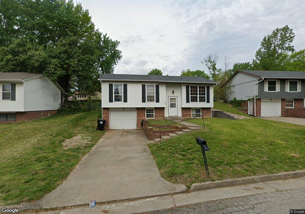
5003 Bagnall Dr Jefferson City, MO 65109
Estimated Value: $200,000 - $209,000
3
Beds
2
Baths
944
Sq Ft
$216/Sq Ft
Est. Value
About This Home
This home is located at 5003 Bagnall Dr, Jefferson City, MO 65109 and is currently estimated at $203,750, approximately $215 per square foot. 5003 Bagnall Dr is a home located in Cole County with nearby schools including Clarence Lawson Elementary School, Thomas Jefferson Middle School, and Capital City High School.
Ownership History
Date
Name
Owned For
Owner Type
Purchase Details
Closed on
Apr 6, 2021
Sold by
Gilbert Margaret R
Bought by
Cable Geroge and Cable Lora
Current Estimated Value
Home Financials for this Owner
Home Financials are based on the most recent Mortgage that was taken out on this home.
Original Mortgage
$85,500
Outstanding Balance
$77,258
Interest Rate
3.05%
Mortgage Type
Stand Alone Refi Refinance Of Original Loan
Estimated Equity
$126,492
Create a Home Valuation Report for This Property
The Home Valuation Report is an in-depth analysis detailing your home's value as well as a comparison with similar homes in the area
Home Values in the Area
Average Home Value in this Area
Purchase History
| Date | Buyer | Sale Price | Title Company |
|---|---|---|---|
| Cable Geroge | -- | None Available |
Source: Public Records
Mortgage History
| Date | Status | Borrower | Loan Amount |
|---|---|---|---|
| Open | Cable Geroge | $85,500 |
Source: Public Records
Tax History Compared to Growth
Tax History
| Year | Tax Paid | Tax Assessment Tax Assessment Total Assessment is a certain percentage of the fair market value that is determined by local assessors to be the total taxable value of land and additions on the property. | Land | Improvement |
|---|---|---|---|---|
| 2025 | $843 | $15,630 | $2,280 | $13,350 |
| 2024 | $843 | $14,100 | $0 | $14,100 |
| 2023 | $843 | $14,100 | $0 | $14,100 |
| 2022 | $845 | $14,100 | $0 | $14,100 |
| 2021 | $850 | $14,100 | $0 | $14,100 |
| 2020 | $862 | $16,188 | $2,280 | $13,908 |
| 2019 | $838 | $15,124 | $2,280 | $12,844 |
| 2018 | $798 | $14,497 | $2,280 | $12,217 |
| 2017 | $778 | $14,098 | $2,280 | $11,818 |
| 2016 | $657 | $14,098 | $2,280 | $11,818 |
| 2015 | $743 | $0 | $0 | $0 |
| 2014 | $743 | $14,098 | $2,280 | $11,818 |
Source: Public Records
Map
Nearby Homes
- 1600 Northport Dr
- 1616 Westview Dr
- 4911 Lucia Dr
- 1628 Westview Dr
- 5203 Starlite Ct
- 1333 Grandview Dr
- 1323 Grandview Dr
- 5121 S Brooks Dr
- 5117 S Brooks Dr
- 1317 Grandview Dr
- 1910 Eliana Dr
- 5318 Thornridge Dr
- 5314 Thornridge Dr
- 5405 Collier Ln
- 4817 Carly Dr
- 5416 S Brooks Dr
- 5417 Collier Ln
- 1901 Eliana Dr
- 2001 Buschman Ln
- 5506 Kenview Dr
- 5001 Bagnall Dr
- 5005 Bagnall Dr
- 5005 Shady Ln
- 5000 Scruggs Station Rd
- 5007 Bagnall Dr
- 5007 Shady Ln
- 5003 Shady Ln
- 5002 Scruggs Station Rd
- 5000 Bagnall Dr
- 5001 Shady Ln
- 5002 Bagnall Dr
- 5009 Shady Ln
- 5006 Scruggs Station Rd
- 1508 Shady Ln
- 5006 Bagnall Dr
- 5004 Bagnall Dr
- 5008 Bagnall Dr
- 5008 Scruggs Station Rd
- 4915 Scruggs Station Rd
- 5017 Bagnall Dr