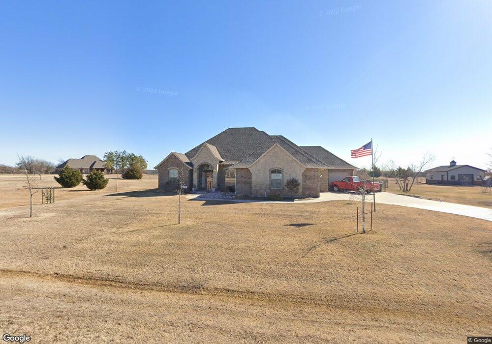
5004 Pheasant Pointe Dr Edmond, OK 73034
East Edmond NeighborhoodEstimated Value: $476,000 - $540,000
3
Beds
3
Baths
2,502
Sq Ft
$204/Sq Ft
Est. Value
About This Home
This home is located at 5004 Pheasant Pointe Dr, Edmond, OK 73034 and is currently estimated at $509,303, approximately $203 per square foot. 5004 Pheasant Pointe Dr is a home located in Oklahoma County with nearby schools including Centennial Elementary School, Central Middle School, and Memorial High School.
Ownership History
Date
Name
Owned For
Owner Type
Purchase Details
Closed on
Oct 15, 2010
Sold by
Silver Stone Homes Llc
Bought by
Taylor Ronald J and Taylor Mickey J
Current Estimated Value
Home Financials for this Owner
Home Financials are based on the most recent Mortgage that was taken out on this home.
Original Mortgage
$257,680
Outstanding Balance
$167,623
Interest Rate
4.38%
Mortgage Type
New Conventional
Estimated Equity
$341,680
Purchase Details
Closed on
Sep 18, 2009
Sold by
Pheasant Pointe Development Llc
Bought by
Silver Stone Homes
Home Financials for this Owner
Home Financials are based on the most recent Mortgage that was taken out on this home.
Original Mortgage
$297,848
Interest Rate
3.75%
Mortgage Type
Purchase Money Mortgage
Create a Home Valuation Report for This Property
The Home Valuation Report is an in-depth analysis detailing your home's value as well as a comparison with similar homes in the area
Home Values in the Area
Average Home Value in this Area
Purchase History
| Date | Buyer | Sale Price | Title Company |
|---|---|---|---|
| Taylor Ronald J | $303,500 | American Eagle Title Ins Co | |
| Silver Stone Homes | $45,000 | The Oklahoma City Abstract & |
Source: Public Records
Mortgage History
| Date | Status | Borrower | Loan Amount |
|---|---|---|---|
| Open | Taylor Ronald J | $257,680 | |
| Previous Owner | Silver Stone Homes | $297,848 |
Source: Public Records
Tax History
| Year | Tax Paid | Tax Assessment Tax Assessment Total Assessment is a certain percentage of the fair market value that is determined by local assessors to be the total taxable value of land and additions on the property. | Land | Improvement |
|---|---|---|---|---|
| 2025 | -- | $34,602 | $6,130 | $28,472 |
| 2023 | $0 | $34,602 | $5,079 | $29,523 |
| 2022 | -- | $34,602 | $5,730 | $28,872 |
| 2021 | $0 | $34,602 | $6,523 | $28,079 |
| 2020 | $0 | $34,602 | $6,547 | $28,055 |
| 2019 | $3,556 | $34,602 | $6,402 | $28,200 |
| 2018 | $0 | $34,603 | $0 | $0 |
| 2017 | $3,564 | $34,601 | $6,758 | $27,843 |
| 2016 | $3,556 | $34,601 | $6,748 | $27,853 |
| 2015 | $3,552 | $34,601 | $6,017 | $28,584 |
| 2014 | $3,547 | $34,601 | $6,755 | $27,846 |
Source: Public Records
Map
Nearby Homes
- 4601 Maple Ridge Dr
- 4541 Maple Ridge Dr
- 4600 Maple Ridge Dr
- 4549 Maple Ridge Dr
- 4625 Maple Ridge Dr
- 4528 Maple Ridge Dr
- 5216 Bing Cir
- 8416 Rainier St
- 5225 Skylar Rae Rd
- 391 Old Creek Rd
- 7941 E Sorghum Mill Rd
- 8301 Grass Creek Dr
- 8001 Amber Ridge Dr
- 8101 Amber Ridge Dr
- 8109 Amber Ridge Dr
- 4917 Highgarden Ave
- 8117 Amber Ridge Dr
- 7924 Amber Ridge Dr
- 8201 Amber Ridge Dr
- 8100 Amber Ridge Dr
- 5003 Pheasant Pointe Dr
- 5019 Pheasant Crest Rd
- 5106 Pheasant Pointe Dr
- 4900 Pheasant Pointe Dr
- 4901 Pheasant Crest Rd
- 7916 Dove Crossing Dr
- 4901 Pheasant Pointe Dr
- 5105 Pheasant Pointe Dr
- 5018 Pheasant Crest Rd
- 7800 Meaghan Leigh Dr
- 5208 Pheasant Pointe Dr
- 8007 Meaghan Leigh Dr
- 5143 Pheasant Crest Rd
- 5207 Pheasant Pointe Dr
- 4807 Pheasant Pointe Dr
- 7902 Meaghan Leigh Dr
- 5037 Brittany Paige Dr
- 8006 Meaghan Leigh Dr
- 8028 Quail Roost Dr
- 7701 Sandy Ln
Your Personal Tour Guide
Ask me questions while you tour the home.