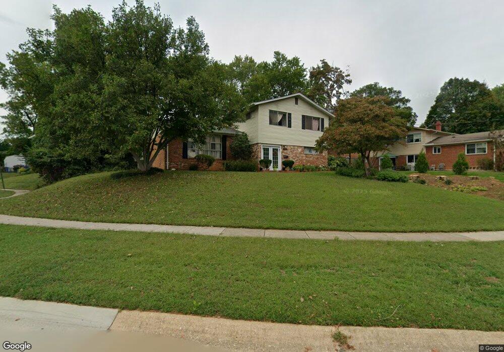
5005 Margot Ct Rockville, MD 20853
Estimated Value: $562,000 - $592,000
4
Beds
3
Baths
1,212
Sq Ft
$474/Sq Ft
Est. Value
About This Home
This home is located at 5005 Margot Ct, Rockville, MD 20853 and is currently estimated at $574,838, approximately $474 per square foot. 5005 Margot Ct is a home located in Montgomery County with nearby schools including Rock Creek Valley Elementary School, Earle B. Wood Middle School, and Rockville High School.
Ownership History
Date
Name
Owned For
Owner Type
Purchase Details
Closed on
Aug 13, 2010
Sold by
Son Mu H and Son Young A
Bought by
Singh Kailash and Singh Rita
Current Estimated Value
Purchase Details
Closed on
Jan 15, 2009
Sold by
Son Mu H
Bought by
Son Mu H
Purchase Details
Closed on
Sep 27, 2008
Sold by
Son Mu H
Bought by
Son Mu H
Purchase Details
Closed on
Jun 15, 2007
Sold by
Shin Yong J
Bought by
Son Mu H
Home Financials for this Owner
Home Financials are based on the most recent Mortgage that was taken out on this home.
Original Mortgage
$95,000
Interest Rate
6.27%
Mortgage Type
Purchase Money Mortgage
Purchase Details
Closed on
May 11, 2007
Sold by
Shin Yong J
Bought by
Son Mu H
Home Financials for this Owner
Home Financials are based on the most recent Mortgage that was taken out on this home.
Original Mortgage
$95,000
Interest Rate
6.27%
Mortgage Type
Purchase Money Mortgage
Create a Home Valuation Report for This Property
The Home Valuation Report is an in-depth analysis detailing your home's value as well as a comparison with similar homes in the area
Home Values in the Area
Average Home Value in this Area
Purchase History
| Date | Buyer | Sale Price | Title Company |
|---|---|---|---|
| Singh Kailash | $323,000 | -- | |
| Son Mu H | -- | -- | |
| Son Mu H | -- | -- | |
| Son Mu H | $475,000 | -- | |
| Son Mu H | $475,000 | -- |
Source: Public Records
Mortgage History
| Date | Status | Borrower | Loan Amount |
|---|---|---|---|
| Previous Owner | Son Mu H | $95,000 | |
| Previous Owner | Son Mu H | $380,000 | |
| Previous Owner | Son Mu H | $380,000 |
Source: Public Records
Tax History Compared to Growth
Tax History
| Year | Tax Paid | Tax Assessment Tax Assessment Total Assessment is a certain percentage of the fair market value that is determined by local assessors to be the total taxable value of land and additions on the property. | Land | Improvement |
|---|---|---|---|---|
| 2025 | $6,058 | $493,900 | $193,200 | $300,700 |
| 2024 | $6,058 | $462,767 | $0 | $0 |
| 2023 | $4,984 | $431,633 | $0 | $0 |
| 2022 | $4,381 | $400,500 | $193,200 | $207,300 |
| 2021 | $4,085 | $391,633 | $0 | $0 |
| 2020 | $4,085 | $382,767 | $0 | $0 |
| 2019 | $3,952 | $373,900 | $176,900 | $197,000 |
| 2018 | $3,772 | $359,800 | $0 | $0 |
| 2017 | $3,674 | $345,700 | $0 | $0 |
| 2016 | $2,933 | $331,600 | $0 | $0 |
| 2015 | $2,933 | $320,100 | $0 | $0 |
| 2014 | $2,933 | $308,600 | $0 | $0 |
Source: Public Records
Map
Nearby Homes
- 13103 Magellan Ave
- 12130Est Veirs Mill Rd
- 12413 Braxfield Ct Unit 3
- 532 Meadow Hall Dr
- 4607 Bayne Ct
- 12403 Braxfield Ct Unit 12
- 4605 Iris St
- 12708 Danvers Ct
- 4606 Iris Place
- 12311 Braxfield Ct Unit 1
- 13520 Sloan St
- 12207 Academy Way Unit 9
- 12802 Leahy Dr
- 13102 Atlantic Ave
- 12204 Braxfield Ct
- 309 Gruenther Ave
- 5714 Crawford Dr
- 13710 Arctic Ave
- 13800 Flint Rock Rd
- 4904 Ertter Dr
- 13004 Margot Dr
- 13006 Margot Dr
- 5009 Margot Ct
- 13008 Margot Dr
- 5011 Margot Ct
- 5006 Margot Ct
- 5004 Margot Ct
- 13010 Margot Dr
- 13002 Margot Dr
- 5002 Margot Ct
- 5008 Margot Ct
- 5010 Margot Ct
- 5006 Mccall St
- 5010 Mccall St
- 13007 Margot Dr
- 5012 Mccall St
- 13000 Margot Dr
- 13009 Margot Dr
- 5000 Mccall St
- 13005 Margot Dr