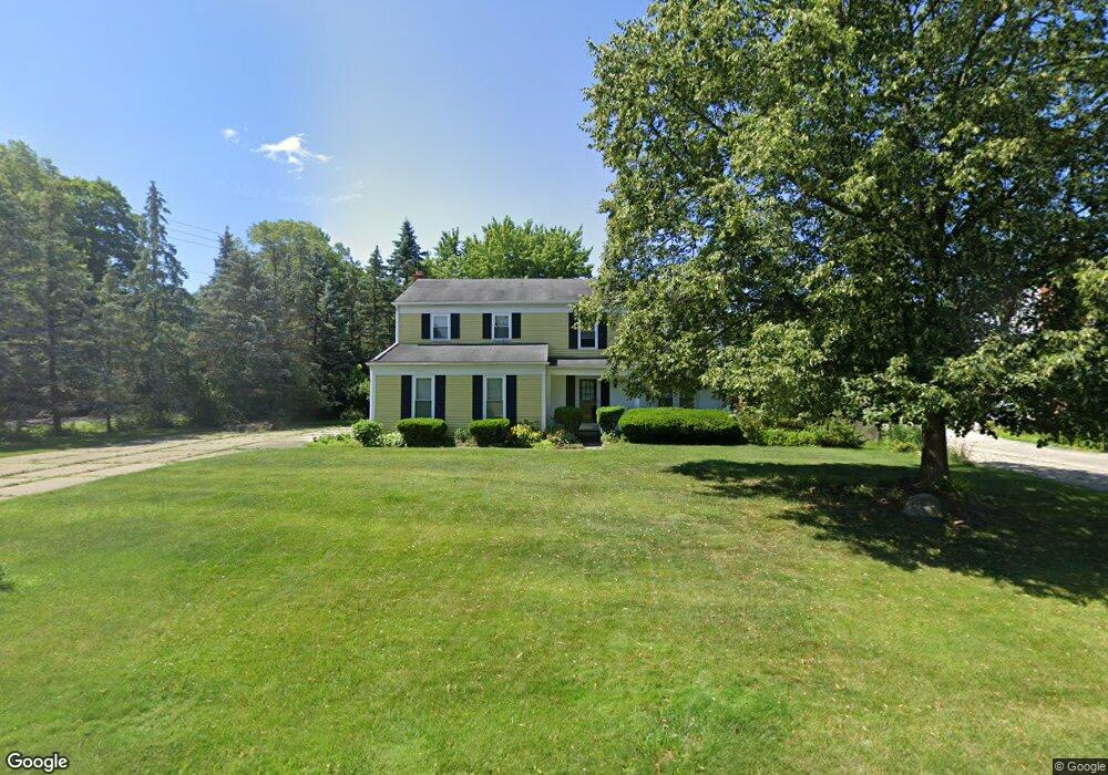
5007 Patrick Rd West Bloomfield, MI 48322
Estimated Value: $373,583 - $380,000
3
Beds
3
Baths
2,049
Sq Ft
$184/Sq Ft
Est. Value
About This Home
This home is located at 5007 Patrick Rd, West Bloomfield, MI 48322 and is currently estimated at $376,896, approximately $183 per square foot. 5007 Patrick Rd is a home located in Oakland County with nearby schools including Sheiko Elementary School, West Bloomfield Middle School, and Brookfield Academy - West Bloomfield.
Ownership History
Date
Name
Owned For
Owner Type
Purchase Details
Closed on
Mar 14, 2024
Sold by
Fournier Myrna
Bought by
Myrna Fournier Living Trust and Fournier
Current Estimated Value
Purchase Details
Closed on
Mar 3, 2015
Sold by
Fournier Myrna and Fournier Raymond
Bought by
Fournier Myrna
Purchase Details
Closed on
May 30, 1997
Sold by
Chudnow Michael L
Bought by
Fournier Raymond
Home Financials for this Owner
Home Financials are based on the most recent Mortgage that was taken out on this home.
Original Mortgage
$143,200
Interest Rate
8.17%
Create a Home Valuation Report for This Property
The Home Valuation Report is an in-depth analysis detailing your home's value as well as a comparison with similar homes in the area
Home Values in the Area
Average Home Value in this Area
Purchase History
| Date | Buyer | Sale Price | Title Company |
|---|---|---|---|
| Myrna Fournier Living Trust | -- | None Listed On Document | |
| Myrna Fournier Living Trust | -- | None Listed On Document | |
| Fournier Myrna | -- | None Available | |
| Fournier Raymond | $179,000 | -- |
Source: Public Records
Mortgage History
| Date | Status | Borrower | Loan Amount |
|---|---|---|---|
| Previous Owner | Fournier Raymond | $143,200 |
Source: Public Records
Tax History Compared to Growth
Tax History
| Year | Tax Paid | Tax Assessment Tax Assessment Total Assessment is a certain percentage of the fair market value that is determined by local assessors to be the total taxable value of land and additions on the property. | Land | Improvement |
|---|---|---|---|---|
| 2024 | $2,328 | $153,670 | $0 | $0 |
| 2022 | $2,229 | $132,920 | $45,000 | $87,920 |
| 2021 | $3,245 | $122,830 | $0 | $0 |
| 2020 | $2,093 | $120,590 | $40,550 | $80,040 |
| 2018 | $3,129 | $107,300 | $28,700 | $78,600 |
| 2015 | -- | $89,230 | $0 | $0 |
| 2014 | -- | $81,240 | $0 | $0 |
| 2011 | -- | $71,940 | $0 | $0 |
Source: Public Records
Map
Nearby Homes
- 5016 Patrick Rd
- 5023 Meadowbrook Dr
- 5015 Langlewood Dr
- 6067 Charles Dr
- 5120 Langlewood Ct
- 4800 Faircourt Dr
- 6323 Potomac Cir Unit 22
- 5720 Beauchamp
- 5106 Rock Run
- 5216 Brett Ct Unit 53
- 4516 Kevin Ct
- 5353 Wright Way W
- 5710 Hobnail Cir
- 5428 Hammersmith Dr
- 5353 W Bloomfield Lake Rd
- 5946 Cherry Crest Dr
- 6121 Westbrooke Dr Unit 7
- 6607 Westbrooke Ct
- 4185 Pinehurst Ct
- 5130 Lake Bluff Rd
- 5021 Patrick Rd
- 5006 Meadowbrook Dr
- 5004 Patrick Rd
- 5031 Patrick Rd
- 5018 Meadowbrook Dr
- 4955 Patrick Rd
- 5028 Patrick Rd
- 5945 Farmington Rd
- 4996 Meadowbrook Dr
- 4994 Meadowbrook Dr
- 5884 Shilo Ct
- 5030 Meadowbrook Dr
- 5043 Patrick Rd
- 5878 Shilo Ct
- 4900 Patrick Rd
- 5040 Patrick Rd
- 5009 Meadowbrook Dr
- 4929 Patrick Rd
- 4806 Lenomar Ct
- 4828 Lenomar Ct