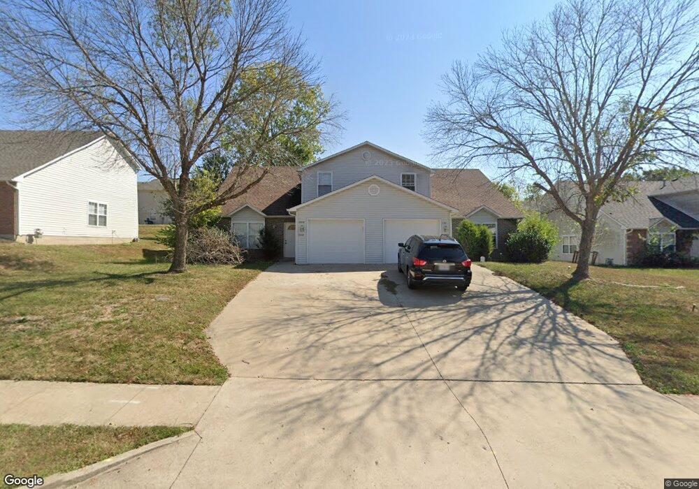
5008 Carrieridge Dr Unit 5010 Columbia, MO 65203
Estimated Value: $307,000 - $394,000
6
Beds
4
Baths
2,543
Sq Ft
$136/Sq Ft
Est. Value
About This Home
This home is located at 5008 Carrieridge Dr Unit 5010, Columbia, MO 65203 and is currently estimated at $346,699, approximately $136 per square foot. 5008 Carrieridge Dr Unit 5010 is a home located in Boone County with nearby schools including Rock Bridge Elementary School, Ann Hawkins Gentry Middle School, and Rock Bridge High School.
Ownership History
Date
Name
Owned For
Owner Type
Purchase Details
Closed on
Apr 3, 2009
Sold by
Mckay Isaac and Mckay Faye R
Bought by
Mckay Dennis Edward
Current Estimated Value
Home Financials for this Owner
Home Financials are based on the most recent Mortgage that was taken out on this home.
Original Mortgage
$120,500
Interest Rate
6%
Mortgage Type
Future Advance Clause Open End Mortgage
Create a Home Valuation Report for This Property
The Home Valuation Report is an in-depth analysis detailing your home's value as well as a comparison with similar homes in the area
Home Values in the Area
Average Home Value in this Area
Purchase History
| Date | Buyer | Sale Price | Title Company |
|---|---|---|---|
| Mckay Dennis Edward | -- | Boone Central Title Company |
Source: Public Records
Mortgage History
| Date | Status | Borrower | Loan Amount |
|---|---|---|---|
| Closed | Mckay Dennis Edward | $120,500 |
Source: Public Records
Tax History Compared to Growth
Tax History
| Year | Tax Paid | Tax Assessment Tax Assessment Total Assessment is a certain percentage of the fair market value that is determined by local assessors to be the total taxable value of land and additions on the property. | Land | Improvement |
|---|---|---|---|---|
| 2025 | $2,287 | $37,278 | $5,548 | $31,730 |
| 2024 | $2,287 | $33,896 | $5,548 | $28,348 |
| 2023 | $2,268 | $33,896 | $5,548 | $28,348 |
| 2022 | $2,265 | $33,896 | $5,548 | $28,348 |
| 2021 | $2,270 | $33,896 | $5,548 | $28,348 |
| 2020 | $2,322 | $32,585 | $5,548 | $27,037 |
| 2019 | $2,322 | $32,585 | $5,548 | $27,037 |
| 2018 | $2,248 | $0 | $0 | $0 |
| 2017 | $2,221 | $31,331 | $5,548 | $25,783 |
| 2016 | $2,217 | $31,331 | $5,548 | $25,783 |
| 2015 | $2,036 | $31,331 | $5,548 | $25,783 |
| 2014 | -- | $31,331 | $5,548 | $25,783 |
Source: Public Records
Map
Nearby Homes
- 301 E Old Plank Rd
- 4733 Brandon Woods St
- 29 N Cedar Lake Dr W Unit 208
- 4779 Bethel St
- 302 W Cedar Lake Dr W Dr
- LOT 129 Clear Creek Estates
- 525 W Bethel Dr
- LOT 135 Clear Creek Estates
- LOT 136 Clear Creek Estates
- LOT 128 Clear Creek Estates
- LOT 101 Clear Creek Estates
- 5657 Ralph Dobbs Way
- 5663 Ralph Dobbs Way
- 210 Hellwig Ln
- 4305 Needham Ct
- 141 Donald Neil Ct
- 5411 Heath Ct
- 809 Rutland Dr
- 214 Hellwig Ln
- 6201 S Ridgewood Rd
- 5006 Carrieridge Dr
- 5004 Carrieridge Dr Unit 5006
- 5012-14 Carrie Ridge Dr
- 5012 Carrieridge Dr Unit 5014
- 5007 Betty Jean Way
- 5009 Betty Jean Way Unit 5011
- 5009-5011 Betty Jean Way
- 5003 Betty Jean Way
- 5001 Betty Jean Way Unit 5003
- 5001-5003 Betty Jean Way
- 5011 Betty Jean Way
- 5009-5011 Carrie Ridge
- 5009 Carrieridge Dr Unit 5011
- 5011 Carrieridge Dr
- 5013 Carrieridge Dr Unit 5015
- 5016 Carrieridge Dr Unit 5018
- 5007 Carrieridge Dr
- 5005 Carrieridge Dr Unit 5007
- 5015 Carrieridge Dr
- 5018 Carrieridge Dr