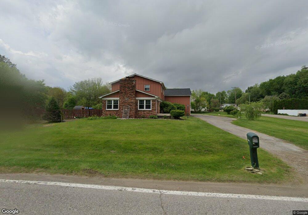
50081 Sass Rd Chesterfield, MI 48047
Estimated Value: $316,000 - $398,000
4
Beds
2
Baths
2,433
Sq Ft
$151/Sq Ft
Est. Value
About This Home
This home is located at 50081 Sass Rd, Chesterfield, MI 48047 and is currently estimated at $367,042, approximately $150 per square foot. 50081 Sass Rd is a home with nearby schools including Sugarbush Elementary School, Dean A. Naldrett School, and Anchor Bay Middle School South.
Ownership History
Date
Name
Owned For
Owner Type
Purchase Details
Closed on
May 20, 2021
Sold by
Vredevoogd Michael
Bought by
Vredevoogd Michael and Gerken Michele
Current Estimated Value
Purchase Details
Closed on
Feb 25, 2021
Sold by
Vredevoogd Michael
Bought by
Vredevoogd Michael and Gerken Michele
Purchase Details
Closed on
Jun 21, 2019
Sold by
Vredevoogd Michael
Bought by
Vredevoogd Michael and Gerken Michele
Purchase Details
Closed on
Aug 26, 2008
Sold by
Vredevoogd Michael James and Donohue Vredevoogd Kathleen
Bought by
Vredevoogd Michael James
Purchase Details
Closed on
Dec 28, 2004
Sold by
Donohue Vredevoogd Michael James and Donohue Vredevoogd Kathleen
Bought by
Donohue Vredevoogd Michael James and Donohue Vredevoogd Kathleen
Create a Home Valuation Report for This Property
The Home Valuation Report is an in-depth analysis detailing your home's value as well as a comparison with similar homes in the area
Home Values in the Area
Average Home Value in this Area
Purchase History
| Date | Buyer | Sale Price | Title Company |
|---|---|---|---|
| Vredevoogd Michael | -- | None Available | |
| Vredevoogd Michael | -- | None Available | |
| Vredevoogd Michael | -- | None Available | |
| Vredevoogd Michael James | $12,500 | None Available | |
| Donohue Vredevoogd Michael James | -- | -- |
Source: Public Records
Tax History Compared to Growth
Tax History
| Year | Tax Paid | Tax Assessment Tax Assessment Total Assessment is a certain percentage of the fair market value that is determined by local assessors to be the total taxable value of land and additions on the property. | Land | Improvement |
|---|---|---|---|---|
| 2025 | $4,692 | $188,800 | $0 | $0 |
| 2024 | $2,702 | $182,100 | $0 | $0 |
| 2023 | $2,561 | $172,600 | $0 | $0 |
| 2022 | $4,246 | $155,100 | $0 | $0 |
| 2021 | $4,128 | $150,500 | $0 | $0 |
| 2020 | $2,353 | $149,600 | $0 | $0 |
| 2019 | $3,399 | $136,500 | $0 | $0 |
| 2018 | $3,504 | $115,600 | $33,700 | $81,900 |
| 2017 | $3,406 | $106,300 | $33,650 | $72,650 |
| 2016 | $3,399 | $106,300 | $0 | $0 |
| 2015 | $1,580 | $103,350 | $0 | $0 |
| 2014 | $1,580 | $98,050 | $33,650 | $64,400 |
| 2012 | -- | $0 | $0 | $0 |
Source: Public Records
Map
Nearby Homes
- 49400 Callens Rd
- 50402 Oakbrooke Dr
- 48570 Sugarbush Rd Unit 56
- 31450 23 Mile Rd
- 49681 Manistee Dr
- 15 Harmony Rd
- 31736 William Dr
- 33806 Au Sable New Dr Unit 38
- 51133 Sarah Ct
- 33802 Au Sable Dr
- 49596 Platte River Dr
- 51204 Cathryn Ct Unit 6
- 33831 Au Sable Dr Unit 24
- 33796 Michigamme Dr Unit 34
- 51728 Mitchell Dr
- 32922 Oakwood Dr Unit 10
- 48526 Jefferson Ave
- 48118 Forbes St
- 48556 Harbor Dr
- 51314 Johns Dr
- 31910 Sikon Rd
- 50115 Sass Rd
- 0 Sass Rd Unit 28088923
- 0 Sass Rd Unit 28147087
- 0 Sass Rd Unit 29075773
- 0 Sass Rd Unit 210061636
- 0 Sass Rd Unit 210137173
- 0 Sass Rd Unit 214104606
- 0 Sass Rd Unit 215012747
- 0 Sass Rd Unit 216003367
- 0 Sass Rd Unit 4559193
- 0 Sass Rd Unit 4251738
- 0 Sass Rd Unit 4921839
- 0 Sass Rd Unit 867961
- 0 Sass Rd Unit 867987
- 0 Sass Rd Unit 886284
- 0 Sass Rd Unit 873011
- 0 Sass Rd Unit 893496
- 0 Sass Rd Unit 893495
- 0 Sass Rd Unit 4667951