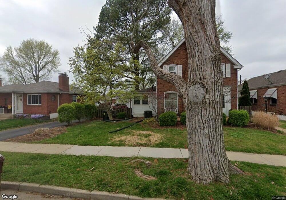
5009 Deville Ave Saint Louis, MO 63119
Estimated Value: $285,000 - $311,000
3
Beds
1
Bath
1,379
Sq Ft
$217/Sq Ft
Est. Value
About This Home
This home is located at 5009 Deville Ave, Saint Louis, MO 63119 and is currently estimated at $299,382, approximately $217 per square foot. 5009 Deville Ave is a home located in St. Louis County with nearby schools including Mesnier Primary School, Gotsch Intermediate School, and Rogers Middle School.
Ownership History
Date
Name
Owned For
Owner Type
Purchase Details
Closed on
Jul 19, 2004
Sold by
Lauter Gregory J and Lauter Lisa M
Bought by
Lauter Gregory J and Lauter Lisa M
Current Estimated Value
Purchase Details
Closed on
May 3, 2004
Sold by
Lauter Calvin J and Lauter Donald J
Bought by
Lauter Gregory J and Garavaglia Lisa
Home Financials for this Owner
Home Financials are based on the most recent Mortgage that was taken out on this home.
Original Mortgage
$82,700
Interest Rate
5.38%
Mortgage Type
Stand Alone Refi Refinance Of Original Loan
Create a Home Valuation Report for This Property
The Home Valuation Report is an in-depth analysis detailing your home's value as well as a comparison with similar homes in the area
Home Values in the Area
Average Home Value in this Area
Purchase History
We collect this data history from publicly available records. To have your information removed, we recommend requesting removal directly through your county’s website.
| Date | Buyer | Sale Price | Title Company |
|---|---|---|---|
| Lauter Gregory J | -- | -- | |
| Lauter Gregory J | $104,000 | -- |
Source: Public Records
Mortgage History
We collect this data history from publicly available records. To have your information removed, we recommend requesting removal directly through your county’s website.
| Date | Status | Borrower | Loan Amount |
|---|---|---|---|
| Closed | Lauter Gregory J | $82,700 |
Source: Public Records
Tax History
| Year | Tax Paid | Tax Assessment Tax Assessment Total Assessment is a certain percentage of the fair market value that is determined by local assessors to be the total taxable value of land and additions on the property. | Land | Improvement |
|---|---|---|---|---|
| 2025 | $3,610 | $57,590 | $25,210 | $32,380 |
| 2024 | $3,610 | $46,380 | $15,750 | $30,630 |
| 2023 | $3,610 | $46,380 | $15,750 | $30,630 |
| 2022 | $3,296 | $39,600 | $15,750 | $23,850 |
| 2021 | $3,004 | $39,600 | $15,750 | $23,850 |
| 2020 | $3,029 | $36,800 | $14,190 | $22,610 |
| 2019 | $3,136 | $36,800 | $14,190 | $22,610 |
| 2018 | $2,720 | $28,660 | $12,640 | $16,020 |
| 2017 | $2,712 | $28,660 | $12,640 | $16,020 |
| 2016 | $2,474 | $26,950 | $10,740 | $16,210 |
| 2015 | $2,481 | $26,950 | $10,740 | $16,210 |
| 2014 | $3,046 | $32,900 | $8,660 | $24,240 |
Source: Public Records
Map
Nearby Homes
- 4900 Deville Ave
- 7416 Nottingham Ave
- 5012 Michael Ave
- 7313 Nottingham Ave
- 4800 Verguene Ave
- 7309 Nottingham Ave
- 25 Saint Charles Place
- 7424 Lansdowne Ave
- 7400 Whitehall Colonial Ln Unit 421
- 7356 Whitehall Colonial Ln
- 7515 Lansdowne Ave
- 7507 Triwoods Dr Unit H
- 7415 Triwoods Dr Unit D
- 7617 Triwoods Dr Unit D
- 7611 Triwoods Dr Unit D
- 7611 Triwoods Dr Unit J
- 7316 Whitehall Colonial Ln
- 7409 Triwoods Dr Unit I
- 7326 Westover Colonial Ln
- 33 S Laclede Station Rd S
- 5007 Deville Ave
- 5015 Deville Ave
- 5017 Deville Ave
- 5010 Shrewsbury Ave
- 5012 Shrewsbury Ave
- 5008 Shrewsbury Ave
- 5014 Shrewsbury Ave
- 5019 Deville Ave
- 5006 Shrewsbury Ave
- 7416 Weil Ave
- 7420 Weil Ave
- 5010 Deville Ave
- 5026 Shrewsbury Ave
- 5014 Deville Ave
- 5021 Deville Ave
- 5008 Deville Ave
- 7422 Weil Ave
- 5000 Deville Ave
- 5016 Deville Ave
- 7424 Weil Ave
Your Personal Tour Guide
Ask me questions while you tour the home.