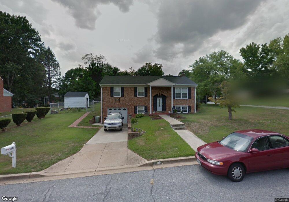
5009 Roblee Dr Upper Marlboro, MD 20772
Estimated Value: $403,937 - $485,000
--
Bed
2
Baths
1,144
Sq Ft
$385/Sq Ft
Est. Value
About This Home
This home is located at 5009 Roblee Dr, Upper Marlboro, MD 20772 and is currently estimated at $440,984, approximately $385 per square foot. 5009 Roblee Dr is a home located in Prince George's County with nearby schools including Barack Obama Elementary School, James Madison Middle School, and Dr. Henry A. Wise Jr. High School.
Ownership History
Date
Name
Owned For
Owner Type
Purchase Details
Closed on
Sep 30, 2019
Sold by
Howell Helen J and Estate Of Clinton Lee Jessup
Bought by
Carter Jarvis
Current Estimated Value
Home Financials for this Owner
Home Financials are based on the most recent Mortgage that was taken out on this home.
Original Mortgage
$247,350
Outstanding Balance
$216,659
Interest Rate
3.6%
Mortgage Type
New Conventional
Estimated Equity
$224,325
Purchase Details
Closed on
Sep 26, 1980
Sold by
Campbell Frederick
Bought by
Jessup Clinton L and Jessup Cheryl A
Create a Home Valuation Report for This Property
The Home Valuation Report is an in-depth analysis detailing your home's value as well as a comparison with similar homes in the area
Home Values in the Area
Average Home Value in this Area
Purchase History
| Date | Buyer | Sale Price | Title Company |
|---|---|---|---|
| Carter Jarvis | $255,000 | Strategic Natl Ttl Group Llc | |
| Jessup Clinton L | $79,900 | -- |
Source: Public Records
Mortgage History
| Date | Status | Borrower | Loan Amount |
|---|---|---|---|
| Open | Carter Jarvis | $247,350 |
Source: Public Records
Tax History Compared to Growth
Tax History
| Year | Tax Paid | Tax Assessment Tax Assessment Total Assessment is a certain percentage of the fair market value that is determined by local assessors to be the total taxable value of land and additions on the property. | Land | Improvement |
|---|---|---|---|---|
| 2025 | $5,405 | $359,200 | $101,200 | $258,000 |
| 2024 | $5,405 | $336,867 | $0 | $0 |
| 2023 | $5,072 | $314,533 | $0 | $0 |
| 2022 | $4,740 | $292,200 | $81,200 | $211,000 |
| 2021 | $4,554 | $279,667 | $0 | $0 |
| 2020 | $4,367 | $267,133 | $0 | $0 |
| 2019 | $3,646 | $254,600 | $100,600 | $154,000 |
| 2018 | $3,663 | $246,500 | $0 | $0 |
| 2017 | $3,408 | $238,400 | $0 | $0 |
| 2016 | -- | $230,300 | $0 | $0 |
| 2015 | $3,017 | $226,100 | $0 | $0 |
| 2014 | $3,017 | $221,900 | $0 | $0 |
Source: Public Records
Map
Nearby Homes
- 5005 Ashford Dr
- 5020 Ashford Dr
- 5308 Thomas Sim Lee Terrace
- 11504 Carriage Crossing Dr
- 4506 Cross Country Terrace
- 4504 Cross Country Terrace
- 4521 Thoroughbred Dr
- 10610 Mary Carroll Ct
- 4506 Grazing Way
- 10611 Mary Carroll Ct
- 4804 Bridle Ridge Rd
- 11007 Meridian Hill Way
- 4307 Lariat Dr
- 11001 Flying Change Ct
- 4902 Bridle Ridge Rd
- 11007 Fillys Ford Crossing
- 4302 Bridle Ridge Rd
- 11002 Fillys Ford Crossing
- 11508 Pegasus Ct
- 11015 Blanton Way Unit B - STRAUSS E
- 5011 Roblee Dr
- 11103 Tenbury Ct
- 5005 Roblee Dr
- 5008 Roblee Dr
- 11100 Lynford Ct
- 5010 Roblee Dr
- 11102 Tenbury Ct
- 11101 Tenbury Ct
- 5012 Roblee Dr
- 5004 Roblee Dr
- 11100 Tenbury Ct
- 5015 Roblee Dr
- 11101 Lynford Ct
- 4916 Ashford Dr
- 4914 Ashford Dr
- 5014 Roblee Dr
- 5009 Brimfield Dr
- 4918 Ashford Dr
- 5011 Brimfield Dr
- 5002 Roblee Dr