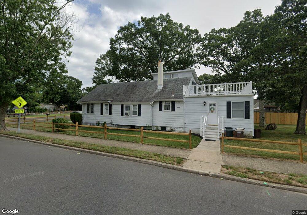
501 1st St Somers Point, NJ 08244
Estimated Value: $321,618 - $373,000
--
Bed
--
Bath
1,228
Sq Ft
$290/Sq Ft
Est. Value
About This Home
This home is located at 501 1st St, Somers Point, NJ 08244 and is currently estimated at $355,905, approximately $289 per square foot. 501 1st St is a home located in Atlantic County with nearby schools including Mainland Regional High School, ChARTer TECH High School for the Performing Arts, and Saint Joseph Regional School.
Ownership History
Date
Name
Owned For
Owner Type
Purchase Details
Closed on
Jan 16, 2024
Sold by
Wigglesworth Thomas
Bought by
Stasuk Margaret A
Current Estimated Value
Purchase Details
Closed on
Dec 20, 2023
Sold by
Wigglesworth Dorothy L
Bought by
Stasuk Margaret A and Wigglesworth Thomas
Purchase Details
Closed on
Sep 17, 2010
Sold by
Wigglesworth Thomas P and Wigglesworth Dorothy L
Bought by
Wigglesworth Dorothy L
Create a Home Valuation Report for This Property
The Home Valuation Report is an in-depth analysis detailing your home's value as well as a comparison with similar homes in the area
Home Values in the Area
Average Home Value in this Area
Purchase History
| Date | Buyer | Sale Price | Title Company |
|---|---|---|---|
| Stasuk Margaret A | -- | None Listed On Document | |
| Stasuk Margaret A | -- | None Listed On Document | |
| Wigglesworth Dorothy L | -- | None Available |
Source: Public Records
Tax History Compared to Growth
Tax History
| Year | Tax Paid | Tax Assessment Tax Assessment Total Assessment is a certain percentage of the fair market value that is determined by local assessors to be the total taxable value of land and additions on the property. | Land | Improvement |
|---|---|---|---|---|
| 2025 | $5,961 | $166,700 | $68,800 | $97,900 |
| 2024 | $5,961 | $166,700 | $68,800 | $97,900 |
| 2023 | $5,069 | $166,700 | $68,800 | $97,900 |
| 2022 | $5,069 | $166,700 | $68,800 | $97,900 |
| 2021 | $4,986 | $166,700 | $68,800 | $97,900 |
| 2020 | $4,874 | $166,700 | $68,800 | $97,900 |
| 2019 | $4,723 | $166,700 | $68,800 | $97,900 |
| 2018 | $5,024 | $180,100 | $68,800 | $111,300 |
| 2017 | $4,826 | $180,100 | $68,800 | $111,300 |
| 2016 | $4,584 | $180,100 | $68,800 | $111,300 |
| 2015 | $4,532 | $180,100 | $68,800 | $111,300 |
| 2014 | $4,363 | $180,100 | $68,800 | $111,300 |
Source: Public Records
Map
Nearby Homes
- 421 Shore Rd
- 1020 Pleasant Ave
- 1013 Pleasant Ave
- 1014 Pleasant Ave
- 1024 Pleasant Ave
- 1015 Pleasant Ave
- 303 Garden Terrace
- 1102 Jesse Dr
- 2102 Angelina Ln
- 25 W Pierson Ave
- 109 E Cedar Ave
- 101 E Johnson Ave
- 123 E Cedar Ave
- 215 Fox Terrace
- 1002 Pleasant Ave
- 29 E Pierson Ave
- 112 E Pierson Ave
- 114 E Pierson Ave
- 1803 Pleasant Ave
- 653 4th St
- 507 1st St
- 509 1st St
- 459 1st St
- 40 W Maryland Ave
- 116 W Maryland Ave
- 455 1st St
- 446 Bethel Rd
- 36 W Maryland Ave
- 103 W Maryland Ave
- 32 W Maryland Ave
- 27 W Maryland Ave
- 26 W Maryland Ave
- 450 Bethel Rd
- 452 Bethel Rd
- 448 Bethel Rd
- 24 W Maryland Ave
- 427 1st St Unit 427
- 425 1st St
- 458 Atlantic Ave
- 118 W Groveland Ave