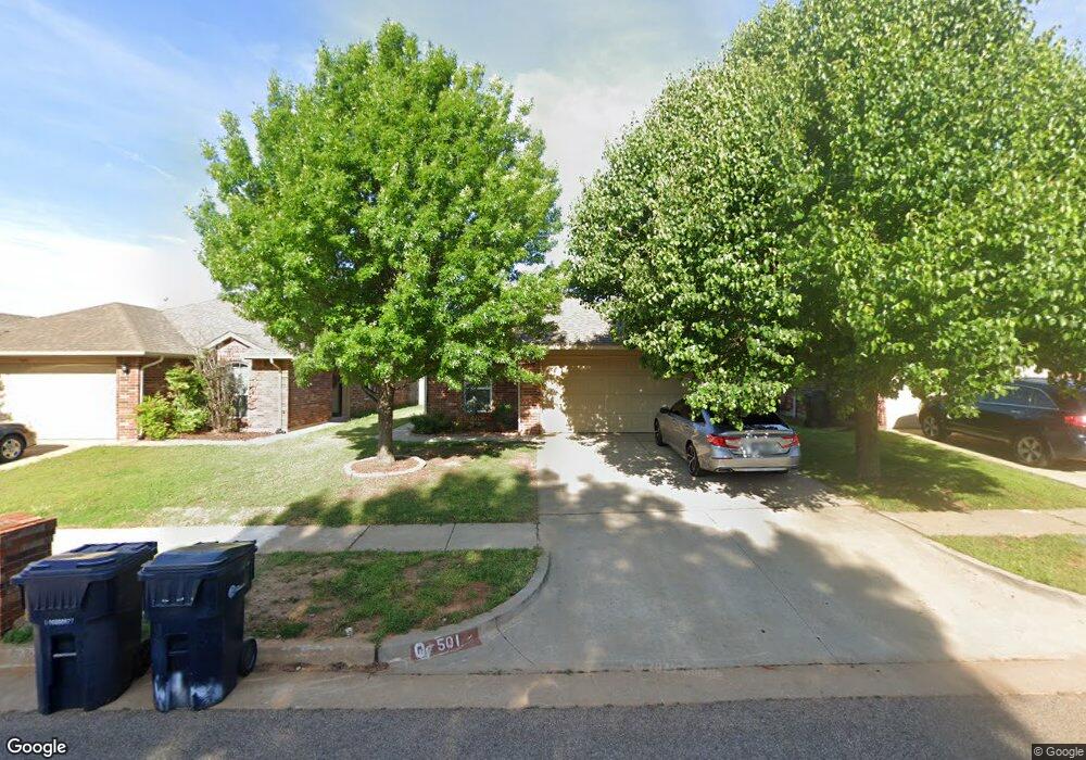
501 Apache Gate Dr Yukon, OK 73099
Westgate NeighborhoodEstimated Value: $202,000 - $207,000
3
Beds
2
Baths
1,302
Sq Ft
$157/Sq Ft
Est. Value
About This Home
This home is located at 501 Apache Gate Dr, Yukon, OK 73099 and is currently estimated at $203,820, approximately $156 per square foot. 501 Apache Gate Dr is a home located in Canadian County with nearby schools including Mustang Trails Elementary School, Meadow Brook Intermediate School, and Mustang Central Middle School.
Ownership History
Date
Name
Owned For
Owner Type
Purchase Details
Closed on
Aug 12, 2015
Sold by
Fisher Brooks Ann E and Brooks Ryan
Bought by
Joseph Loosamma and Thomas Mathukutty
Current Estimated Value
Home Financials for this Owner
Home Financials are based on the most recent Mortgage that was taken out on this home.
Original Mortgage
$84,000
Outstanding Balance
$31,877
Interest Rate
4.13%
Mortgage Type
New Conventional
Estimated Equity
$171,943
Purchase Details
Closed on
Oct 12, 2006
Sold by
High Strive Construction Lp
Bought by
Fisher Ann E
Home Financials for this Owner
Home Financials are based on the most recent Mortgage that was taken out on this home.
Original Mortgage
$113,060
Interest Rate
6.44%
Mortgage Type
FHA
Create a Home Valuation Report for This Property
The Home Valuation Report is an in-depth analysis detailing your home's value as well as a comparison with similar homes in the area
Home Values in the Area
Average Home Value in this Area
Purchase History
| Date | Buyer | Sale Price | Title Company |
|---|---|---|---|
| Joseph Loosamma | $112,000 | First American Title | |
| Fisher Ann E | $858,750 | None Available |
Source: Public Records
Mortgage History
| Date | Status | Borrower | Loan Amount |
|---|---|---|---|
| Open | Joseph Loosamma | $84,000 | |
| Previous Owner | Fisher Ann E | $113,060 |
Source: Public Records
Tax History
| Year | Tax Paid | Tax Assessment Tax Assessment Total Assessment is a certain percentage of the fair market value that is determined by local assessors to be the total taxable value of land and additions on the property. | Land | Improvement |
|---|---|---|---|---|
| 2025 | $2,153 | $19,559 | $1,800 | $17,759 |
| 2024 | $2,009 | $18,628 | $1,800 | $16,828 |
| 2023 | $2,009 | $17,741 | $1,800 | $15,941 |
| 2022 | $1,942 | $16,896 | $1,800 | $15,096 |
| 2021 | $1,843 | $16,092 | $1,800 | $14,292 |
| 2020 | $1,808 | $15,630 | $1,800 | $13,830 |
| 2019 | $1,720 | $14,885 | $1,800 | $13,085 |
| 2018 | $1,669 | $14,177 | $1,800 | $12,377 |
| 2017 | $1,663 | $14,311 | $1,800 | $12,511 |
| 2016 | $1,625 | $14,027 | $1,800 | $12,227 |
| 2015 | $1,660 | $13,192 | $1,800 | $11,392 |
| 2014 | $1,660 | $14,220 | $1,800 | $12,420 |
Source: Public Records
Map
Nearby Homes
- 12316 SW 5th St
- 12401 SW 7th St
- 12824 NW 4th Terrace
- 400 S Greengate Dr
- 501 S Greengate Dr
- 12616 NW 1st Terrace
- 12260 SW 10th St
- 13 Evermore Ln
- 13033 SW 10th St
- 12012 Larkdale Dr
- 713 Cactus Ct
- 24 Carat Dr
- 512 Tumbleweed Dr
- 12429 NW 2nd St
- 12500 NW 3rd Place
- 12729 NW 2nd St
- 12316 SW 12th St
- 624 Caladium Dr
- 12020 SW 10th St
- 12516 SW 11th St
- 505 Apache Gate Dr
- 417 Apache Gate Dr
- 413 Apache Gate Dr
- 500 Cherokee Gate Dr
- 504 Cherokee Gate Dr
- 420 Cherokee Gate Dr
- 416 Cherokee Gate Dr
- 513 Apache Gate Dr
- 409 Apache Gate Dr
- 412 Cherokee Gate Dr
- 508 Cherokee Gate Dr
- 500 Apache Gate Dr
- 512 Cherokee Gate Dr
- 412 Apache Gate Dr
- 405 Apache Gate Dr
- 408 Cherokee Gate Dr
- 508 Apache Gate Dr
- 408 Apache Gate Dr
- 517 Apache Gate Dr
- 516 Cherokee Gate Dr
Your Personal Tour Guide
Ask me questions while you tour the home.