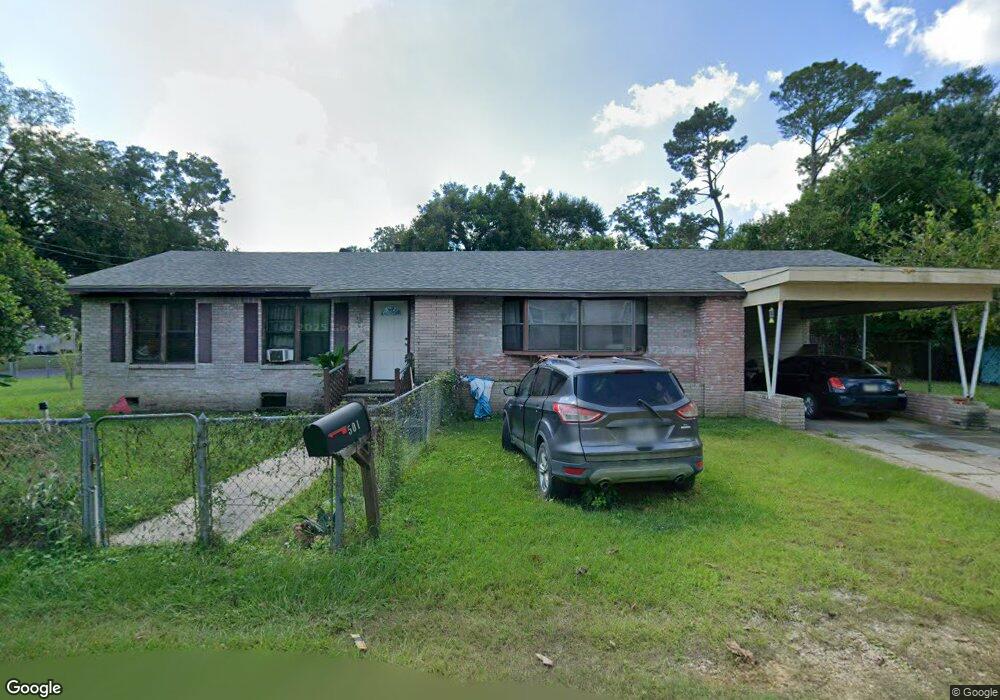
501 Brown St Deridder, LA 70634
Estimated Value: $126,000 - $185,000
4
Beds
3
Baths
1,970
Sq Ft
$79/Sq Ft
Est. Value
About This Home
This home is located at 501 Brown St, Deridder, LA 70634 and is currently estimated at $154,753, approximately $78 per square foot. 501 Brown St is a home located in Beauregard Parish with nearby schools including K.R. Hanchey Elementary School, Pine Wood Elementary School, and Carver Elementary School.
Ownership History
Date
Name
Owned For
Owner Type
Purchase Details
Closed on
Jul 16, 2021
Sold by
Hardwick Properties Llc
Bought by
Iles Paul M and Iles Denise R
Current Estimated Value
Home Financials for this Owner
Home Financials are based on the most recent Mortgage that was taken out on this home.
Original Mortgage
$108,007
Outstanding Balance
$98,000
Interest Rate
2.9%
Mortgage Type
New Conventional
Estimated Equity
$56,753
Purchase Details
Closed on
Jul 8, 2020
Sold by
Vodicka Jerry
Bought by
Hardwick Properties Llc
Create a Home Valuation Report for This Property
The Home Valuation Report is an in-depth analysis detailing your home's value as well as a comparison with similar homes in the area
Home Values in the Area
Average Home Value in this Area
Purchase History
| Date | Buyer | Sale Price | Title Company |
|---|---|---|---|
| Iles Paul M | $110,000 | None Available | |
| Hardwick Properties Llc | $44,750 | None Available |
Source: Public Records
Mortgage History
| Date | Status | Borrower | Loan Amount |
|---|---|---|---|
| Open | Iles Paul M | $108,007 |
Source: Public Records
Tax History Compared to Growth
Tax History
| Year | Tax Paid | Tax Assessment Tax Assessment Total Assessment is a certain percentage of the fair market value that is determined by local assessors to be the total taxable value of land and additions on the property. | Land | Improvement |
|---|---|---|---|---|
| 2024 | $1,127 | $10,975 | $375 | $10,600 |
| 2023 | $1,040 | $9,900 | $300 | $9,600 |
| 2022 | $1,040 | $9,900 | $300 | $9,600 |
| 2021 | $423 | $4,028 | $300 | $3,728 |
| 2020 | $399 | $3,800 | $300 | $3,500 |
| 2019 | $400 | $3,800 | $300 | $3,500 |
| 2018 | $400 | $3,800 | $300 | $3,500 |
| 2017 | $400 | $3,800 | $300 | $3,500 |
| 2016 | $400 | $3,800 | $300 | $3,500 |
| 2015 | $40 | $3,800 | $300 | $3,500 |
| 2014 | $385 | $3,800 | $300 | $3,500 |
Source: Public Records
Map
Nearby Homes
- 501 Magnolia St
- 0 Brown St Unit SWL25102366
- 508 Magnolia St
- 304 Broad St Unit Street
- 205 N Royal St
- 0 Tbd Shirley St
- 0 W Dr Tbd
- 605 Roberts St
- 116 W Port St
- 104 N Royal St
- 801 Shirley St
- 0 U S Highway 190 Unit WEST 02-5707
- 737 Roberts St Unit A and B
- 106 N Texas St
- 721 N Texas St
- 115 N Texas St
- 1012 Mc Arthur St
- 1007 Shirley St
- 1110 W Port St Unit West Port
- 112 S Texas St Unit S
- 511 Franklin St
- 515 Franklin St
- 505 Brown St
- 517 Franklin St
- 514 Franklin St
- 514 Franklin St Unit St.
- 510 Franklin St
- 509 Magnolia St
- 507 Brown St
- 508 Mcmahon St
- 510 Mcmahon St
- 601 Magnolia St
- 605 Magnolia St
- 507 Magnolia St
- 512 Mcmahon St
- 505 Magnolia St
- 0 Mcmahon St
- 507 Mcmahon St
- 607 Magnolia St
- 602 Magnolia St