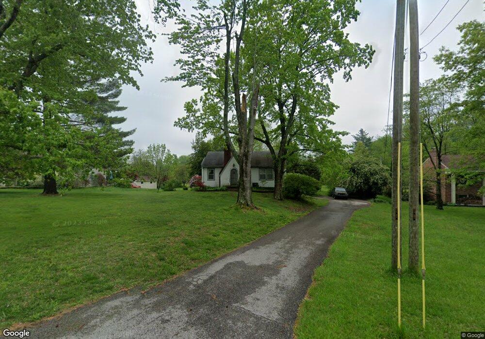
501 Captain Frank Rd New Albany, IN 47150
Estimated Value: $145,000 - $206,762
2
Beds
1
Bath
1,039
Sq Ft
$180/Sq Ft
Est. Value
About This Home
This home is located at 501 Captain Frank Rd, New Albany, IN 47150 and is currently estimated at $186,941, approximately $179 per square foot. 501 Captain Frank Rd is a home located in Floyd County with nearby schools including Green Valley Elementary School, Nathaniel Scribner Middle School, and New Albany Senior High School.
Ownership History
Date
Name
Owned For
Owner Type
Purchase Details
Closed on
Jun 23, 2011
Sold by
Jensen Stanley Keith and Burkhart Janet L
Bought by
Englert Josh A
Current Estimated Value
Home Financials for this Owner
Home Financials are based on the most recent Mortgage that was taken out on this home.
Original Mortgage
$68,225
Outstanding Balance
$47,297
Interest Rate
4.75%
Mortgage Type
FHA
Estimated Equity
$139,644
Create a Home Valuation Report for This Property
The Home Valuation Report is an in-depth analysis detailing your home's value as well as a comparison with similar homes in the area
Home Values in the Area
Average Home Value in this Area
Purchase History
| Date | Buyer | Sale Price | Title Company |
|---|---|---|---|
| Englert Josh A | -- | Signature Title Llc |
Source: Public Records
Mortgage History
| Date | Status | Borrower | Loan Amount |
|---|---|---|---|
| Open | Englert Josh A | $68,225 |
Source: Public Records
Tax History Compared to Growth
Tax History
| Year | Tax Paid | Tax Assessment Tax Assessment Total Assessment is a certain percentage of the fair market value that is determined by local assessors to be the total taxable value of land and additions on the property. | Land | Improvement |
|---|---|---|---|---|
| 2024 | $1,659 | $155,200 | $49,800 | $105,400 |
| 2023 | $1,538 | $141,200 | $49,800 | $91,400 |
| 2022 | $1,291 | $125,000 | $49,800 | $75,200 |
| 2021 | $1,184 | $115,400 | $49,800 | $65,600 |
| 2020 | $1,143 | $115,400 | $49,800 | $65,600 |
| 2019 | $1,020 | $110,200 | $49,800 | $60,400 |
| 2018 | $1,092 | $114,700 | $49,800 | $64,900 |
| 2017 | $770 | $94,100 | $49,800 | $44,300 |
| 2016 | $708 | $93,700 | $49,800 | $43,900 |
| 2014 | $715 | $89,900 | $49,800 | $40,100 |
| 2013 | -- | $92,000 | $49,800 | $42,200 |
Source: Public Records
Map
Nearby Homes
- 6 Valley View Ct
- 1519 Valley View Rd
- 2318 Coyle Dr
- 810 Katie Lane (Lot 10)
- 201 Virginia Ct
- 420 Sherley St
- 301 Country Club Dr
- 131 Olive Ave
- 1202 Naghel St
- 929 Valley View Rd
- 1107 Griffin St
- 917 Valley View Rd
- 226 Sloemer Ave
- 1309 Vine St
- 210 Clay St
- 911 Cherry St
- 2703 Clearstream Ct
- 61 Wolfe Trace Ct
- 2424 Stover Dr
- 511 E Daisy Ln
- 417 Captain Frank Rd
- 503 Captain Frank Rd
- 413 Captain Frank Rd
- 418 Captain Frank Rd
- 502 Captain Frank Rd
- 409 Captain Frank Rd
- 511 Captain Frank Rd
- 506 Captain Frank Rd
- 510 Captain Frank Rd
- 405 Captain Frank Rd
- 414 Captain Frank Rd
- 410 Captain Frank Rd
- 401 Captain Frank Rd
- 309 Captain Frank Rd
- 0 Fawcett Hill Rd
- 2104 Fawcett Hill Rd
- 606 Captain Frank Rd
- 2303 Fawcett Hill Rd
- 602 Captain Frank Rd
- 2120 Fawcett Hill Rd