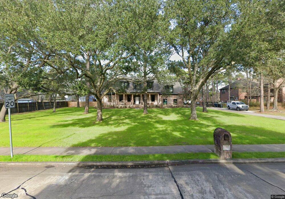
501 Cedarwood Dr Friendswood, TX 77546
Estimated Value: $774,000 - $846,000
--
Bed
3
Baths
4,088
Sq Ft
$201/Sq Ft
Est. Value
About This Home
This home is located at 501 Cedarwood Dr, Friendswood, TX 77546 and is currently estimated at $822,551, approximately $201 per square foot. 501 Cedarwood Dr is a home located in Galveston County with nearby schools including C.W. Cline Elementary School, Windsong Elementary School, and Friendswood Junior High School.
Ownership History
Date
Name
Owned For
Owner Type
Purchase Details
Closed on
Sep 26, 2020
Sold by
Trevino Loy W and Trevino Susan D
Bought by
Wiley Kristen Michelle and Wiley James Robert
Current Estimated Value
Home Financials for this Owner
Home Financials are based on the most recent Mortgage that was taken out on this home.
Original Mortgage
$500,000
Outstanding Balance
$444,723
Interest Rate
2.9%
Mortgage Type
Commercial
Estimated Equity
$377,828
Create a Home Valuation Report for This Property
The Home Valuation Report is an in-depth analysis detailing your home's value as well as a comparison with similar homes in the area
Home Values in the Area
Average Home Value in this Area
Purchase History
| Date | Buyer | Sale Price | Title Company |
|---|---|---|---|
| Wiley Kristen Michelle | -- | Stewart Title |
Source: Public Records
Mortgage History
| Date | Status | Borrower | Loan Amount |
|---|---|---|---|
| Open | Wiley Kristen Michelle | $500,000 |
Source: Public Records
Tax History Compared to Growth
Tax History
| Year | Tax Paid | Tax Assessment Tax Assessment Total Assessment is a certain percentage of the fair market value that is determined by local assessors to be the total taxable value of land and additions on the property. | Land | Improvement |
|---|---|---|---|---|
| 2025 | $11,304 | $746,532 | -- | -- |
| 2024 | $11,304 | $678,665 | -- | -- |
| 2023 | $11,304 | $616,968 | $0 | $0 |
| 2022 | $12,354 | $560,880 | $109,530 | $451,350 |
| 2021 | $13,128 | $562,040 | $109,530 | $452,510 |
| 2020 | $12,081 | $501,470 | $109,530 | $391,940 |
| 2019 | $12,987 | $511,450 | $109,530 | $401,920 |
| 2018 | $13,164 | $515,370 | $109,530 | $405,840 |
| 2017 | $12,544 | $515,370 | $109,530 | $405,840 |
| 2016 | $11,404 | $515,380 | $109,530 | $405,850 |
| 2015 | $3,627 | $399,200 | $109,530 | $289,670 |
| 2014 | $3,756 | $399,200 | $109,530 | $289,670 |
Source: Public Records
Map
Nearby Homes
- 208 Echo Ave
- 103 Echo Ave
- 200 Quaker Dr
- 206 Quaker Dr
- 198 Quaker Dr
- 204 Monte Bello Dr
- 508 Williamsburg Cir
- 716 Penn Dr
- 215 E Heritage Dr
- 506 W Shadowbend Ave
- 501 Colonial Dr
- 300 W Edgewood Dr
- 524 Fairdale St
- 407 Colonial Dr
- 201 Live Oak Ln
- 207 Live Oak Ln
- 14 Haverford Ln
- 503 Independence Dr
- 106 Melody Ln
- 607 Misty Ln
- 505 Cedarwood Dr
- 109 W Spreading Oaks Ave
- 509 Cedarwood Dr
- 203 W Spreading Oaks Ave
- 204 Stanley Ct
- 207 W Spreading Oaks Ave
- 513 Cedarwood Dr
- 405 Laurel Dr
- 2007 S Friendswood Dr
- 517 Cedarwood Dr
- 201 Stanley Ct
- 211 W Spreading Oaks Ave
- 203 Stanley Ct
- 401 Laurel Dr
- 107 W Willowick Ave
- 107 W Willowick Ave Unit 13
- 107 W Willowick Ave Unit 8 and 9
- 107 W Willowick Ave Unit 6
- 107 W Willowick Ave Unit 4
- 107 W Willowick Ave Unit 14