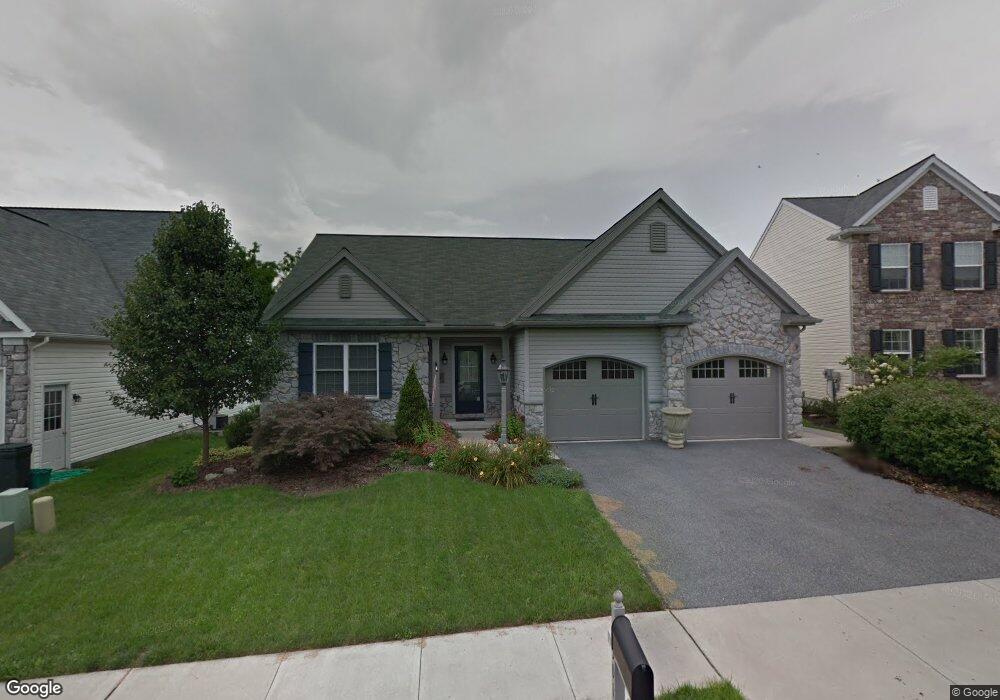
501 Charles Dr Manheim, PA 17545
Estimated Value: $427,639 - $537,000
3
Beds
3
Baths
2,888
Sq Ft
$167/Sq Ft
Est. Value
About This Home
This home is located at 501 Charles Dr, Manheim, PA 17545 and is currently estimated at $482,660, approximately $167 per square foot. 501 Charles Dr is a home located in Lancaster County with nearby schools including Manheim Central Senior High School, Manheim Christian Day School, and Sporting Hill Christian School.
Ownership History
Date
Name
Owned For
Owner Type
Purchase Details
Closed on
Sep 28, 2009
Sold by
Estate Of Robert G Scanlon and Brehm Karen S
Bought by
Damschen Gerald A and Damschen Marilyn M
Current Estimated Value
Home Financials for this Owner
Home Financials are based on the most recent Mortgage that was taken out on this home.
Original Mortgage
$283,950
Outstanding Balance
$174,939
Interest Rate
4%
Mortgage Type
VA
Estimated Equity
$307,721
Create a Home Valuation Report for This Property
The Home Valuation Report is an in-depth analysis detailing your home's value as well as a comparison with similar homes in the area
Home Values in the Area
Average Home Value in this Area
Purchase History
| Date | Buyer | Sale Price | Title Company |
|---|---|---|---|
| Damschen Gerald A | $274,900 | None Available |
Source: Public Records
Mortgage History
| Date | Status | Borrower | Loan Amount |
|---|---|---|---|
| Open | Damschen Gerald A | $283,950 |
Source: Public Records
Tax History Compared to Growth
Tax History
| Year | Tax Paid | Tax Assessment Tax Assessment Total Assessment is a certain percentage of the fair market value that is determined by local assessors to be the total taxable value of land and additions on the property. | Land | Improvement |
|---|---|---|---|---|
| 2025 | $5,366 | $225,600 | $54,700 | $170,900 |
| 2024 | $5,366 | $263,200 | $54,700 | $208,500 |
| 2023 | $5,253 | $263,200 | $54,700 | $208,500 |
| 2022 | $5,118 | $263,200 | $54,700 | $208,500 |
| 2021 | $5,002 | $263,200 | $54,700 | $208,500 |
| 2020 | $5,002 | $263,200 | $54,700 | $208,500 |
| 2019 | $4,915 | $263,200 | $54,700 | $208,500 |
| 2018 | $3,656 | $263,200 | $54,700 | $208,500 |
| 2017 | $4,881 | $209,400 | $36,700 | $172,700 |
| 2016 | $4,881 | $209,400 | $36,700 | $172,700 |
| 2015 | $1,159 | $209,400 | $36,700 | $172,700 |
| 2014 | $3,477 | $209,400 | $36,700 | $172,700 |
Source: Public Records
Map
Nearby Homes
- 609 Hamaker Rd
- 554 Mallard Dr
- 655 White Oak Rd
- 538 Brookshire Ave
- 732 Heather Ridge Unit 147
- 981 Cambridge Dr
- 239 E High St
- 188 N Main St
- 162 N Charlotte St
- 121 Mill St
- 2 S Charlotte St
- 108 110 S Main St
- 123 S Main St
- 125 S Main St
- 27 W Ferdinand St
- 33 W Ferdinand St
- 37 W Ferdinand St
- 43 W Ferdinand St
- 55 S Grant St
- 140 S Charlotte St
- 505 Charles Dr
- 497 Charles Dr
- 600 Hamaker Rd
- 493 Charles Dr
- 610 Hamaker Rd
- 327 White Oak Rd
- 484 Charles Dr
- 489 Charles Dr
- 614 Hamaker Rd
- 605 Hamaker Rd
- 601 Hamaker Rd
- 613 Hamaker Rd
- 480 Charles Dr
- 485 Charles Dr
- 481 Charles Dr
- 476 Charles Dr
- 617 Hamaker Rd
- 622 Hamaker Rd
- 474 Charles Dr
- 621 Hamaker Rd