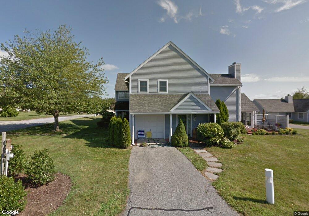
501 Corey Ln Middletown, RI 02842
Estimated Value: $685,350 - $819,000
3
Beds
3
Baths
1,704
Sq Ft
$440/Sq Ft
Est. Value
About This Home
This home is located at 501 Corey Ln, Middletown, RI 02842 and is currently estimated at $749,338, approximately $439 per square foot. 501 Corey Ln is a home located in Newport County with nearby schools including Middletown High School, St Michael's Country Day School, and St George's School.
Ownership History
Date
Name
Owned For
Owner Type
Purchase Details
Closed on
Mar 29, 2018
Sold by
Sullivan Patrick
Bought by
Patrick Sullivan Ret
Current Estimated Value
Purchase Details
Closed on
Sep 30, 2002
Sold by
Newman Zalman D
Bought by
Noble Richard and Noble Hannelore
Purchase Details
Closed on
Aug 5, 1988
Sold by
Whitehall Devel
Bought by
Dove Patrick
Create a Home Valuation Report for This Property
The Home Valuation Report is an in-depth analysis detailing your home's value as well as a comparison with similar homes in the area
Home Values in the Area
Average Home Value in this Area
Purchase History
| Date | Buyer | Sale Price | Title Company |
|---|---|---|---|
| Patrick Sullivan Ret | -- | -- | |
| Noble Richard | $255,000 | -- | |
| Dove Patrick | $152,000 | -- |
Source: Public Records
Mortgage History
| Date | Status | Borrower | Loan Amount |
|---|---|---|---|
| Previous Owner | Dove Patrick | $77,000 | |
| Previous Owner | Dove Patrick | $35,000 | |
| Previous Owner | Dove Patrick | $55,500 |
Source: Public Records
Tax History
| Year | Tax Paid | Tax Assessment Tax Assessment Total Assessment is a certain percentage of the fair market value that is determined by local assessors to be the total taxable value of land and additions on the property. | Land | Improvement |
|---|---|---|---|---|
| 2025 | $5,889 | $499,500 | $0 | $499,500 |
| 2024 | $5,624 | $499,500 | $0 | $499,500 |
| 2023 | $4,540 | $360,600 | $0 | $360,600 |
| 2022 | $4,334 | $360,600 | $0 | $360,600 |
| 2021 | $4,334 | $360,600 | $0 | $360,600 |
| 2020 | $4,590 | $333,600 | $0 | $333,600 |
| 2018 | $4,587 | $333,600 | $0 | $333,600 |
| 2016 | $4,510 | $292,500 | $0 | $292,500 |
| 2015 | $4,399 | $292,500 | $0 | $292,500 |
| 2014 | $4,103 | $255,300 | $0 | $255,300 |
| 2013 | $4,011 | $255,300 | $0 | $255,300 |
Source: Public Records
Map
Nearby Homes
- 310 Corey Ln
- 223 Corey Ln
- 16 Ward Ave
- 476 Green End Ave
- 81 Beagle Dr
- 23 Indian Hill Cir
- 10 Oceanview Dr
- 403 Valley Rd
- 74 Valley Rd
- 55 John Clarke Rd Unit 8
- 55 John Clarke Rd Unit 3
- 55 John Clarke Rd Unit 24
- 206 Reservoir Rd
- 141 Gray Craig Rd
- 118 Wolcott Ave
- 1 Ichabod Ln
- 533 Forest Park
- 662 Forest Park
- 836 Forest Park
- 743 Forest Park
Your Personal Tour Guide
Ask me questions while you tour the home.