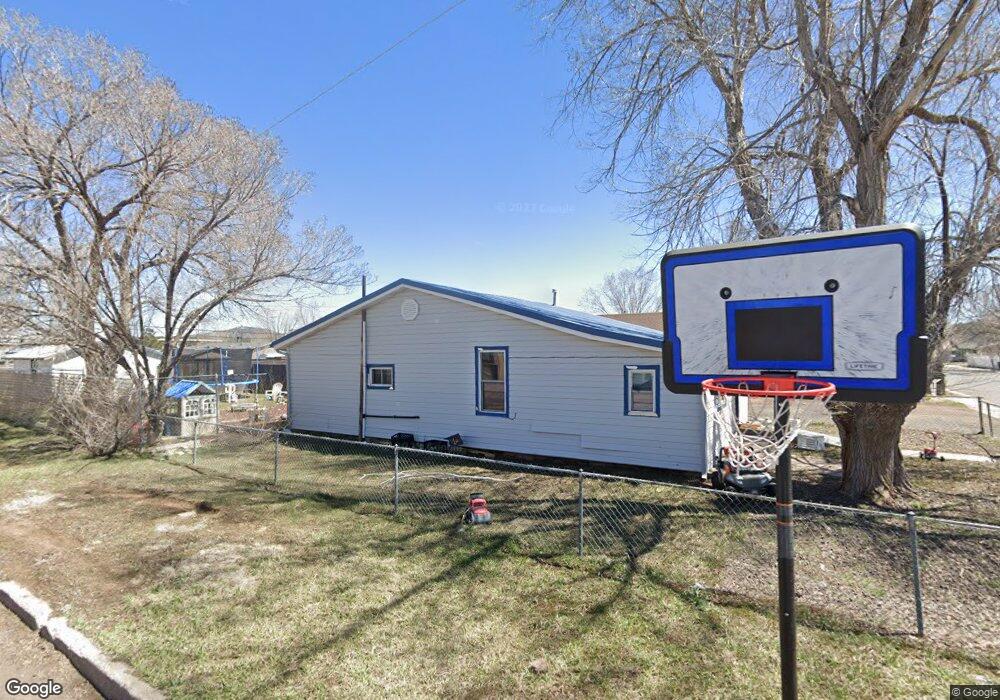
501 E Edison Ave Williams, AZ 86046
Estimated Value: $289,155 - $403,000
2
Beds
1
Bath
1,126
Sq Ft
$319/Sq Ft
Est. Value
About This Home
This home is located at 501 E Edison Ave, Williams, AZ 86046 and is currently estimated at $359,039, approximately $318 per square foot. 501 E Edison Ave is a home located in Coconino County with nearby schools including Williams Elementary/Middle School, Williams High School, and Heritage Elementary - Williams.
Ownership History
Date
Name
Owned For
Owner Type
Purchase Details
Closed on
Jul 25, 2017
Sold by
Hess James and Hess Ann
Bought by
Matthews Financial Investments Llc
Current Estimated Value
Home Financials for this Owner
Home Financials are based on the most recent Mortgage that was taken out on this home.
Original Mortgage
$100,000
Outstanding Balance
$83,060
Interest Rate
3.88%
Mortgage Type
Seller Take Back
Estimated Equity
$275,979
Create a Home Valuation Report for This Property
The Home Valuation Report is an in-depth analysis detailing your home's value as well as a comparison with similar homes in the area
Home Values in the Area
Average Home Value in this Area
Purchase History
| Date | Buyer | Sale Price | Title Company |
|---|---|---|---|
| Matthews Financial Investments Llc | $110,000 | Pioneer Title Agency |
Source: Public Records
Mortgage History
| Date | Status | Borrower | Loan Amount |
|---|---|---|---|
| Open | Matthews Financial Investments Llc | $100,000 |
Source: Public Records
Tax History
| Year | Tax Paid | Tax Assessment Tax Assessment Total Assessment is a certain percentage of the fair market value that is determined by local assessors to be the total taxable value of land and additions on the property. | Land | Improvement |
|---|---|---|---|---|
| 2025 | $833 | $19,730 | -- | -- |
| 2024 | $833 | $18,615 | -- | -- |
| 2023 | $809 | $15,083 | $0 | $0 |
| 2022 | $770 | $11,953 | $0 | $0 |
| 2021 | $742 | $11,630 | $0 | $0 |
| 2020 | $727 | $10,214 | $0 | $0 |
| 2019 | $706 | $9,026 | $0 | $0 |
| 2018 | $683 | $8,249 | $0 | $0 |
| 2017 | $669 | $7,105 | $0 | $0 |
| 2016 | $633 | $6,595 | $0 | $0 |
| 2015 | $642 | $6,805 | $0 | $0 |
Source: Public Records
Map
Nearby Homes
- 218 E Edison Ave
- 701 N Airport Rd
- 00 S Pine St
- 344 E Route 66
- 1124 N Grand Canyon Blvd Unit C
- 241 W Grant Ave
- 401 S 1st St
- 1105 W Morse Ave
- 304 S 4th St
- 901 Wells Fargo Dr
- 1258 W Morse Ave
- 500 W Meade Ave
- 216 Pinecrest Trail
- 162 Pinecrest Trail
- 118 Pinecrest Trail
- 224 N Morse Ave
- 147 Pinecrest Trail
- 215 W Hancock Ave
- 920 W Sheridan Ave
- 1011 W Sheridan Ave
- 503 E Edison Ave
- 441 E Edison Ave
- 541 E Edison Ave
- 433 E Edison Ave
- 510 E Edison Ave
- 502 E Edison Ave
- 515 N Locust St
- 500 E Rodeo Rd
- 425 E Edison Ave
- 504 Rodeo Rd
- 513 N Locust St
- 630 E Edison Ave
- 436 E Edison Ave
- 420 E Edison Ave
- 512 N Locust St
- 616 N Airport Rd
- 411 E Edison Ave
- 507 N Locust St
- 605 N Cedar St
- 409 E Edison Ave
Your Personal Tour Guide
Ask me questions while you tour the home.