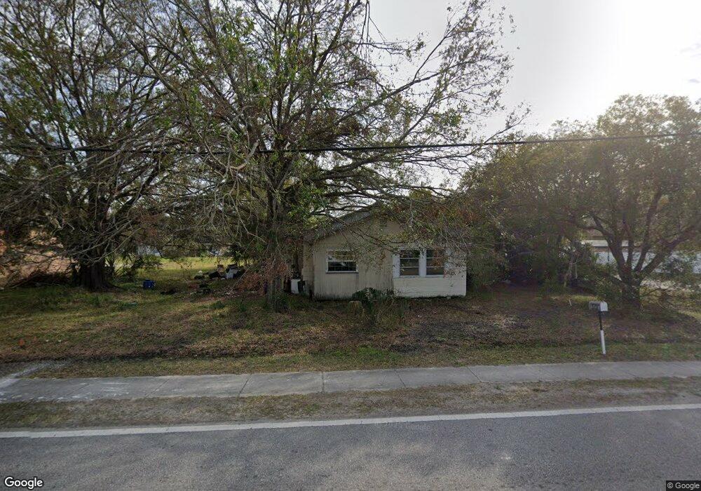
501 E Shell Point Rd Ruskin, FL 33570
Estimated Value: $139,000 - $246,000
2
Beds
1
Bath
1,056
Sq Ft
$166/Sq Ft
Est. Value
About This Home
This home is located at 501 E Shell Point Rd, Ruskin, FL 33570 and is currently estimated at $175,125, approximately $165 per square foot. 501 E Shell Point Rd is a home located in Hillsborough County with nearby schools including Thompson Elementary School, Shields Middle School, and Lennard High School.
Ownership History
Date
Name
Owned For
Owner Type
Purchase Details
Closed on
Apr 1, 2008
Sold by
Vires Tony L and Vires Michelle S
Bought by
Shell Point Shelter Llc
Current Estimated Value
Purchase Details
Closed on
Jun 27, 2000
Sold by
Farr Rudolph J and Farr Judith M
Bought by
Vires Tony L and Vires Michelle S
Home Financials for this Owner
Home Financials are based on the most recent Mortgage that was taken out on this home.
Original Mortgage
$44,500
Interest Rate
8.55%
Create a Home Valuation Report for This Property
The Home Valuation Report is an in-depth analysis detailing your home's value as well as a comparison with similar homes in the area
Home Values in the Area
Average Home Value in this Area
Purchase History
| Date | Buyer | Sale Price | Title Company |
|---|---|---|---|
| Shell Point Shelter Llc | $70,000 | South Bay Title Insurance Ag | |
| Vires Tony L | $45,000 | -- |
Source: Public Records
Mortgage History
| Date | Status | Borrower | Loan Amount |
|---|---|---|---|
| Previous Owner | Vires Tony L | $44,500 |
Source: Public Records
Tax History
| Year | Tax Paid | Tax Assessment Tax Assessment Total Assessment is a certain percentage of the fair market value that is determined by local assessors to be the total taxable value of land and additions on the property. | Land | Improvement |
|---|---|---|---|---|
| 2025 | $2,129 | $113,048 | $67,797 | $45,251 |
| 2024 | $2,129 | $113,048 | $67,797 | $45,251 |
| 2023 | $1,963 | $105,054 | $56,498 | $48,556 |
| 2022 | $1,811 | $106,238 | $45,198 | $61,040 |
| 2021 | $1,647 | $84,488 | $35,593 | $48,895 |
| 2020 | $1,494 | $78,549 | $36,723 | $41,826 |
| 2019 | $1,339 | $69,780 | $26,554 | $43,226 |
| 2018 | $1,242 | $66,188 | $0 | $0 |
| 2017 | $1,101 | $51,113 | $0 | $0 |
| 2016 | $1,012 | $37,293 | $0 | $0 |
| 2015 | $926 | $33,903 | $0 | $0 |
| 2014 | $846 | $30,821 | $0 | $0 |
| 2013 | -- | $28,019 | $0 | $0 |
Source: Public Records
Map
Nearby Homes
- 204 E Shell Point Rd
- 502 3rd Ave SE
- 506 3rd Ave SE
- 508 Glenn Cross Dr
- 0 1st St NE
- 205 2nd Ave SE
- 808 1st Ave NE
- 714 Barclay Wood Dr
- 77 E Shell Point Rd
- 501 Delwood Breck St
- 736 Royal Empress Dr
- 762 Barclay Wood Dr
- 0 W Shell Point Rd
- 1 W Shell Point
- 928 Royal Empress Dr
- 610 N US Highway 41
- 1021 Spotted Egret Loop
- 1023 Spotted Egret Loop
- 601 8th Ct SE
- 1025 Spotted Egret Loop
- 511 E Shell Point Rd
- 502 2nd Ave NE
- 204 5th St NE
- 423 E Shell Point Rd
- 202 5th St NE
- 506 2nd Ave NE
- 210 6th St NE
- 202 6th St NE
- 415 E Shell Point Rd
- 115 5th St NE
- 505 2nd Ave NE
- 112 5th St NE
- 110 6th St NE
- 508 E Shell Point Rd
- 409 E Shell Point Rd
- 113 5th St NE
- 111 5th St NE
- 203 6th St NE
- 205 6th St NE
Your Personal Tour Guide
Ask me questions while you tour the home.