


501 Emily Rd Mazomanie, WI 53560
Estimated payment $473/month
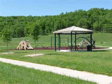
About This Lot
LIMITED TIME PRICING! New Community located in Mazomanie"s new Pheasant Ridge Run subdivision.Easy commute to Middleton/Madison! Level lot. Zoned for 4 Unit.
Property Details
Property Type
- Land
Est. Annual Taxes
- $678
Lot Details
- 0.43 Acre Lot
- Lot Dimensions are 120x155
- Level Lot
- Property is zoned Multi
Schools
- Black Earth-Mazomanie Elementary School
- Wisconsin Heights Middle School
- Wisconsin Heights High School
Utilities
- Underground Utilities
- Phone Available
- Cable TV Available
Community Details
- Pheasant Ridge Run Subdivision
Listing and Financial Details
- Assessor Parcel Number 0806-174-0672-1
Map
Home Values in the Area
Average Home Value in this Area
Tax History
| Year | Tax Paid | Tax Assessment Tax Assessment Total Assessment is a certain percentage of the fair market value that is determined by local assessors to be the total taxable value of land and additions on the property. | Land | Improvement |
|---|---|---|---|---|
| 2024 | $1,169 | $59,500 | $59,500 | -- |
| 2023 | $1,122 | $59,500 | $59,500 | $0 |
| 2021 | $1,224 | $50,000 | $50,000 | $0 |
| 2020 | $678 | $29,800 | $29,800 | $0 |
| 2019 | $656 | $29,800 | $29,800 | $0 |
| 2018 | $633 | $29,800 | $29,800 | $0 |
| 2017 | $627 | $29,800 | $29,800 | $0 |
| 2016 | $646 | $29,800 | $29,800 | $0 |
| 2015 | $640 | $29,800 | $29,800 | $0 |
| 2014 | $619 | $29,800 | $29,800 | $0 |
| 2013 | $598 | $29,800 | $29,800 | $0 |
Property History
| Date | Event | Price | List to Sale | Price per Sq Ft |
|---|---|---|---|---|
| 06/03/2024 06/03/24 | For Sale | $79,000 | 0.0% | -- |
| 05/31/2024 05/31/24 | Off Market | $79,000 | -- | -- |
| 04/02/2024 04/02/24 | Price Changed | $79,000 | -11.2% | -- |
| 10/30/2020 10/30/20 | Price Changed | $89,000 | +13.4% | -- |
| 06/08/2018 06/08/18 | Price Changed | $78,500 | -21.4% | -- |
| 08/30/2010 08/30/10 | For Sale | $99,900 | -- | -- |
Source: South Central Wisconsin Multiple Listing Service
MLS Number: 1604715
APN: 0806-174-0672-1
Disclaimer: Certain information contained herein is derived from information provided by parties other than Homes.com. All information provided is deemed reliable, but is not guaranteed to be accurate and should be independently verified.
![]() IDX information is provided exclusively for personal, non-commercial use, and may not be used for any purpose other than to identify prospective properties consumers may be interested in purchasing. Information is deemed reliable but not guaranteed.
IDX information is provided exclusively for personal, non-commercial use, and may not be used for any purpose other than to identify prospective properties consumers may be interested in purchasing. Information is deemed reliable but not guaranteed.
- 505 Emily Rd
- 603 Prairie Ln
- 429 Emily Rd
- 507 Prairie Ln
- 508 Prairie Ln
- 503 Ridge Dr
- 708 Reeve Rd
- 607 Ridge Dr
- 605 Ridge Dr
- 603 Ridge Dr
- 601 Ridge Dr
- Lot 19 Prairie Ln
- 709 Prairie Ln
- 705 Prairie Ln
- Lot 2 Csm 12049 Highway 14
- 721 Lichte Dr
- 714 Lichte Dr
- 218 W Division St
- 124 W Exchange St
- Lot 18 Ridge Run
- 35 Brodhead St
- 1300 Main St
- 431 Water St Unit 208
- 10988 Ridge St Unit 2
- 400 W Garfield St
- 1916 Eastwood Way
- 1908 Fox Run Unit 1908
- 1205 Temple Dr
- 8951 White Coral Way
- 2842-2876 Pleasant View Rd
- 1455 Plainview Rd
- 10202 Rustling Birch Rd
- 732 Bear Claw Way
- 652 Bear Claw Way
- 9603 Paragon St
- 9201 Waterside St
- 1040 Cedar St Unit Upper
- 8560 Greenway Blvd
- 8860 Blackhawk Rd
- 8561 Greenway Blvd
