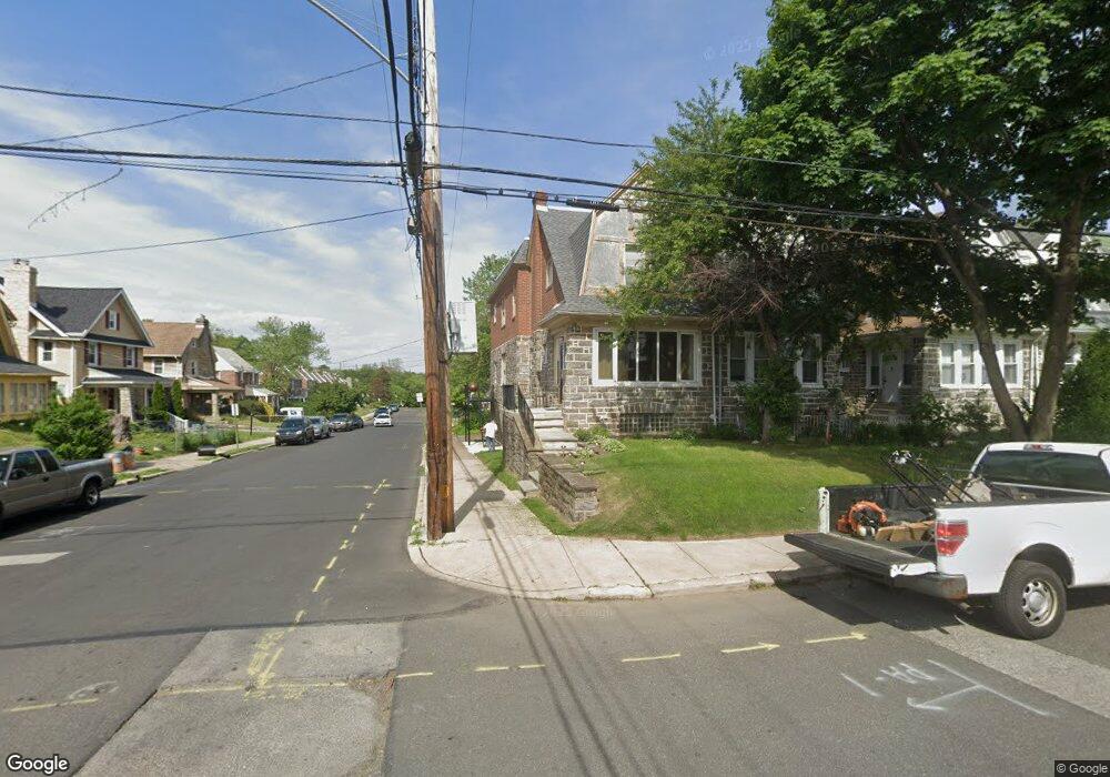
501 Holly Rd Lansdowne, PA 19050
Estimated Value: $255,000 - $331,000
4
Beds
2
Baths
2,160
Sq Ft
$138/Sq Ft
Est. Value
About This Home
This home is located at 501 Holly Rd, Lansdowne, PA 19050 and is currently estimated at $297,452, approximately $137 per square foot. 501 Holly Rd is a home located in Delaware County with nearby schools including Evans Elementary School, Penn Wood Middle School, and Penn Wood High School - Cypress Street Campus.
Ownership History
Date
Name
Owned For
Owner Type
Purchase Details
Closed on
Jan 29, 1994
Sold by
Walker Darlene T and Boggs Jerry Attrill
Bought by
Boggs Jerry A
Current Estimated Value
Home Financials for this Owner
Home Financials are based on the most recent Mortgage that was taken out on this home.
Original Mortgage
$33,250
Interest Rate
6.44%
Mortgage Type
VA
Create a Home Valuation Report for This Property
The Home Valuation Report is an in-depth analysis detailing your home's value as well as a comparison with similar homes in the area
Home Values in the Area
Average Home Value in this Area
Purchase History
| Date | Buyer | Sale Price | Title Company |
|---|---|---|---|
| Boggs Jerry A | -- | Commonwealth Land Title Ins |
Source: Public Records
Mortgage History
| Date | Status | Borrower | Loan Amount |
|---|---|---|---|
| Closed | Boggs Jerry A | $33,250 |
Source: Public Records
Tax History Compared to Growth
Tax History
| Year | Tax Paid | Tax Assessment Tax Assessment Total Assessment is a certain percentage of the fair market value that is determined by local assessors to be the total taxable value of land and additions on the property. | Land | Improvement |
|---|---|---|---|---|
| 2025 | $6,784 | $158,880 | $32,500 | $126,380 |
| 2024 | $6,784 | $158,880 | $32,500 | $126,380 |
| 2023 | $6,162 | $158,880 | $32,500 | $126,380 |
| 2022 | $5,875 | $158,880 | $32,500 | $126,380 |
| 2021 | $8,884 | $158,880 | $32,500 | $126,380 |
| 2020 | $4,861 | $77,830 | $18,750 | $59,080 |
| 2019 | $4,775 | $77,830 | $18,750 | $59,080 |
| 2018 | $4,709 | $77,830 | $0 | $0 |
| 2017 | $4,610 | $77,830 | $0 | $0 |
| 2016 | $436 | $77,830 | $0 | $0 |
| 2015 | $436 | $77,830 | $0 | $0 |
| 2014 | $436 | $77,830 | $0 | $0 |
Source: Public Records
Map
Nearby Homes
- 407 Church Ln
- 503 Bonsall Ave
- 435 Bonsall Ave
- 536 Cypress St
- 530 Orchard Ave
- 603 Penn St
- 702 Cedar Ave
- 711 Yeadon Ave Unit 1
- 722 Yeadon Ave
- 1016 Whitby Ave
- 740 Church Ln
- 608 Pembroke Ave
- 7026 Atlantic Ave
- 800 Bullock Ave
- 813 Arbor Rd
- 825 Laurel Rd
- 7123 Seaford Rd
- 7129 Seaford Rd
- 808 Serrill Ave
- 1212 S Millick St