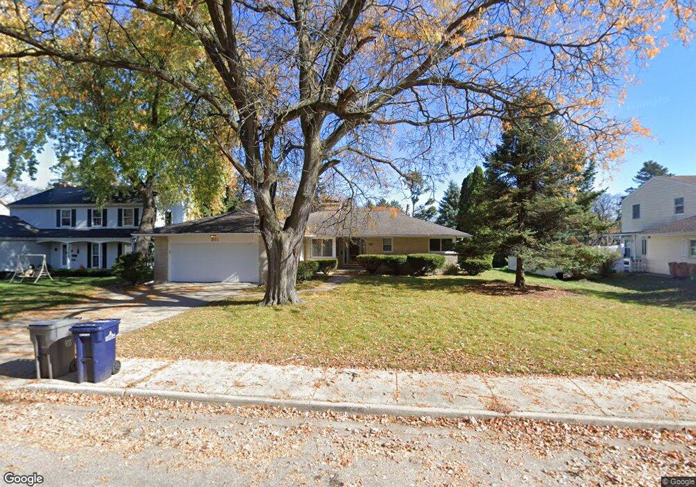
501 Hubbard Ave Elgin, IL 60123
Grant Park NeighborhoodEstimated Value: $286,000 - $331,792
2
Beds
3
Baths
1,591
Sq Ft
$196/Sq Ft
Est. Value
About This Home
This home is located at 501 Hubbard Ave, Elgin, IL 60123 and is currently estimated at $312,198, approximately $196 per square foot. 501 Hubbard Ave is a home located in Kane County with nearby schools including Highland Elementary School, Kimball Middle School, and Larkin High School.
Ownership History
Date
Name
Owned For
Owner Type
Purchase Details
Closed on
Feb 4, 2021
Sold by
Roberts Mary A and Roberts David P
Bought by
Roberts Mary A and The Mary A Roberts Declaration
Current Estimated Value
Purchase Details
Closed on
Feb 2, 2009
Sold by
Deutsche Bank National Trust Company
Bought by
Roberts David P and Roberts Mary A
Purchase Details
Closed on
Sep 26, 2008
Sold by
Avelar Karla
Bought by
Deutsche Bank National Trust Company
Purchase Details
Closed on
Mar 15, 2005
Sold by
Skjoldager Scott and Jurczak Susan
Bought by
Avelar Karla
Home Financials for this Owner
Home Financials are based on the most recent Mortgage that was taken out on this home.
Original Mortgage
$189,600
Interest Rate
6%
Mortgage Type
Purchase Money Mortgage
Create a Home Valuation Report for This Property
The Home Valuation Report is an in-depth analysis detailing your home's value as well as a comparison with similar homes in the area
Home Values in the Area
Average Home Value in this Area
Purchase History
| Date | Buyer | Sale Price | Title Company |
|---|---|---|---|
| Roberts Mary A | -- | None Available | |
| Roberts David P | $138,000 | World Title Guaranty Inc | |
| Deutsche Bank National Trust Company | $174,505 | None Available | |
| Avelar Karla | $237,000 | Chicago Title Insurance Comp |
Source: Public Records
Mortgage History
| Date | Status | Borrower | Loan Amount |
|---|---|---|---|
| Previous Owner | Avelar Karla | $189,600 | |
| Closed | Avelar Karla | $47,400 |
Source: Public Records
Tax History Compared to Growth
Tax History
| Year | Tax Paid | Tax Assessment Tax Assessment Total Assessment is a certain percentage of the fair market value that is determined by local assessors to be the total taxable value of land and additions on the property. | Land | Improvement |
|---|---|---|---|---|
| 2024 | $7,054 | $88,138 | $25,341 | $62,797 |
| 2023 | $6,788 | $79,626 | $22,894 | $56,732 |
| 2022 | $6,296 | $72,605 | $20,875 | $51,730 |
| 2021 | $6,056 | $67,881 | $19,517 | $48,364 |
| 2020 | $5,910 | $64,803 | $18,632 | $46,171 |
| 2019 | $5,765 | $61,729 | $17,748 | $43,981 |
| 2018 | $5,749 | $58,153 | $16,720 | $41,433 |
| 2017 | $5,654 | $54,975 | $15,806 | $39,169 |
| 2016 | $5,439 | $51,002 | $14,664 | $36,338 |
| 2015 | -- | $46,748 | $13,441 | $33,307 |
| 2014 | -- | $46,171 | $13,275 | $32,896 |
| 2013 | -- | $47,389 | $13,625 | $33,764 |
Source: Public Records
Map
Nearby Homes
- 518 Clark St
- 3 Garden Crescent Ct
- 558 N Crystal St
- 340 Hubbard Ave
- 587 N Clifton Ave
- 315 N Commonwealth Ave
- 431 N Crystal St
- Lot N Alfred Ave
- 1103 Lawrence Ave
- 308 N Clifton Ave
- 334 N Crystal St
- 362 Heine Ave
- 319 Triggs Ave
- 44 N Du Bois Ave
- 1300 Wolff Ave
- 712 W Highland Ave Unit 4
- 41 Hamilton Ave
- 705 W Highland Ave
- 15 N Edison Ave
- 1550 W Highland Ave
- 509 Hubbard Ave
- 491 Hubbard Ave
- 506 N Worth Ave
- 500 N Worth Ave
- 917 Wing St
- 510 N Worth Ave
- 485 Hubbard Ave
- 498 Hubbard Ave
- 482 N Worth Ave
- 508 Hubbard Ave
- 490 Hubbard Ave
- 514 Hubbard Ave
- 484 Hubbard Ave
- 865 Wing St
- 955 Wing St
- 505 N Worth Ave
- 521 Wing Park Blvd
- 495 N Worth Ave
- 517 Wing Park Blvd
- 971 Demmond St