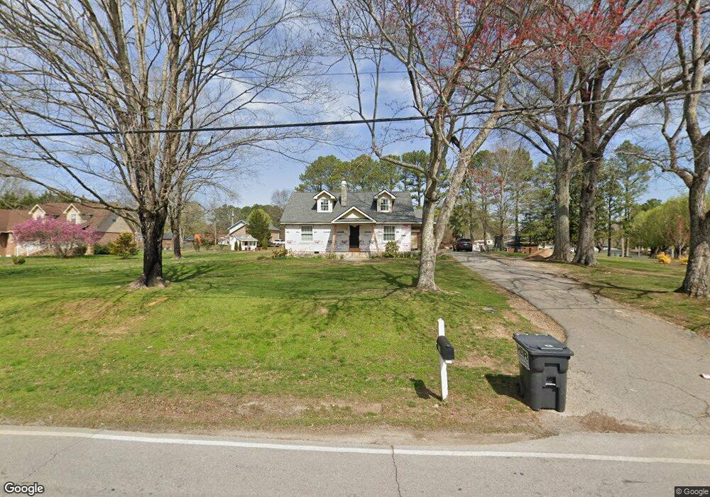
501 Kay Conley Rd Rock Spring, GA 30739
Rock Spring NeighborhoodEstimated Value: $303,000 - $454,000
--
Bed
2
Baths
3,261
Sq Ft
$112/Sq Ft
Est. Value
About This Home
This home is located at 501 Kay Conley Rd, Rock Spring, GA 30739 and is currently estimated at $365,333, approximately $112 per square foot. 501 Kay Conley Rd is a home located in Walker County with nearby schools including Rock Spring Elementary School, Lafayette High School, and Alice M Daley Adventist School.
Ownership History
Date
Name
Owned For
Owner Type
Purchase Details
Closed on
Sep 21, 2007
Sold by
Pickard Carrie
Bought by
Pickard Russell L and Rickard Glorious R
Current Estimated Value
Purchase Details
Closed on
Sep 12, 1986
Sold by
Stephenson Triston
Bought by
Pickard Gregory and Pickard Carrie
Purchase Details
Closed on
Mar 13, 1965
Bought by
Stephenson Triston
Create a Home Valuation Report for This Property
The Home Valuation Report is an in-depth analysis detailing your home's value as well as a comparison with similar homes in the area
Home Values in the Area
Average Home Value in this Area
Purchase History
| Date | Buyer | Sale Price | Title Company |
|---|---|---|---|
| Pickard Russell L | -- | -- | |
| Pickard Carrie Vivian | -- | -- | |
| Pickard Gregory | $53,000 | -- | |
| Stephenson Triston | -- | -- |
Source: Public Records
Tax History Compared to Growth
Tax History
| Year | Tax Paid | Tax Assessment Tax Assessment Total Assessment is a certain percentage of the fair market value that is determined by local assessors to be the total taxable value of land and additions on the property. | Land | Improvement |
|---|---|---|---|---|
| 2024 | $1,628 | $59,658 | $11,860 | $47,798 |
| 2023 | $2,501 | $109,091 | $11,860 | $97,231 |
| 2022 | $2,347 | $94,316 | $11,860 | $82,456 |
| 2021 | $1,835 | $65,492 | $11,860 | $53,632 |
| 2020 | $1,696 | $57,991 | $11,860 | $46,131 |
| 2019 | $1,751 | $59,997 | $11,860 | $48,137 |
| 2018 | $1,588 | $59,997 | $11,860 | $48,137 |
| 2017 | $1,856 | $57,972 | $11,860 | $46,112 |
| 2016 | $1,500 | $57,972 | $11,860 | $46,112 |
| 2015 | $1,283 | $46,271 | $8,200 | $38,071 |
| 2014 | $1,182 | $46,271 | $8,200 | $38,071 |
| 2013 | -- | $46,271 | $8,200 | $38,071 |
Source: Public Records
Map
Nearby Homes
- 1902 Long Hollow Rd
- 195 Honeysuckle Dr
- 59 Honeysuckle Dr
- 36 Pheonix Cir
- 5602 Georgia 95
- 00 Georgia 95
- 1003 Highway N Old 27
- 1370 Old Highway 27
- 1476 Arnold Rd
- 386 Twelve Oaks Dr
- 701 Bicentennial Trail
- 285 Cooper Rd
- 1121 Arnold Rd
- 375 Cooper Rd
- 10180 Us Highway 27
- 788 Long Hollow Rd
- 954 Goodson Cir
- 514 Ginger Lake Dr
- 918 Old Lafayette Rd
- 15 Willow Cir
- 477 Kay Conley Rd
- 286 Jordan Cir
- 486 Kay Conley Rd
- 498 Kay Conley Rd
- 544 Kay Conley Rd
- 229 Jordan Cir
- 2847 Peavine Rd
- 272 Jordan Cir
- 2892 Peavine Rd
- 2814 Peavine Rd
- 464 Kay Conley Rd
- 417 Kay Conley Rd
- 262 Jordan Cir
- 199 Jordan Cir
- 261 Jordan Cir
- 2910 Peavine Rd
- 2792 Peavine Rd
- 436 Kay Conley Rd
- 403 Kay Conley Rd
- 220 Jordan Cir