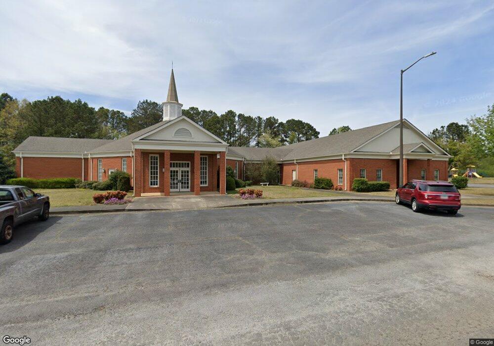
501 Northside Dr Carrollton, GA 30117
Estimated Value: $2,031,355
--
Bed
6
Baths
5,836
Sq Ft
$348/Sq Ft
Est. Value
About This Home
This home is located at 501 Northside Dr, Carrollton, GA 30117 and is currently estimated at $2,031,355, approximately $348 per square foot. 501 Northside Dr is a home located in Carroll County with nearby schools including Carrollton Elementary School, Carrollton Upper Elementary School, and Carrollton Middle School.
Ownership History
Date
Name
Owned For
Owner Type
Purchase Details
Closed on
Jun 1, 2010
Sold by
Trinity Baptist Church
Bought by
Trinity Baptist Church Of Carr
Current Estimated Value
Purchase Details
Closed on
Jun 1, 1988
Bought by
Trinity Baptist
Create a Home Valuation Report for This Property
The Home Valuation Report is an in-depth analysis detailing your home's value as well as a comparison with similar homes in the area
Home Values in the Area
Average Home Value in this Area
Purchase History
| Date | Buyer | Sale Price | Title Company |
|---|---|---|---|
| Trinity Baptist Church Of Carr | $755,000 | -- | |
| Trinity Baptist | -- | -- |
Source: Public Records
Tax History Compared to Growth
Tax History
| Year | Tax Paid | Tax Assessment Tax Assessment Total Assessment is a certain percentage of the fair market value that is determined by local assessors to be the total taxable value of land and additions on the property. | Land | Improvement |
|---|---|---|---|---|
| 2024 | -- | $280,923 | $106,200 | $174,723 |
| 2023 | $0 | $280,924 | $106,200 | $174,724 |
| 2022 | $8,200 | $280,924 | $106,200 | $174,724 |
| 2021 | $8,200 | $280,924 | $106,200 | $174,724 |
| 2020 | $8,406 | $280,924 | $106,200 | $174,724 |
| 2019 | $8,406 | $280,924 | $106,200 | $174,724 |
| 2018 | $8,499 | $280,924 | $106,200 | $174,724 |
| 2017 | $0 | $280,924 | $106,200 | $174,724 |
| 2016 | $8,499 | $280,924 | $106,200 | $174,724 |
| 2015 | -- | $280,923 | $106,200 | $174,724 |
| 2014 | -- | $280,924 | $106,200 | $174,724 |
Source: Public Records
Map
Nearby Homes
- 105 Providence Ct
- 131 Hunter Way
- 221 Turtle Cove
- 255 Morgan Rd
- The McGinnis Plan at Morgan Landing
- 211 Greystone Dr
- 2580 Shady Grove Rd
- 231 N Lakeshore Dr
- 223 N Lakeshore Dr
- 1890 Shady Grove Rd
- 0 Knight Dr W
- 121 Wilson Cir
- 1711B Bankhead Hwy
- 0 Old Airport Rd Unit 10599783
- 0 Old Airport Rd Unit 7642336
- 0 Old Airport Rd Unit 10599779
- 3 Burns Rd
- 2 Burns Rd
- 0 Shady Grove Rd Unit 10601173
- 0 Shady Grove Rd Unit 10601172
- 202 Providence Dr
- 204 Providence Dr
- 112 Providence Dr
- 206 Providence Dr Unit 214
- 206 Providence Dr
- 110 Providence Dr
- 208 Providence Dr
- 108 Providence Dr
- 0 Providence Dr Unit 7250432
- 0 Providence Dr Unit 8646856
- 0 Providence Dr Unit 8614795
- 0 Providence Dr Unit 8334190
- 0 Providence Dr Unit 8087277
- 0 Providence Dr Unit 7319840
- 0 Providence Dr Unit 7514268
- 0 Providence Dr Unit 7221557
- 0 Providence Dr Unit 8724946
- 0 Providence Dr Unit 8751943
- 0 Providence Dr Unit 8786804
- 0 Providence Dr Unit 3228494