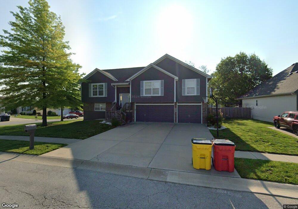
501 NW Whitney Dr Grain Valley, MO 64029
Estimated Value: $335,387 - $389,000
3
Beds
3
Baths
1,578
Sq Ft
$228/Sq Ft
Est. Value
About This Home
This home is located at 501 NW Whitney Dr, Grain Valley, MO 64029 and is currently estimated at $359,847, approximately $228 per square foot. 501 NW Whitney Dr is a home located in Jackson County with nearby schools including Grain Valley High School.
Ownership History
Date
Name
Owned For
Owner Type
Purchase Details
Closed on
Oct 11, 2019
Sold by
Mickelson Graig R and Mickelson Graig
Bought by
Mickelson Graig and Mickelson Cassaundra
Current Estimated Value
Home Financials for this Owner
Home Financials are based on the most recent Mortgage that was taken out on this home.
Original Mortgage
$142,000
Outstanding Balance
$125,028
Interest Rate
3.75%
Mortgage Type
New Conventional
Estimated Equity
$234,819
Purchase Details
Closed on
Jul 18, 2008
Sold by
Kindell Michael B and Kindell Lindsay
Bought by
Mickelson Graig R
Home Financials for this Owner
Home Financials are based on the most recent Mortgage that was taken out on this home.
Original Mortgage
$164,912
Interest Rate
6.4%
Mortgage Type
FHA
Create a Home Valuation Report for This Property
The Home Valuation Report is an in-depth analysis detailing your home's value as well as a comparison with similar homes in the area
Home Values in the Area
Average Home Value in this Area
Purchase History
| Date | Buyer | Sale Price | Title Company |
|---|---|---|---|
| Mickelson Graig | -- | Servicelink | |
| Mickelson Graig R | -- | Chicago Title |
Source: Public Records
Mortgage History
| Date | Status | Borrower | Loan Amount |
|---|---|---|---|
| Open | Mickelson Graig | $142,000 | |
| Closed | Mickelson Graig R | $164,912 |
Source: Public Records
Tax History Compared to Growth
Tax History
| Year | Tax Paid | Tax Assessment Tax Assessment Total Assessment is a certain percentage of the fair market value that is determined by local assessors to be the total taxable value of land and additions on the property. | Land | Improvement |
|---|---|---|---|---|
| 2025 | $4,910 | $46,235 | $9,388 | $36,847 |
| 2024 | $4,726 | $59,613 | $7,288 | $52,325 |
| 2023 | $4,726 | $59,612 | $6,876 | $52,736 |
| 2022 | $3,169 | $34,960 | $6,394 | $28,566 |
| 2021 | $3,095 | $34,960 | $6,394 | $28,566 |
| 2020 | $3,133 | $34,906 | $6,394 | $28,512 |
| 2019 | $3,069 | $34,906 | $6,394 | $28,512 |
| 2018 | $3,017 | $32,067 | $4,787 | $27,280 |
| 2017 | $3,017 | $32,067 | $4,787 | $27,280 |
| 2016 | $2,648 | $28,158 | $4,465 | $23,693 |
| 2014 | $2,471 | $26,076 | $4,465 | $21,611 |
Source: Public Records
Map
Nearby Homes
- 505 NW Whitney Dr
- 1601 NW Nicholas Dr
- 801 NW Hickory Ridge Dr
- 803 NW Hickory Ridge Dr
- 1401 NW Hickory Ridge Ct
- 401 NW Europa Dr
- 1702 NW Hedgewood Dr
- 1800 NW Mya Ct
- TBD E Duncan Rd
- 816 NW Cedar Ln
- 1415 NE Jaclyn Dr
- 1403 NW Burr Oak Ct
- 2 Ooida Dr
- 408 NW Rust Ct
- 952 NW Maplewood Ct
- 805 NW Thieme St
- 809 NW Poplar Ct
- 2003 NW Elmwood Dr
- 1103 NW Hickory Ct
- 1208 NW Golfview Dr
- 504 NW Whitney Dr
- 503 NW Whitney Dr
- 506 NW Whitney Dr
- 508 NW Whitney Ct
- 605 NW Whitney Ct
- 410 NW Whitney Dr
- 610 NW Whitney Dr
- 604 NW Whitney Ct
- 408 NW Whitney Dr
- 1406 NW Madison Ct
- 612 NW Whitney Dr
- 406 NW Whitney Dr
- 1408 NW Madison Ct
- 1808 NW Madison Ct
- 614 NW Whitney Dr
- 601 NW Whitney Dr
- 1409 NW Madison Ct
- 607 NW Whitney Ct
- 606 NW Whitney Ct
- 1407 NW Madison Ct