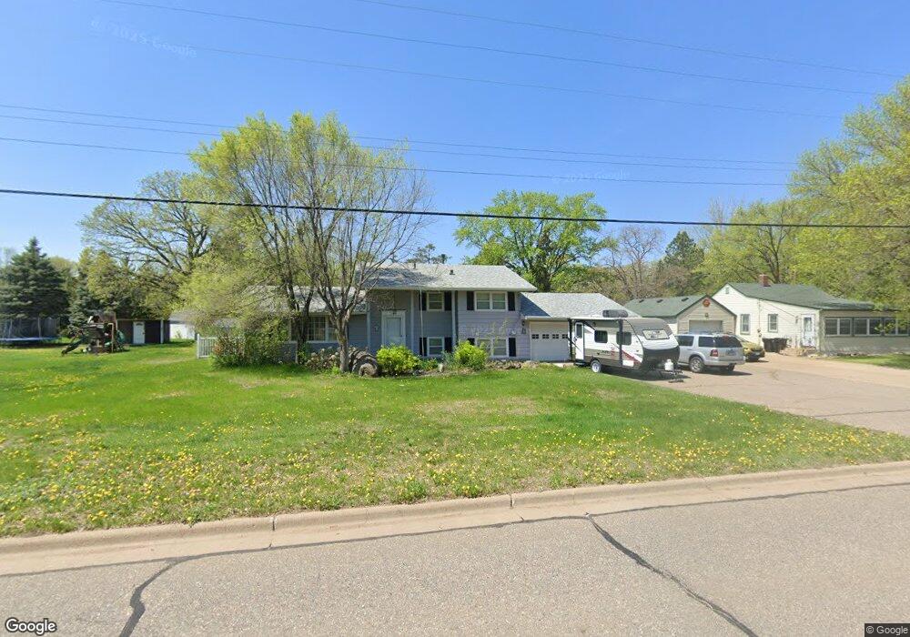
501 Ormsbee St Big Lake, MN 55309
Estimated Value: $280,000 - $324,000
3
Beds
1
Bath
1,120
Sq Ft
$269/Sq Ft
Est. Value
About This Home
This home is located at 501 Ormsbee St, Big Lake, MN 55309 and is currently estimated at $301,032, approximately $268 per square foot. 501 Ormsbee St is a home located in Sherburne County with nearby schools including Liberty Elementary School, Independence Elementary School, and Big Lake Middle School.
Ownership History
Date
Name
Owned For
Owner Type
Purchase Details
Closed on
Aug 23, 2016
Sold by
Brenteson Chad Lawrence and Estate Of Larry Brenteson
Bought by
Wichern Merle and Caile Irene
Current Estimated Value
Home Financials for this Owner
Home Financials are based on the most recent Mortgage that was taken out on this home.
Original Mortgage
$178,709
Interest Rate
3.43%
Mortgage Type
VA
Create a Home Valuation Report for This Property
The Home Valuation Report is an in-depth analysis detailing your home's value as well as a comparison with similar homes in the area
Home Values in the Area
Average Home Value in this Area
Purchase History
| Date | Buyer | Sale Price | Title Company |
|---|---|---|---|
| Wichern Merle | $173,000 | None Available |
Source: Public Records
Mortgage History
| Date | Status | Borrower | Loan Amount |
|---|---|---|---|
| Previous Owner | Wichern Merle | $178,709 |
Source: Public Records
Tax History
| Year | Tax Paid | Tax Assessment Tax Assessment Total Assessment is a certain percentage of the fair market value that is determined by local assessors to be the total taxable value of land and additions on the property. | Land | Improvement |
|---|---|---|---|---|
| 2025 | $3,488 | $281,400 | $81,100 | $200,300 |
| 2024 | $3,408 | $279,200 | $81,100 | $198,100 |
| 2023 | $3,312 | $279,700 | $81,100 | $198,600 |
| 2022 | $3,150 | $261,400 | $68,700 | $192,700 |
| 2020 | $2,986 | $201,300 | $41,100 | $160,200 |
| 2019 | $2,848 | $188,300 | $36,400 | $151,900 |
| 2018 | $2,742 | $176,600 | $33,500 | $143,100 |
| 2017 | $2,664 | $162,500 | $30,500 | $132,000 |
| 2016 | $2,586 | $151,900 | $27,300 | $124,600 |
| 2015 | $2,414 | $148,400 | $27,300 | $121,100 |
| 2014 | $1,888 | $145,300 | $28,700 | $116,600 |
| 2013 | -- | $106,300 | $23,000 | $83,300 |
Source: Public Records
Map
Nearby Homes
- 464 Ormsbee St
- 701 Independence Dr NW
- 705 Independence Dr NW
- 683 Eagle Lake Rd S
- 19041 Gunter Way
- 541 William St
- 19400 Karen Ln
- 19235 Engle Wood Dr
- 365 Karen Ln
- 461 Lexington Ave
- 23xxx 182nd St NW
- 220 Euclid Ave
- 1120 Wall St
- 591 Glenwood Ave
- 20050 County Road 81 NW
- 741 Glenwood Ave
- 1431 Powell St N
- 18012 Walnut Cir
- 18008 Walnut Cir
- 20311 Gordon Ln
Your Personal Tour Guide
Ask me questions while you tour the home.