
Seller's Agent in 2025
Melissa Riley
Westcott Properties
(401) 721-4000
2 in this area
136 Total Sales
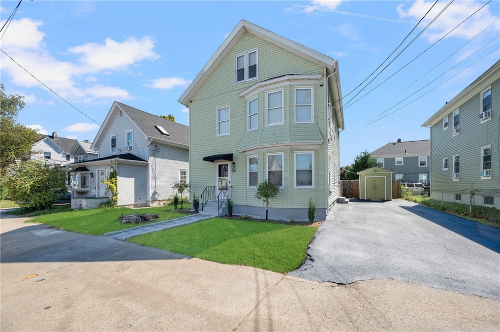
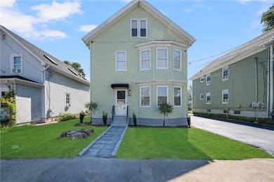
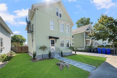
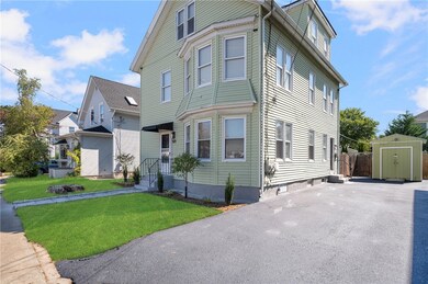
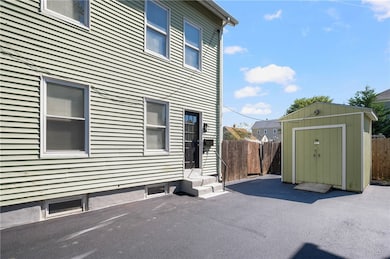
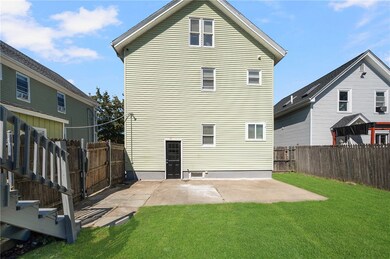
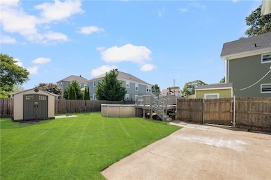
Outstanding Owner-Occupied or Investment Opportunity in Pawtucket!!! Welcome home to this spacious two-family property offering both comfort and income potential. Perfect for an owner-occupant or savvy investor, this home features two newly renovated units. First Floor: A bright and inviting 2-bedroom, 1-bath unit ideal for rental income or extended family. Second & Third Floor Townhouse: A rare find! This expansive 4-bedroom, 2-bath unit spans two levels, offering a single-family feel with plenty of space to spread out. Step outside and enjoy a fenced-in backyard retreat featuring two sheds for storage and a sparkling above ground pool perfect for entertaining or relaxing at home. This home is not to be missed! Live in one unit and collect rent in the other!
Last Agent to Sell the Property
Westcott Properties License #RES.0033799 Listed on: 09/10/2025
| Date | Type | Sale Price | Title Company |
|---|---|---|---|
| Warranty Deed | $350,000 | None Available | |
| Warranty Deed | $350,000 | None Available | |
| Public Action Common In Florida Clerks Tax Deed Or Tax Deeds Or Property Sold For Taxes | $1,590 | None Available | |
| Public Action Common In Florida Clerks Tax Deed Or Tax Deeds Or Property Sold For Taxes | $1,590 | None Available | |
| Warranty Deed | $113,500 | -- |
| Date | Status | Loan Amount | Loan Type |
|---|---|---|---|
| Open | $420,000 | Purchase Money Mortgage | |
| Closed | $420,000 | Purchase Money Mortgage | |
| Previous Owner | $155,000 | No Value Available | |
| Previous Owner | $121,600 | No Value Available | |
| Previous Owner | $107,800 | Purchase Money Mortgage |
| Date | Event | Price | List to Sale | Price per Sq Ft |
|---|---|---|---|---|
| 11/03/2025 11/03/25 | Sold | $615,000 | +2.5% | $182 / Sq Ft |
| 10/06/2025 10/06/25 | Pending | -- | -- | -- |
| 09/10/2025 09/10/25 | For Sale | $599,900 | -- | $178 / Sq Ft |
| Year | Tax Paid | Tax Assessment Tax Assessment Total Assessment is a certain percentage of the fair market value that is determined by local assessors to be the total taxable value of land and additions on the property. | Land | Improvement |
|---|---|---|---|---|
| 2025 | $4,968 | $377,800 | $128,400 | $249,400 |
| 2024 | $4,662 | $377,800 | $128,400 | $249,400 |
| 2023 | $4,306 | $254,200 | $77,400 | $176,800 |
| 2022 | $4,215 | $254,200 | $77,400 | $176,800 |
| 2021 | $4,215 | $254,200 | $77,400 | $176,800 |
| 2020 | $3,668 | $175,600 | $54,300 | $121,300 |
| 2019 | $3,668 | $175,600 | $54,300 | $121,300 |
| 2018 | $3,535 | $175,600 | $54,300 | $121,300 |
| 2017 | $3,528 | $155,300 | $59,200 | $96,100 |
| 2016 | $3,400 | $155,300 | $59,200 | $96,100 |
| 2015 | $3,400 | $155,300 | $59,200 | $96,100 |
| 2014 | $3,392 | $147,100 | $59,200 | $87,900 |
Seller's Agent in 2025
Melissa Riley
Westcott Properties
(401) 721-4000
2 in this area
136 Total Sales
N
Buyer's Agent in 2025
Nathan Applegate
Coldwell Banker Realty
(401) 286-3116
1 in this area
2 Total Sales
Source: State-Wide MLS
MLS Number: 1394890
APN: PAWT-000049-000000-000145
Disclaimer: Certain information contained herein is derived from information provided by parties other than Homes.com. All information provided is deemed reliable, but is not guaranteed to be accurate and should be independently verified.
![]() IDX information is provided exclusively for personal, non-commercial use, and may not be used for any purpose other than to identify prospective properties consumers may be interested in purchasing. Information is deemed reliable but not guaranteed.
IDX information is provided exclusively for personal, non-commercial use, and may not be used for any purpose other than to identify prospective properties consumers may be interested in purchasing. Information is deemed reliable but not guaranteed.
Copyright © 2025 State-Wide MLS, Inc. All rights reserved.