Estimated Value: $257,000 - $449,875
--
Bed
1
Bath
2,112
Sq Ft
$172/Sq Ft
Est. Value
About This Home
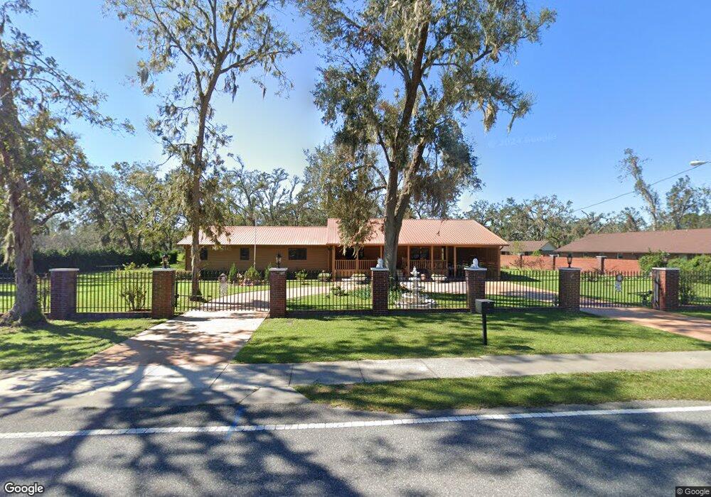
This home is located at 501 Puckett Rd, Perry, FL 32348 and is currently estimated at $363,219, approximately $171 per square foot. 501 Puckett Rd is a home located in Taylor County with nearby schools including Steinhatchee School, Perry Primary School, and Taylor County Elementary School.
Ownership History
Date
Name
Owned For
Owner Type
Purchase Details
Closed on
Sep 12, 2015
Sold by
Lollis Bobbie Jean and Lollis Bobbie Jean
Bought by
Lollis George R and Lollis Bobbie Jean
Current Estimated Value
Purchase Details
Closed on
Jan 31, 2007
Sold by
Lollis George R and Lollis Bobbie Jean
Bought by
Gr & Bj Lollis & Sons Llc
Purchase Details
Closed on
Oct 29, 2001
Sold by
Yegge Gerald J and Yegge Tina
Bought by
Lollis Bobbie Jean and Lollis George Rozell
Create a Home Valuation Report for This Property
The Home Valuation Report is an in-depth analysis detailing your home's value as well as a comparison with similar homes in the area
Home Values in the Area
Average Home Value in this Area
Purchase History
| Date | Buyer | Sale Price | Title Company |
|---|---|---|---|
| Lollis George R | -- | Frith Abstract & Title Co | |
| Gr & Bj Lollis & Sons Llc | $62,300 | Frith Abstract & Title Co | |
| Lollis Bobbie Jean | $20,000 | Frith Abstract & Title Compa |
Source: Public Records
Tax History Compared to Growth
Tax History
| Year | Tax Paid | Tax Assessment Tax Assessment Total Assessment is a certain percentage of the fair market value that is determined by local assessors to be the total taxable value of land and additions on the property. | Land | Improvement |
|---|---|---|---|---|
| 2025 | $6,653 | $381,740 | $35,900 | $345,840 |
| 2024 | $5,898 | $381,740 | $35,900 | $345,840 |
| 2023 | $5,898 | $278,530 | $0 | $0 |
| 2022 | $5,324 | $315,670 | $29,450 | $286,220 |
| 2021 | $4,597 | $248,790 | $29,450 | $219,340 |
| 2020 | $4,050 | $198,130 | $29,450 | $168,680 |
| 2019 | $4,141 | $201,470 | $29,450 | $172,020 |
| 2018 | $4,074 | $200,000 | $29,450 | $170,550 |
| 2017 | $4,043 | $192,620 | $29,450 | $163,170 |
| 2016 | $3,595 | $166,530 | $81,690 | $84,840 |
| 2015 | $2,301 | $110,930 | $26,090 | $84,840 |
| 2014 | -- | $121,407 | $0 | $0 |
Source: Public Records
Map
Nearby Homes
- 707 Puckett Rd
- 517 Judson Dr
- 415 Judson Dr
- 150 Houck Rd
- 0 Airport Rd Unit 25458733
- 136 Palmetto St
- 117 O Quinn Rd
- 1124 S Orange St
- 1124 S Orange St Unit 2
- 608 Plantation Rd
- 1212 S Center St
- 00 U S Highway 19
- 0 U S Highway 19 Unit 390248
- 0 U S Highway 19 Unit 795534
- 1100 S Wilder St
- 00 Paige St
- 0 U S 27
- 205 Susan St
- 831 U S 27
- 0 US Highway 98 Unit 10649270