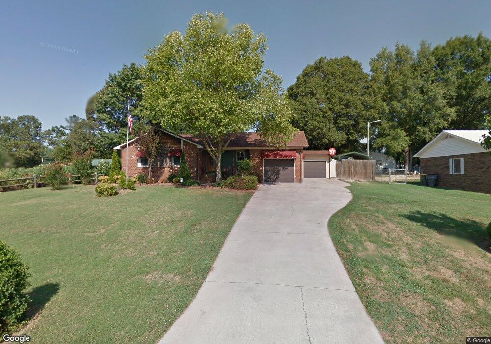
501 Queens Gate Dr Kannapolis, NC 28083
Estimated Value: $270,000 - $311,352
2
Beds
2
Baths
1,135
Sq Ft
$254/Sq Ft
Est. Value
About This Home
This home is located at 501 Queens Gate Dr, Kannapolis, NC 28083 and is currently estimated at $288,588, approximately $254 per square foot. 501 Queens Gate Dr is a home located in Cabarrus County with nearby schools including Jackson Park Elementary School, Kannapolis Middle, and A.L. Brown High School.
Ownership History
Date
Name
Owned For
Owner Type
Purchase Details
Closed on
Sep 16, 2002
Sold by
Whitten Jeffrey Lynn and Voncannon Vickie A
Bought by
Voncannon Vickie A
Current Estimated Value
Home Financials for this Owner
Home Financials are based on the most recent Mortgage that was taken out on this home.
Original Mortgage
$49,200
Interest Rate
6.27%
Purchase Details
Closed on
Apr 1, 1983
Create a Home Valuation Report for This Property
The Home Valuation Report is an in-depth analysis detailing your home's value as well as a comparison with similar homes in the area
Home Values in the Area
Average Home Value in this Area
Purchase History
| Date | Buyer | Sale Price | Title Company |
|---|---|---|---|
| Voncannon Vickie A | -- | -- | |
| -- | $52,000 | -- |
Source: Public Records
Mortgage History
| Date | Status | Borrower | Loan Amount |
|---|---|---|---|
| Closed | Voncannon Vickie A | $49,200 |
Source: Public Records
Tax History
| Year | Tax Paid | Tax Assessment Tax Assessment Total Assessment is a certain percentage of the fair market value that is determined by local assessors to be the total taxable value of land and additions on the property. | Land | Improvement |
|---|---|---|---|---|
| 2025 | $3,511 | $309,220 | $44,000 | $265,220 |
| 2024 | $3,511 | $309,220 | $44,000 | $265,220 |
| 2023 | $2,486 | $181,430 | $26,000 | $155,430 |
| 2022 | $2,378 | $173,550 | $26,000 | $147,550 |
| 2021 | $2,378 | $173,550 | $26,000 | $147,550 |
| 2020 | $2,378 | $173,550 | $26,000 | $147,550 |
| 2019 | $1,965 | $143,420 | $24,000 | $119,420 |
| 2018 | $1,936 | $143,420 | $24,000 | $119,420 |
| 2017 | $1,907 | $143,420 | $24,000 | $119,420 |
| 2016 | $1,907 | $158,680 | $42,000 | $116,680 |
| 2015 | $1,999 | $158,680 | $42,000 | $116,680 |
| 2014 | $1,999 | $158,680 | $42,000 | $116,680 |
Source: Public Records
Map
Nearby Homes
- 2208 Brantley Rd
- 569 Hunter Ave
- 545 Collins St
- 2137 Lane St
- 2041 Brantley Creek Dr
- 361 China Grove Rd
- 1905 Clay St
- 453 China Grove Rd
- 2420 Lane St
- 2105 Woodlawn St
- 506 Nola Ave
- 1547 Tammy Ct
- 1517 Jamaica Rd
- 1526 Shepard St
- 2020 Quill Ct
- 137 Beaumont Ave
- 141 Beaumont Ave
- 807 Carolyn Ave
- 2124 Clear Brook Dr
- 1301 Mount Vernon Ave
- 503 Queens Gate Dr
- 2205 Brantley Rd
- 2003 Brantley Rd
- 502 Florence Ave
- 506 Florence Ave
- 508 Florence Ave
- 505 Queens Gate Dr
- 500 Queens Gate Dr
- 2207 Brantley Rd
- 502 Queens Gate Dr
- 510 Florence Ave
- 2123 Brantley Rd
- 507 Queens Gate Dr
- 501 Florence Ave
- 2204 Brantley Rd
- 503 Florence Ave
- 2190 Brantley Rd
- 2209 Brantley Rd
- 2202 Brantley Rd
- 2202 Brantley Rd Unit 4
Your Personal Tour Guide
Ask me questions while you tour the home.