Estimated Value: $125,000 - $223,000
3
Beds
2
Baths
1,896
Sq Ft
$91/Sq Ft
Est. Value
About This Home
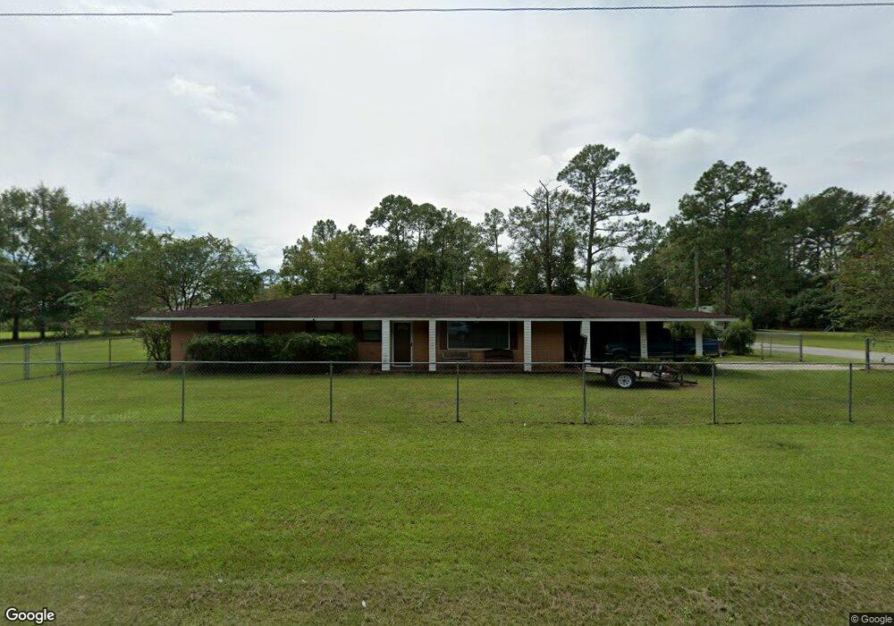
This home is located at 501 Radio Station Rd, Alma, GA 31510 and is currently estimated at $173,090, approximately $91 per square foot. 501 Radio Station Rd is a home located in Bacon County with nearby schools including Bacon County Primary School, Bacon County Elementary School, and Bacon County Middle School.
Ownership History
Date
Name
Owned For
Owner Type
Purchase Details
Closed on
Mar 8, 2012
Sold by
Myers Annette
Bought by
Beckham Stanely
Current Estimated Value
Purchase Details
Closed on
Jun 21, 2011
Sold by
Ho Chuk Keung and Ho Eric
Bought by
Ho Annette Myers
Purchase Details
Closed on
Sep 27, 2001
Sold by
Smith Alan B
Bought by
Ho Chuk Keung
Purchase Details
Closed on
Jan 11, 1991
Bought by
Smith Alan B
Create a Home Valuation Report for This Property
The Home Valuation Report is an in-depth analysis detailing your home's value as well as a comparison with similar homes in the area
Home Values in the Area
Average Home Value in this Area
Purchase History
| Date | Buyer | Sale Price | Title Company |
|---|---|---|---|
| Beckham Stanely | $85,400 | -- | |
| Ho Annette Myers | -- | -- | |
| Ho Chuk Keung | $52,000 | -- | |
| Smith Alan B | $40,000 | -- |
Source: Public Records
Tax History Compared to Growth
Tax History
| Year | Tax Paid | Tax Assessment Tax Assessment Total Assessment is a certain percentage of the fair market value that is determined by local assessors to be the total taxable value of land and additions on the property. | Land | Improvement |
|---|---|---|---|---|
| 2024 | $1,844 | $52,200 | $3,680 | $48,520 |
| 2023 | $1,657 | $47,040 | $3,680 | $43,360 |
| 2022 | $1,361 | $36,720 | $3,680 | $33,040 |
| 2021 | $1,366 | $36,840 | $3,680 | $33,160 |
| 2020 | $1,295 | $33,544 | $3,360 | $30,184 |
| 2019 | $1,295 | $33,544 | $3,360 | $30,184 |
| 2018 | $1,364 | $35,317 | $3,360 | $31,957 |
| 2017 | $1,422 | $35,317 | $3,360 | $31,957 |
| 2016 | $1,365 | $35,317 | $3,360 | $31,957 |
| 2015 | $1,384 | $35,755 | $3,824 | $31,931 |
| 2014 | $904 | $35,755 | $3,824 | $31,931 |
| 2013 | $904 | $28,569 | $3,823 | $24,745 |
Source: Public Records
Map
Nearby Homes
- 611 S Bead St
- 403 S Ware St
- 117 Grace Loop Unit 1
- 118 Grace Loop Unit 1
- 122 Grace Loop Unit 1
- 9TH E 417
- 314 W 16th St
- 1348 U S 1
- 113 Brite Blue Dr
- 198 Meadow Rd
- 166 Grace Loop Unit 1
- 907 N Pierce St
- 0 Oriole Rd Unit 1654653
- 0 Oriole Rd Unit 10543585
- 0 Oriole Rd Unit 25773381
- 0 Oriole Rd Unit 160930
- 401 Lee St
- 224 Meadow Rd
- 118 Morris Dr
- 1109 W 4th Street Extension
- 405 Radio Station Rd
- 107 Mccrea Ave
- 108 Mccrea Ave
- 507 Radio Station Rd
- 109 Mccrea Ave
- 403 Radio Station Rd
- 304 Crosby Rd
- 202 Mccrea Ave
- 401 Williams St
- 401 Radio Station Rd
- 308 Crosby Rd
- 305 Crosby Rd
- 207 Crosby Rd
- 510 Radio Station Rd
- 303 Crosby Rd
- 511 Radio Station Rd
- 704 Townsend Ln
- 203 Crosby Rd
- 310 Crosby Rd
- 706 Townsend Ln