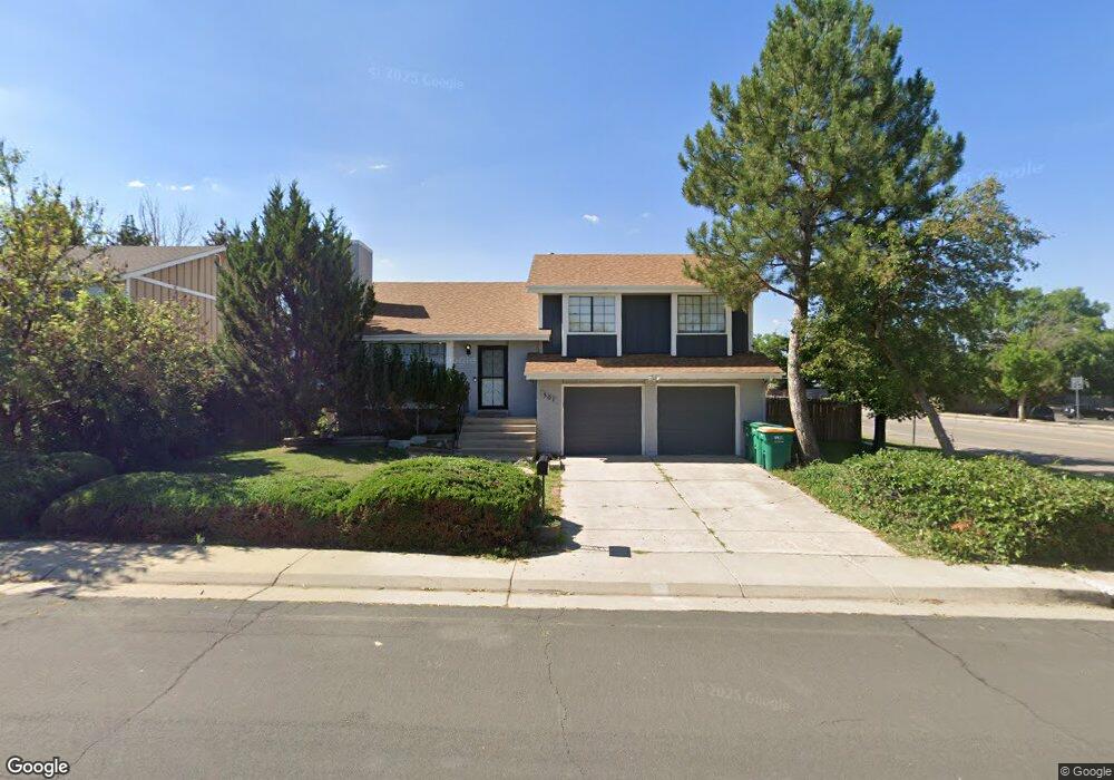
501 S Laredo Cir Aurora, CO 80017
Centre Pointe NeighborhoodEstimated Value: $459,000 - $496,000
4
Beds
2
Baths
2,052
Sq Ft
$236/Sq Ft
Est. Value
About This Home
This home is located at 501 S Laredo Cir, Aurora, CO 80017 and is currently estimated at $484,250, approximately $235 per square foot. 501 S Laredo Cir is a home located in Arapahoe County with nearby schools including Tollgate Elementary School of Expeditionary Learning, Mrachek Middle School, and Gateway High School.
Ownership History
Date
Name
Owned For
Owner Type
Purchase Details
Closed on
Dec 23, 2025
Sold by
Griffin Michael
Bought by
501 Laredo Cir Llc
Current Estimated Value
Purchase Details
Closed on
Oct 5, 2020
Sold by
Brown Michael R and Brown Uison
Bought by
Griffin Michael
Home Financials for this Owner
Home Financials are based on the most recent Mortgage that was taken out on this home.
Original Mortgage
$280,000
Interest Rate
5%
Mortgage Type
New Conventional
Purchase Details
Closed on
Sep 27, 1990
Sold by
Conversion Arapco
Bought by
Brown Michael R Brown Uison
Purchase Details
Closed on
Aug 1, 1984
Sold by
Conversion Arapco
Bought by
Conversion Arapco
Purchase Details
Closed on
Jun 1, 1984
Sold by
Conversion Arapco
Bought by
Conversion Arapco
Purchase Details
Closed on
Jun 1, 1979
Sold by
Conversion Arapco
Bought by
Conversion Arapco
Purchase Details
Closed on
Jul 4, 1776
Bought by
Conversion Arapco
Create a Home Valuation Report for This Property
The Home Valuation Report is an in-depth analysis detailing your home's value as well as a comparison with similar homes in the area
Home Values in the Area
Average Home Value in this Area
Purchase History
| Date | Buyer | Sale Price | Title Company |
|---|---|---|---|
| 501 Laredo Cir Llc | -- | None Listed On Document | |
| Griffin Michael | $280,000 | Tiago Title | |
| Brown Michael R Brown Uison | -- | -- | |
| Conversion Arapco | -- | -- | |
| Conversion Arapco | -- | -- | |
| Conversion Arapco | -- | -- | |
| Conversion Arapco | -- | -- |
Source: Public Records
Mortgage History
| Date | Status | Borrower | Loan Amount |
|---|---|---|---|
| Previous Owner | Griffin Michael | $280,000 |
Source: Public Records
Tax History
| Year | Tax Paid | Tax Assessment Tax Assessment Total Assessment is a certain percentage of the fair market value that is determined by local assessors to be the total taxable value of land and additions on the property. | Land | Improvement |
|---|---|---|---|---|
| 2025 | $3,134 | $28,251 | -- | -- |
| 2024 | $3,040 | $32,709 | -- | -- |
| 2023 | $3,040 | $32,709 | $0 | $0 |
| 2022 | $2,626 | $26,153 | $0 | $0 |
| 2021 | $2,711 | $26,153 | $0 | $0 |
| 2020 | $2,407 | $23,116 | $0 | $0 |
| 2019 | $2,394 | $23,116 | $0 | $0 |
| 2018 | $1,989 | $18,806 | $0 | $0 |
| 2017 | $1,730 | $18,806 | $0 | $0 |
| 2016 | $1,659 | $17,655 | $0 | $0 |
| 2015 | $1,601 | $17,655 | $0 | $0 |
| 2014 | -- | $11,924 | $0 | $0 |
| 2013 | -- | $13,940 | $0 | $0 |
Source: Public Records
Map
Nearby Homes
- 15875 E Custer Dr
- 491 S Kalispell Way Unit 305
- 575 S Memphis Way
- 481 S Kalispell Way Unit 306
- 16255 E Alaska Place Unit 1
- 467 S Memphis Way Unit 17
- 16001 E Alaska Place Unit 7
- 16001 E Alaska Place Unit 1
- 648 S Kalispell Way
- 477 S Memphis Way Unit 11
- 16064 E Exposition Dr
- 588 S Mobile Place
- 16201 E Dakota Place Unit H
- 619 S Norfolk Way
- 844 S Joplin Cir
- 752 S Granby Cir
- 1024 S Mobile St
- 858 S Granby Cir
- 17095 E Alameda Pkwy
- 1092 S Granby Way
- 503 S Laredo Cir
- 532 S Kalispell Way
- 542 S Kalispell Way
- 505 S Laredo Cir
- 500 S Laredo Cir
- 502 S Laredo Cir
- 552 S Kalispell Way
- 504 S Laredo Cir
- 513 S Kittredge Way
- 515 S Kittredge Way
- 506 S Laredo Cir
- 582 S Kalispell Way
- 517 S Kittredge Way
- 562 S Kalispell Way
- 15855 E Custer Dr
- 572 S Kalispell Way
- 525 S Kittredge Way
- 510 S Laredo Cir
- 15845 E Custer Dr
- 545 S Kittredge Way
Your Personal Tour Guide
Ask me questions while you tour the home.