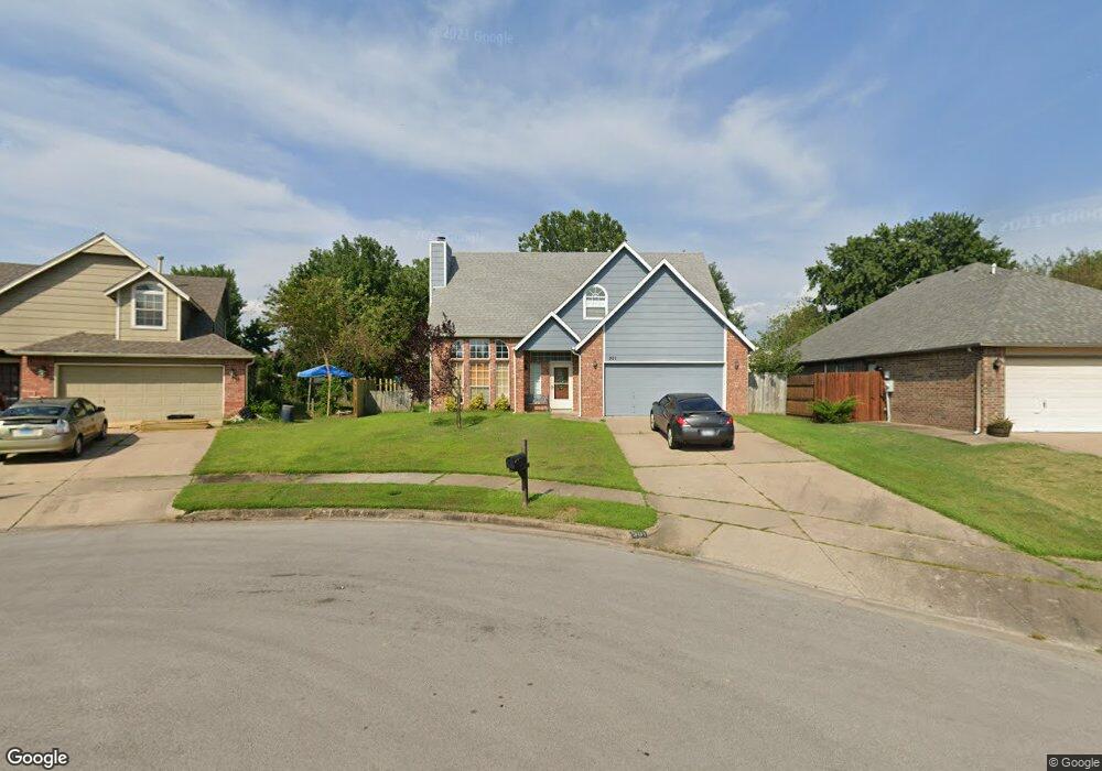
501 S Laurel Ave Broken Arrow, OK 74012
Country Aire Estates NeighborhoodEstimated Value: $264,096 - $280,000
3
Beds
3
Baths
2,176
Sq Ft
$125/Sq Ft
Est. Value
About This Home
This home is located at 501 S Laurel Ave, Broken Arrow, OK 74012 and is currently estimated at $272,774, approximately $125 per square foot. 501 S Laurel Ave is a home located in Tulsa County with nearby schools including Peters Elementary School, Union 8th Grade Center, and Union 6th-7th Grade Center.
Ownership History
Date
Name
Owned For
Owner Type
Purchase Details
Closed on
Nov 22, 2011
Sold by
Nouraei Navid Michael and Ardeshirzadeh Alieh
Bought by
Stanley Roger B
Current Estimated Value
Home Financials for this Owner
Home Financials are based on the most recent Mortgage that was taken out on this home.
Original Mortgage
$141,988
Outstanding Balance
$96,673
Interest Rate
4.14%
Mortgage Type
VA
Estimated Equity
$176,101
Purchase Details
Closed on
Jul 1, 1991
Purchase Details
Closed on
Apr 1, 1991
Create a Home Valuation Report for This Property
The Home Valuation Report is an in-depth analysis detailing your home's value as well as a comparison with similar homes in the area
Home Values in the Area
Average Home Value in this Area
Purchase History
| Date | Buyer | Sale Price | Title Company |
|---|---|---|---|
| Stanley Roger B | $139,000 | Tulsa Abstract & Title Co | |
| -- | $85,000 | -- | |
| -- | $15,000 | -- |
Source: Public Records
Mortgage History
| Date | Status | Borrower | Loan Amount |
|---|---|---|---|
| Open | Stanley Roger B | $141,988 |
Source: Public Records
Tax History Compared to Growth
Tax History
| Year | Tax Paid | Tax Assessment Tax Assessment Total Assessment is a certain percentage of the fair market value that is determined by local assessors to be the total taxable value of land and additions on the property. | Land | Improvement |
|---|---|---|---|---|
| 2025 | $2,440 | $18,587 | $2,061 | $16,526 |
| 2024 | $2,254 | $18,016 | $2,452 | $15,564 |
| 2023 | $2,254 | $18,462 | $2,641 | $15,821 |
| 2022 | $2,202 | $16,924 | $3,003 | $13,921 |
| 2021 | $2,141 | $16,402 | $2,910 | $13,492 |
| 2020 | $2,089 | $15,895 | $3,105 | $12,790 |
| 2019 | $2,061 | $15,707 | $3,068 | $12,639 |
| 2018 | $1,991 | $15,221 | $2,973 | $12,248 |
| 2017 | $1,955 | $15,749 | $3,076 | $12,673 |
| 2016 | $1,869 | $15,290 | $3,300 | $11,990 |
| 2015 | $1,870 | $15,290 | $3,300 | $11,990 |
| 2014 | $1,859 | $15,290 | $3,300 | $11,990 |
Source: Public Records
Map
Nearby Homes
- 521 S Kalanchoe Ave
- 3212 W Houston Place
- 517 S Hemlock Ave
- 507 S Redwood Ave
- 3812 W El Paso St
- 3309 W Knoxville St
- 2600 W Commercial St
- 208 N Nyssa Ave
- 2604 W Broadway St
- 3843 W Galveston Place
- 2509 W Broadway St
- 2314 W Galveston Place
- 3309 W Freeport St
- 2605 W Detroit St
- 409 N Palm Ave
- 4201 W Detroit St
- 908 S Umbrella Cir
- 3310 W Pittsburg Place
- 0 W Houston St Unit 2538461
- 1517 S Nyssa Ave
- 505 S Laurel Ave
- 3300 W Fort Worth St
- 404 S Kalanchoe Ave
- 509 S Laurel Ave
- 3304 W Fort Worth St
- 504 S Kalanchoe Ave
- 3105 W El Paso St
- 3308 W Fort Worth St
- 3109 W El Paso St
- 500 S Laurel Ave
- 513 S Laurel Ave
- 3101 W El Paso St
- 504 S Laurel Ave
- 508 S Kalanchoe Ave
- 3201 W El Paso St
- 3312 W Fort Worth St
- 508 S Laurel Ave
- 517 S Laurel Ave
- 3309 W Fort Worth St
- 512 S Kalanchoe Ave W
