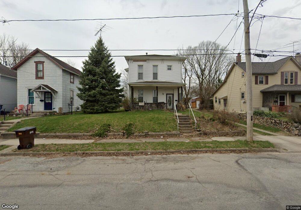
501 Scott St Springfield, OH 45505
Estimated Value: $47,000 - $102,000
3
Beds
2
Baths
1,592
Sq Ft
$48/Sq Ft
Est. Value
About This Home
This home is located at 501 Scott St, Springfield, OH 45505 and is currently estimated at $76,648, approximately $48 per square foot. 501 Scott St is a home located in Clark County with nearby schools including Lincoln Elementary School, Hayward Middle School, and Springfield High School.
Ownership History
Date
Name
Owned For
Owner Type
Purchase Details
Closed on
Jan 20, 2003
Sold by
Winkle Roy
Bought by
Potter Donald
Current Estimated Value
Purchase Details
Closed on
Jun 20, 2001
Sold by
Travis Roger L
Bought by
Chase Manhattan Bank
Purchase Details
Closed on
May 23, 1997
Sold by
Sh Douglas A Damewood Pr
Bought by
United Companies Lending Corp
Purchase Details
Closed on
Dec 14, 1994
Sold by
Huber Craig M
Bought by
Damewood Douglas A and Damewood Donna
Create a Home Valuation Report for This Property
The Home Valuation Report is an in-depth analysis detailing your home's value as well as a comparison with similar homes in the area
Home Values in the Area
Average Home Value in this Area
Purchase History
| Date | Buyer | Sale Price | Title Company |
|---|---|---|---|
| Potter Donald | $16,900 | -- | |
| Chase Manhattan Bank | $16,000 | -- | |
| United Companies Lending Corp | $12,000 | -- | |
| Damewood Douglas A | $4,000 | -- |
Source: Public Records
Tax History
| Year | Tax Paid | Tax Assessment Tax Assessment Total Assessment is a certain percentage of the fair market value that is determined by local assessors to be the total taxable value of land and additions on the property. | Land | Improvement |
|---|---|---|---|---|
| 2025 | $442 | $16,630 | $2,140 | $14,490 |
| 2024 | $556 | $11,830 | $1,810 | $10,020 |
| 2023 | $307 | $11,830 | $1,810 | $10,020 |
| 2022 | $236 | $11,830 | $1,810 | $10,020 |
| 2021 | $68 | $10,020 | $1,530 | $8,490 |
| 2020 | $68 | $10,020 | $1,530 | $8,490 |
| 2019 | $68 | $10,020 | $1,530 | $8,490 |
| 2018 | $0 | $5,890 | $1,530 | $4,360 |
| 2017 | $0 | $5,895 | $1,530 | $4,365 |
| 2016 | -- | $5,895 | $1,530 | $4,365 |
| 2015 | -- | $6,612 | $1,530 | $5,082 |
| 2014 | -- | $6,612 | $1,530 | $5,082 |
| 2013 | $293 | $6,612 | $1,530 | $5,082 |
Source: Public Records
Map
Nearby Homes
- 625 Tibbetts Ave
- 705 York St
- 718 Summer St
- 411 S Limestone St
- 441 E Euclid Ave
- 1008 Tibbetts Ave
- 907-913 S Limestone St
- 205 E Grand Ave
- 453 E Pleasant St
- 1065 Mound St Unit 1067
- 230 Rice St
- 38 W High St Unit 3B
- 702 S Wittenberg Ave
- 1210 S Limestone St
- 1317 Clifton Ave
- 550 E Rose St
- 1215 E High St
- 209 W Liberty St
- 1417 Clifton Ave Unit 1419
- 0 W Perrin Ave Unit 1043508
- 505 Scott St
- 437 Scott St
- 509 Scott St
- 431 Scott St
- 511 Scott St
- 506 Scott St Unit 508
- 517 Scott St
- 516 Linden Ave
- 427 Scott St
- 521 Scott St
- 438 Scott St
- 518 Linden Ave Unit 520
- 430 Linden Ave
- 432 Linden Ave
- 514 Scott St
- 434 Scott St
- 516 Scott St Unit 518
- 522 Linden Ave Unit 524
- 430 Scott St
- 424 Linden Ave Unit 426
Your Personal Tour Guide
Ask me questions while you tour the home.