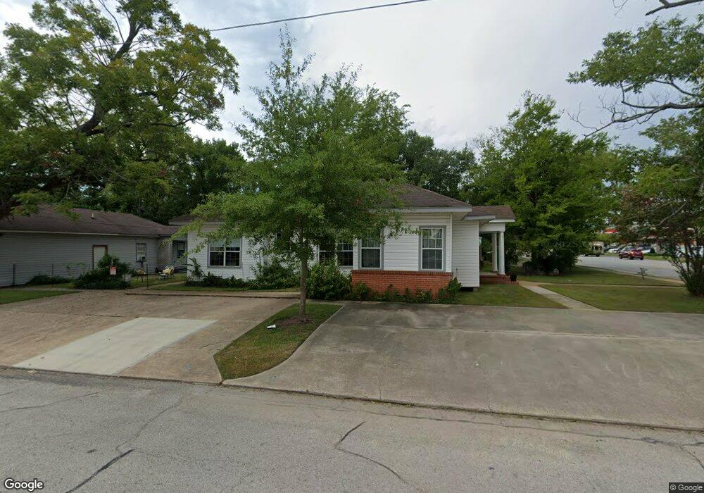
501 W Frank Ave Lufkin, TX 75904
Estimated Value: $155,599 - $329,000
--
Bed
1
Bath
3,492
Sq Ft
$59/Sq Ft
Est. Value
About This Home
This home is located at 501 W Frank Ave, Lufkin, TX 75904 and is currently estimated at $204,650, approximately $58 per square foot. 501 W Frank Ave is a home located in Angelina County with nearby schools including Trout Primary School, Brookhollow Elementary School, and Lufkin Middle School.
Ownership History
Date
Name
Owned For
Owner Type
Purchase Details
Closed on
Sep 22, 2022
Sold by
R & Assemble C Llc
Bought by
Luker Insurance Group Llc
Current Estimated Value
Purchase Details
Closed on
Aug 13, 2013
Sold by
Barrow Earline
Bought by
R & Assemble C Llc
Home Financials for this Owner
Home Financials are based on the most recent Mortgage that was taken out on this home.
Original Mortgage
$62,400
Interest Rate
4.34%
Mortgage Type
Purchase Money Mortgage
Create a Home Valuation Report for This Property
The Home Valuation Report is an in-depth analysis detailing your home's value as well as a comparison with similar homes in the area
Home Values in the Area
Average Home Value in this Area
Purchase History
| Date | Buyer | Sale Price | Title Company |
|---|---|---|---|
| Luker Insurance Group Llc | -- | Security Guaranty Abstract | |
| Luker Insurance Group Llc | -- | Security Guaranty Abstract | |
| R & Assemble C Llc | -- | Community Title Company | |
| R & Assemble C Llc | -- | Community Title Company |
Source: Public Records
Mortgage History
| Date | Status | Borrower | Loan Amount |
|---|---|---|---|
| Previous Owner | R & Assemble C Llc | $62,400 |
Source: Public Records
Tax History Compared to Growth
Tax History
| Year | Tax Paid | Tax Assessment Tax Assessment Total Assessment is a certain percentage of the fair market value that is determined by local assessors to be the total taxable value of land and additions on the property. | Land | Improvement |
|---|---|---|---|---|
| 2025 | $3,049 | $145,900 | $13,820 | $132,080 |
| 2024 | $2,978 | $142,490 | $13,820 | $128,670 |
| 2023 | $2,786 | $140,210 | $13,820 | $126,390 |
| 2022 | $2,773 | $121,740 | $9,520 | $112,220 |
| 2021 | $2,769 | $112,400 | $9,520 | $102,880 |
| 2020 | $2,472 | $100,590 | $9,520 | $91,070 |
| 2019 | $2,615 | $100,590 | $9,520 | $91,070 |
| 2018 | $2,226 | $97,410 | $9,520 | $87,890 |
| 2017 | $2,226 | $93,380 | $9,520 | $83,860 |
| 2016 | $1,865 | $78,220 | $9,520 | $68,700 |
| 2015 | $2,268 | $78,220 | $9,520 | $68,700 |
| 2014 | $2,268 | $79,000 | $9,520 | $69,480 |
Source: Public Records
Map
Nearby Homes
- 420 Mantooth Ave
- 620 Mantooth Ave
- 803 Moore Ave
- 301 Culverhouse St
- 1007 Persimmon Ave
- 122 Pine Branch Ct
- 112 Pine Branch Ct
- 4421 Farm-To-market
- 117 Pine Branch Ct
- 5700 Fm 2497
- 8250 Hwy 103w
- 10683 Hwy 103w
- 1305 West Grove
- Lot 1B Welch Hill Top Rd
- Lot 2 Fm 326
- 10111 Hwy 94w
- 1417 Fm 706s
- Lot 1C Welch Hill Top Rd
- 128 Stoney Ridge
- 3295 Fm 2108
- 501 Frank St
- 501 W Frank Ave
- 509 W Frank Ave
- 419 W Frank Ave
- 419 Frank St
- 510 Moore Ave
- 418 Moore Ave
- 302 N Raguet St
- 206 N Raguet St
- 514 W Frank Ave
- 420 Frank St
- 420 W Frank Ave
- 412 Moore Ave
- 117 N Douglas St
- 419 Moore Ave
- 110 N Raguet St
- 503 Mantooth Ave
- 213 N Raguet St
- 415 Mantooth Ave
- 111 N Douglas St