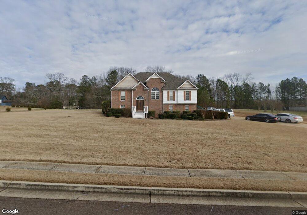
5010 Starla Ln Douglasville, GA 30135
Bill Arp NeighborhoodEstimated Value: $278,000 - $357,000
3
Beds
3
Baths
1,533
Sq Ft
$209/Sq Ft
Est. Value
About This Home
This home is located at 5010 Starla Ln, Douglasville, GA 30135 and is currently estimated at $320,288, approximately $208 per square foot. 5010 Starla Ln is a home located in Douglas County with nearby schools including Bill Arp Elementary School, Fairplay Middle School, and Alexander High School.
Ownership History
Date
Name
Owned For
Owner Type
Purchase Details
Closed on
Jul 31, 2003
Sold by
Shriver Homes Inc
Bought by
Mcneil Malissa F and Mcneil Thomas
Current Estimated Value
Home Financials for this Owner
Home Financials are based on the most recent Mortgage that was taken out on this home.
Original Mortgage
$187,400
Outstanding Balance
$81,922
Interest Rate
5.52%
Mortgage Type
New Conventional
Estimated Equity
$238,366
Create a Home Valuation Report for This Property
The Home Valuation Report is an in-depth analysis detailing your home's value as well as a comparison with similar homes in the area
Home Values in the Area
Average Home Value in this Area
Purchase History
| Date | Buyer | Sale Price | Title Company |
|---|---|---|---|
| Mcneil Malissa F | $187,400 | -- |
Source: Public Records
Mortgage History
| Date | Status | Borrower | Loan Amount |
|---|---|---|---|
| Open | Mcneil Malissa F | $187,400 |
Source: Public Records
Tax History Compared to Growth
Tax History
| Year | Tax Paid | Tax Assessment Tax Assessment Total Assessment is a certain percentage of the fair market value that is determined by local assessors to be the total taxable value of land and additions on the property. | Land | Improvement |
|---|---|---|---|---|
| 2024 | $3,225 | $100,440 | $16,000 | $84,440 |
| 2023 | $3,225 | $100,440 | $16,000 | $84,440 |
| 2022 | $3,336 | $100,440 | $16,000 | $84,440 |
| 2021 | $2,515 | $75,120 | $14,560 | $60,560 |
| 2020 | $2,547 | $75,120 | $14,560 | $60,560 |
| 2019 | $2,330 | $73,440 | $14,560 | $58,880 |
| 2018 | $2,287 | $71,720 | $14,560 | $57,160 |
| 2017 | $2,095 | $64,280 | $14,560 | $49,720 |
| 2016 | $2,071 | $62,440 | $14,560 | $47,880 |
| 2015 | $2,059 | $60,760 | $14,560 | $46,200 |
| 2014 | $1,979 | $57,240 | $14,560 | $42,680 |
| 2013 | -- | $56,560 | $14,560 | $42,000 |
Source: Public Records
Map
Nearby Homes
- 7350 Banks Mill Rd
- 5155 Oakdale Ct
- 7215 Colony Ln
- 7131 Banks Mill Rd
- 7680 Banks Mill Rd
- 5045 Poole Mill Rd
- 5181 Kilroy Ln
- 3949 Georgia 5
- 7277 Avalon Dr
- 0 Dorsett Shoals Rd Unit 20170850
- 0 Dorsett Shoals Rd Unit 7336228
- 6883 Lakeshore Dr
- 7720 Milam Rd
- 0 Big a Rd Unit 20169908
- 5767 W Phillips Mill Rd
- 7212 Milam Rd
- 5355 Brookshire Ct
- 5038 Daniell Mill Rd
- 6881 Dogwood Ln
- 5020 Starla Ln
- 5000 Starla Ln
- 5030 Starla Ln
- 7367 Banks Mill Rd Unit 83
- 7367 Banks Mill Rd
- 5040 Starla Ln
- 5025 Starla Ln
- 5050 Starla Ln
- 7351 Banks Mill Rd
- 5035 Starla Ln
- 5045 Starla Ln
- 7335 Banks Mill Rd
- 5060 Starla Ln
- 5055 Starla Ln
- 7450 Banks Mill Rd
- 7311 Banks Mill Rd
- 7440 Banks Mill Rd
- 7479 Banks Mill Rd
- 7376 Banks Mill Rd
- 7303 Banks Mill Rd