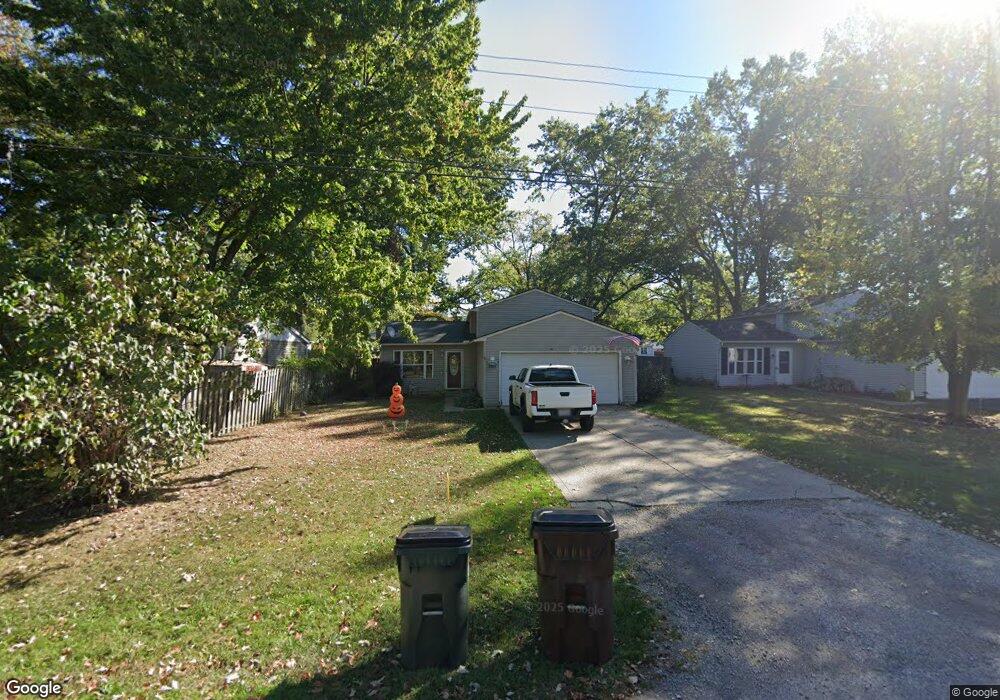
5011 Fleming Ave Lorain, OH 44055
Estimated Value: $148,000 - $181,000
3
Beds
2
Baths
1,360
Sq Ft
$122/Sq Ft
Est. Value
About This Home
This home is located at 5011 Fleming Ave, Lorain, OH 44055 and is currently estimated at $166,198, approximately $122 per square foot. 5011 Fleming Ave is a home located in Lorain County with nearby schools including Vincent Elementary School, Durling Middle School, and Clearview High School.
Ownership History
Date
Name
Owned For
Owner Type
Purchase Details
Closed on
Jun 30, 2003
Sold by
Marconi James Jerrold
Bought by
Brock Michael
Current Estimated Value
Home Financials for this Owner
Home Financials are based on the most recent Mortgage that was taken out on this home.
Original Mortgage
$85,000
Outstanding Balance
$36,437
Interest Rate
5.37%
Mortgage Type
Purchase Money Mortgage
Estimated Equity
$129,761
Purchase Details
Closed on
May 7, 2001
Sold by
Paynter Richard A
Bought by
Firstar Bank Na and Star Bank Na
Create a Home Valuation Report for This Property
The Home Valuation Report is an in-depth analysis detailing your home's value as well as a comparison with similar homes in the area
Home Values in the Area
Average Home Value in this Area
Purchase History
| Date | Buyer | Sale Price | Title Company |
|---|---|---|---|
| Brock Michael | $90,000 | Americas Choice Title Agency | |
| Firstar Bank Na | $64,000 | Attorney'S Title Agency Inc |
Source: Public Records
Mortgage History
| Date | Status | Borrower | Loan Amount |
|---|---|---|---|
| Open | Brock Michael | $85,000 |
Source: Public Records
Tax History
| Year | Tax Paid | Tax Assessment Tax Assessment Total Assessment is a certain percentage of the fair market value that is determined by local assessors to be the total taxable value of land and additions on the property. | Land | Improvement |
|---|---|---|---|---|
| 2024 | $2,031 | $47,443 | $4,036 | $43,407 |
| 2023 | $1,950 | $36,229 | $2,919 | $33,310 |
| 2022 | $2,000 | $36,229 | $2,919 | $33,310 |
| 2021 | $2,085 | $36,229 | $2,919 | $33,310 |
| 2020 | $1,914 | $31,640 | $2,550 | $29,090 |
| 2019 | $1,906 | $31,640 | $2,550 | $29,090 |
| 2018 | $1,915 | $31,640 | $2,550 | $29,090 |
| 2017 | $1,582 | $23,660 | $1,750 | $21,910 |
| 2016 | $1,597 | $23,660 | $1,750 | $21,910 |
| 2015 | $1,601 | $23,660 | $1,750 | $21,910 |
| 2014 | $1,623 | $24,820 | $1,830 | $22,990 |
| 2013 | $1,606 | $24,820 | $1,830 | $22,990 |
Source: Public Records
Map
Nearby Homes
- VL Ridgewood St
- 5196 Farr Ave
- 5193 Liberty Ave
- 4721 Andover Ave
- V/L Rear Land Unit 1
- V/L Rear Land Unit 2
- V/L Grove Ave
- 4411 Tacoma Ave
- 4223 Palm Ave
- 4510 Riverside Dr
- 4429 Norfolk Ave
- 4217 Camden Ave
- 4061 Gregus Ave
- 41629 Northwood St
- 42953 N Ridge Rd
- 41651 Northwood St
- 3934 Gary Ave
- V/L Clinton Ave
- 416 Deer Crossing
- 3641 Tacoma Ave
- 4977 Fleming Ave
- 5019 Fleming Ave
- V/L Fleming Ave
- 4994 Liberty Ave
- 5026 Liberty Ave
- 4940 Liberty Ave
- 5002 Fleming Ave
- 5018 Fleming Ave
- 4910 Liberty Ave
- 5030 Fleming Ave
- 5030 Fleming Ave
- 5105 Fleming Ave
- 5013 Liberty Ave
- 4949 Liberty Ave
- 5037 Liberty Ave
- 5083 Vincent Ave
- 4941 Liberty Ave
- 4929 Liberty Ave
- 5085 Vincent Ave
- 2343 Frankfort St
Your Personal Tour Guide
Ask me questions while you tour the home.