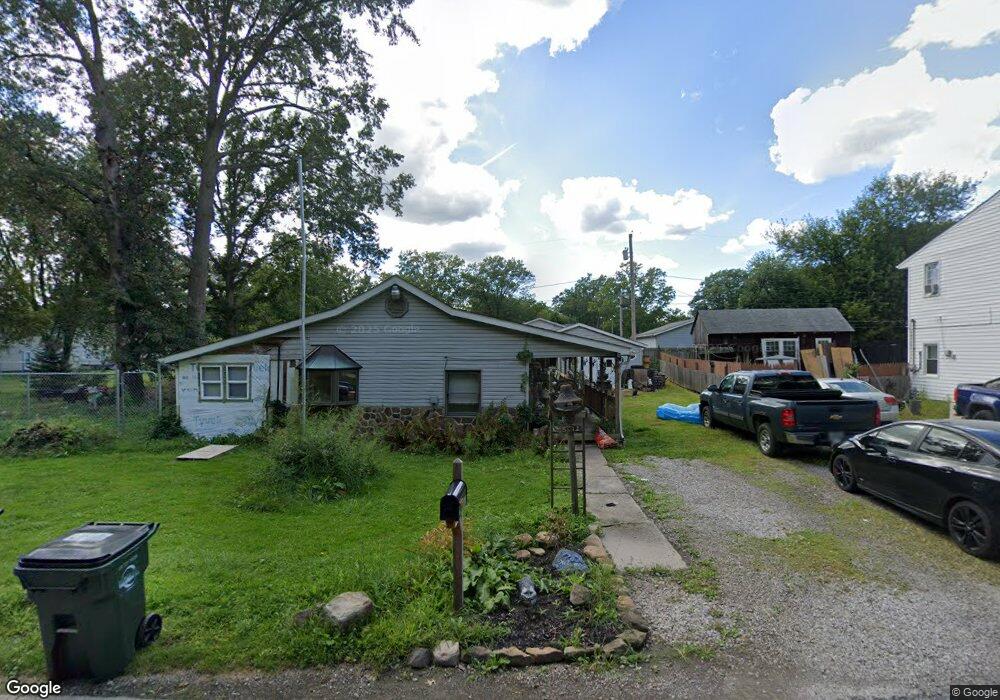
5012 Farr Ave Lorain, OH 44055
Estimated Value: $134,000 - $178,000
4
Beds
1
Bath
1,260
Sq Ft
$117/Sq Ft
Est. Value
About This Home
This home is located at 5012 Farr Ave, Lorain, OH 44055 and is currently estimated at $147,941, approximately $117 per square foot. 5012 Farr Ave is a home located in Lorain County with nearby schools including Vincent Elementary School, Durling Middle School, and Clearview High School.
Ownership History
Date
Name
Owned For
Owner Type
Purchase Details
Closed on
Oct 8, 2021
Sold by
Fleming Steve and Newbraugh Family Trust
Bought by
Ondeka Jaime and Lowery Dennis John
Current Estimated Value
Home Financials for this Owner
Home Financials are based on the most recent Mortgage that was taken out on this home.
Original Mortgage
$73,641
Outstanding Balance
$67,154
Interest Rate
2.8%
Mortgage Type
FHA
Estimated Equity
$80,787
Purchase Details
Closed on
Jul 15, 2014
Sold by
Newbraugh Betty
Bought by
Newbraugh Betty and Newbraugh Family Trust
Purchase Details
Closed on
Jun 12, 2008
Sold by
Newbraugh Frank D and Newbraugh Betty
Bought by
Newbraugh Frank D and Newbraugh Betty
Create a Home Valuation Report for This Property
The Home Valuation Report is an in-depth analysis detailing your home's value as well as a comparison with similar homes in the area
Home Values in the Area
Average Home Value in this Area
Purchase History
| Date | Buyer | Sale Price | Title Company |
|---|---|---|---|
| Ondeka Jaime | $75,000 | None Available | |
| Newbraugh Betty | -- | None Available | |
| Newbraugh Frank D | -- | Attorney |
Source: Public Records
Mortgage History
| Date | Status | Borrower | Loan Amount |
|---|---|---|---|
| Open | Ondeka Jaime | $73,641 |
Source: Public Records
Tax History Compared to Growth
Tax History
| Year | Tax Paid | Tax Assessment Tax Assessment Total Assessment is a certain percentage of the fair market value that is determined by local assessors to be the total taxable value of land and additions on the property. | Land | Improvement |
|---|---|---|---|---|
| 2024 | $1,955 | $43,862 | $7,735 | $36,127 |
| 2023 | $1,687 | $31,203 | $5,590 | $25,613 |
| 2022 | $1,963 | $31,203 | $5,590 | $25,613 |
| 2021 | $1,310 | $31,203 | $5,590 | $25,613 |
| 2020 | $1,138 | $27,250 | $4,880 | $22,370 |
| 2019 | $1,133 | $27,250 | $4,880 | $22,370 |
| 2018 | $1,105 | $27,250 | $4,880 | $22,370 |
| 2017 | $1,071 | $24,570 | $3,350 | $21,220 |
| 2016 | $1,082 | $24,570 | $3,350 | $21,220 |
| 2015 | $1,083 | $24,570 | $3,350 | $21,220 |
| 2014 | $1,086 | $25,770 | $3,510 | $22,260 |
| 2013 | $1,075 | $25,260 | $3,510 | $21,750 |
Source: Public Records
Map
Nearby Homes
- 5278 Farr Ave
- 5193 Liberty Ave
- 0 Vincent Ave
- VL Ridgewood St
- 4651 Camden Ave
- V/L Eschtruth St
- V/L Rear Land Unit 1
- V/L Rear Land Unit 2
- 4543 Norfolk Ave
- V/L Grove Ave
- 3934 Gary Ave
- 5877 Ford Rd
- 2315 Homewood Dr
- 2456 E 37th St
- 2323 Homewood Dr
- 147 Stoney Brook Dr
- 2374 E 37th St
- 206 Stoney Brook Dr
- 3690 Gary Ave
- 2046 Homewood Dr