Estimated Value: $238,351 - $292,000
3
Beds
2
Baths
1,008
Sq Ft
$269/Sq Ft
Est. Value
About This Home
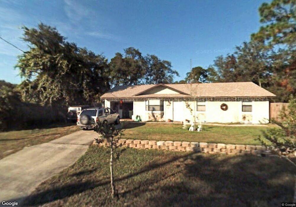
This home is located at 5014 Bridge Rd, Cocoa, FL 32927 and is currently estimated at $271,588, approximately $269 per square foot. 5014 Bridge Rd is a home located in Brevard County with nearby schools including Challenger 7 Elementary School, Space Coast Junior/Senior High School, and Sculptor Charter School.
Ownership History
Date
Name
Owned For
Owner Type
Purchase Details
Closed on
Mar 26, 2004
Sold by
Ostrowsky Eric B and Ostrowsky Melissa
Bought by
Shore Pamela L
Current Estimated Value
Home Financials for this Owner
Home Financials are based on the most recent Mortgage that was taken out on this home.
Original Mortgage
$89,293
Outstanding Balance
$41,639
Interest Rate
5.53%
Estimated Equity
$229,949
Purchase Details
Closed on
Dec 16, 1996
Sold by
Frost David M and Frost Cath D
Bought by
Ostrowsky Eric B and Ostrowsky Melissa
Home Financials for this Owner
Home Financials are based on the most recent Mortgage that was taken out on this home.
Original Mortgage
$61,098
Interest Rate
7.65%
Create a Home Valuation Report for This Property
The Home Valuation Report is an in-depth analysis detailing your home's value as well as a comparison with similar homes in the area
Home Values in the Area
Average Home Value in this Area
Purchase History
| Date | Buyer | Sale Price | Title Company |
|---|---|---|---|
| Shore Pamela L | $90,000 | Fidelity National Title Insu | |
| Ostrowsky Eric B | $59,900 | -- |
Source: Public Records
Mortgage History
| Date | Status | Borrower | Loan Amount |
|---|---|---|---|
| Open | Shore Pamela L | $89,293 | |
| Previous Owner | Ostrowsky Eric B | $61,098 |
Source: Public Records
Tax History
| Year | Tax Paid | Tax Assessment Tax Assessment Total Assessment is a certain percentage of the fair market value that is determined by local assessors to be the total taxable value of land and additions on the property. | Land | Improvement |
|---|---|---|---|---|
| 2025 | $778 | $47,930 | -- | -- |
| 2024 | $753 | $46,580 | -- | -- |
| 2023 | $753 | $45,230 | $0 | $0 |
| 2022 | $714 | $43,920 | $0 | $0 |
| 2021 | $700 | $42,650 | $0 | $0 |
| 2020 | $660 | $42,070 | $0 | $0 |
| 2019 | $598 | $41,130 | $0 | $0 |
| 2018 | $590 | $40,370 | $0 | $0 |
| 2017 | $578 | $39,540 | $0 | $0 |
| 2016 | $570 | $38,730 | $18,000 | $20,730 |
| 2015 | $563 | $38,470 | $15,000 | $23,470 |
| 2014 | $562 | $38,170 | $11,000 | $27,170 |
Source: Public Records
Map
Nearby Homes
- 5914 Stillwater Ave
- 5950 Ackard Ave
- 4905 Bridge Rd
- 6094 Cardiff Ave
- 6020 Cannon Ave
- 5221 Carrick Rd
- 5945 Coker Ave
- 5215 Holden Rd
- 4975 Fay Blvd
- 5220 Holden Rd
- 6210 Stillwater Ave
- 5946 Deer Ln
- 5265 Fay Blvd
- 4545 Rosebud St
- 6310 Depot Ave
- 6375 Cable Ave
- 0 Unassigned Unit MFRTB8466891
- 5915 Clearfield Ave
- 0000 Grissom Pkwy
- 4550 Piedras St
- 5026 Bridge Rd
- 5940 Grissom Pkwy
- 5013 Bridge Rd
- 3800 Grissom Pkwy
- 3850 Grissom Pkwy
- 5001 Bridge Rd
- 5960 Grissom Pkwy
- 5937 Cardiff Ave
- 5025 Bridge Rd
- 0 Corner of Bridge & Cardiff Unit 767912
- 5038 Bridge Rd
- 5037 Bridge Rd
- 5924 Cardiff Ave
- 5980 Grissom Pkwy
- 5947 Cardiff Ave
- 0 Bridge St
- 4990 Bridge Rd
- 5934 Cardiff Ave
- 5945 Grissom Pkwy
- 5050 Bridge Rd
Your Personal Tour Guide
Ask me questions while you tour the home.