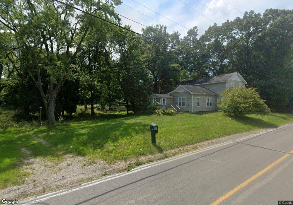
5015 Page Ave Jackson, MI 49201
Estimated Value: $211,000 - $425,000
4
Beds
2
Baths
2,330
Sq Ft
$121/Sq Ft
Est. Value
About This Home
This home is located at 5015 Page Ave, Jackson, MI 49201 and is currently estimated at $281,431, approximately $120 per square foot. 5015 Page Ave is a home located in Jackson County with nearby schools including Keicher Elementary School, Arnold Elementary School, and Michigan Center Junior/Senior High School.
Ownership History
Date
Name
Owned For
Owner Type
Purchase Details
Closed on
Oct 22, 2010
Sold by
Chalfant Gary L and Chalfant Connie L
Bought by
Topping Robert
Current Estimated Value
Home Financials for this Owner
Home Financials are based on the most recent Mortgage that was taken out on this home.
Original Mortgage
$140,932
Outstanding Balance
$93,047
Interest Rate
4.36%
Mortgage Type
New Conventional
Estimated Equity
$188,384
Purchase Details
Closed on
Sep 8, 2009
Sold by
Santora Barbara J
Bought by
Emc Mortgage Corporation
Purchase Details
Closed on
Nov 27, 2002
Sold by
Shellberg Mark Richard
Bought by
Santora Barbara Jeanne and Shellberg Barbara Jeanne
Create a Home Valuation Report for This Property
The Home Valuation Report is an in-depth analysis detailing your home's value as well as a comparison with similar homes in the area
Home Values in the Area
Average Home Value in this Area
Purchase History
| Date | Buyer | Sale Price | Title Company |
|---|---|---|---|
| Topping Robert | $133,500 | At | |
| Emc Mortgage Corporation | $1,000 | Nations Title Agency | |
| Santora Barbara Jeanne | -- | -- |
Source: Public Records
Mortgage History
| Date | Status | Borrower | Loan Amount |
|---|---|---|---|
| Open | Topping Robert | $140,932 |
Source: Public Records
Tax History
| Year | Tax Paid | Tax Assessment Tax Assessment Total Assessment is a certain percentage of the fair market value that is determined by local assessors to be the total taxable value of land and additions on the property. | Land | Improvement |
|---|---|---|---|---|
| 2025 | $2,371 | $114,320 | $0 | $0 |
| 2024 | $12 | $117,701 | $0 | $0 |
| 2022 | $1,805 | $106,778 | $0 | $0 |
| 2021 | $1,778 | $100,883 | $0 | $0 |
| 2020 | $1,762 | $83,842 | $0 | $0 |
| 2019 | $1,713 | $74,045 | $0 | $0 |
| 2018 | $1,673 | $66,044 | $13,683 | $52,361 |
| 2017 | $1,571 | $66,822 | $0 | $0 |
| 2016 | $970 | $67,590 | $14,376 | $53,214 |
| 2015 | -- | $58,537 | $58,537 | $0 |
| 2014 | -- | $53,627 | $0 | $0 |
| 2013 | -- | $53,627 | $53,627 | $0 |
Source: Public Records
Map
Nearby Homes
- 413 7th St
- 0 Huggins Unit 25000799
- 123 N Lakeside Dr
- 125 Edgewater Dr
- 240 Stillwell Ave
- 522 4th St
- VL Stillwell Ave
- 120 Cherry St
- 164 Orchard St
- 430 Jefferson Dr
- 244 Long Ave
- 210 W Grove Ave
- 6803 Napoleon Rd
- 0 Page Ave Unit 23140008
- 4109 Page Ave
- 6831 Price Lake Dr N
- 4934 Warsaw St
- VL S Sutton Rd
- 7430 Lee Rd
- 6835 S Price Lake Dr
Your Personal Tour Guide
Ask me questions while you tour the home.