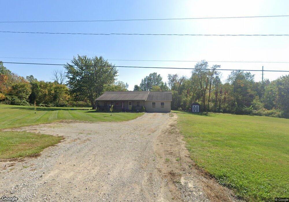
5015 State Route 181 Crestline, OH 44827
Estimated Value: $211,000 - $260,000
2
Beds
1
Bath
1,680
Sq Ft
$137/Sq Ft
Est. Value
About This Home
This home is located at 5015 State Route 181, Crestline, OH 44827 and is currently estimated at $230,842, approximately $137 per square foot. 5015 State Route 181 is a home located in Richland County with nearby schools including Crestline High School and St. Joseph Catholic School.
Ownership History
Date
Name
Owned For
Owner Type
Purchase Details
Closed on
Aug 9, 2012
Sold by
Gray Tiffany A and Gray Andrew M
Bought by
Fulton Lloyd H
Current Estimated Value
Purchase Details
Closed on
Feb 24, 2006
Sold by
Fulton Lloyd H and Fulton Nancy J
Bought by
Gray Andrew M and Gray Tiffany A
Home Financials for this Owner
Home Financials are based on the most recent Mortgage that was taken out on this home.
Original Mortgage
$122,000
Interest Rate
6.2%
Mortgage Type
Fannie Mae Freddie Mac
Purchase Details
Closed on
Nov 6, 2001
Sold by
Countrytyme Lodi Ltd
Bought by
Fulton Lloyd H and Fulton Nancy J
Create a Home Valuation Report for This Property
The Home Valuation Report is an in-depth analysis detailing your home's value as well as a comparison with similar homes in the area
Home Values in the Area
Average Home Value in this Area
Purchase History
| Date | Buyer | Sale Price | Title Company |
|---|---|---|---|
| Fulton Lloyd H | $86,000 | None Available | |
| Gray Andrew M | $106,350 | None Available | |
| Fulton Lloyd H | $23,500 | -- |
Source: Public Records
Mortgage History
| Date | Status | Borrower | Loan Amount |
|---|---|---|---|
| Previous Owner | Gray Andrew M | $122,000 |
Source: Public Records
Tax History Compared to Growth
Tax History
| Year | Tax Paid | Tax Assessment Tax Assessment Total Assessment is a certain percentage of the fair market value that is determined by local assessors to be the total taxable value of land and additions on the property. | Land | Improvement |
|---|---|---|---|---|
| 2024 | $2,758 | $60,240 | $10,190 | $50,050 |
| 2023 | $2,758 | $60,240 | $10,190 | $50,050 |
| 2022 | $2,766 | $51,030 | $9,590 | $41,440 |
| 2021 | $2,722 | $51,030 | $9,590 | $41,440 |
| 2020 | $2,882 | $51,030 | $9,590 | $41,440 |
| 2019 | $2,489 | $43,250 | $8,130 | $35,120 |
| 2018 | $2,459 | $43,250 | $8,130 | $35,120 |
| 2017 | $2,423 | $43,250 | $8,130 | $35,120 |
| 2016 | $2,420 | $45,130 | $7,540 | $37,590 |
| 2015 | $2,384 | $45,130 | $7,540 | $37,590 |
| 2014 | $2,445 | $45,130 | $7,540 | $37,590 |
| 2012 | $2,555 | $46,530 | $7,780 | $38,750 |
Source: Public Records
Map
Nearby Homes
- 4825 Lincoln Hwy
- 5263 Lincoln Hwy
- 5380 Lincoln Hwy
- 5446 Lincoln Hwy
- 5450 Lincoln Hwy
- 1260 Thrush Rd
- 718 E Main St
- 307 S Washington Ave
- 207 Maynard Ave
- 601 Scott St
- 302 S Washington St
- 414 South St
- 115 S Pierce St
- 763 County Line Rd Unit Lot 103
- 763 County Line Rd Unit Lot 109
- 763 County Line Rd Unit Lot 44
- 763 County Line Rd Unit Lot 48
- 763 County Line Rd
- 763 County Line Rd Unit 36
- 763 County Line Rd Unit 32
- 649 N Horning Rd
- 4951 State Route 181
- 5082 State Route 181
- 601 N Horning Rd
- 567 N Horning Rd
- 5049 State Route 181
- 4925 State Route 181
- 662 N Horning Rd
- 534 N Horning Rd
- 4901 State Route 181
- 500 N Horning Rd
- TBD Horning Rd
- 517 Horning Rd
- 483 N Horning Rd
- 4867 State Route 181
- 193 N Horning Rd
- 4860 State Route 181
- 0 Horning Rd
- 4841 State Route 181
- 5149 State Route 181