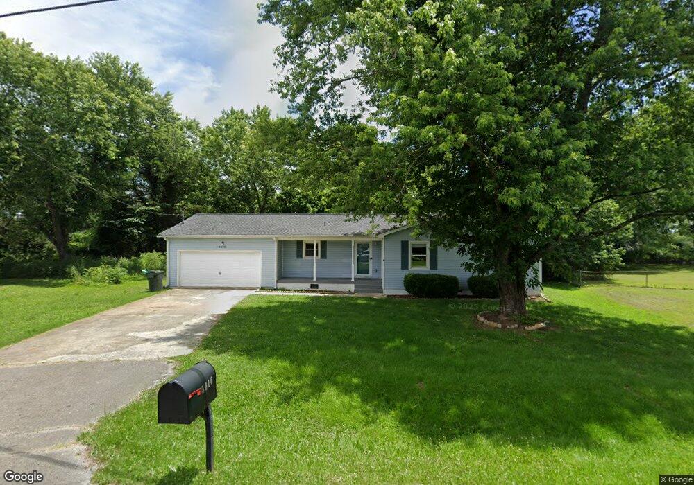
5016 Nancy Cir Huntsville, AL 35811
Estimated Value: $165,434 - $233,000
--
Bed
--
Bath
1,250
Sq Ft
$160/Sq Ft
Est. Value
About This Home
This home is located at 5016 Nancy Cir, Huntsville, AL 35811 and is currently estimated at $200,109, approximately $160 per square foot. 5016 Nancy Cir is a home with nearby schools including Riverton Elementary School, Riverton Intermediate School, and Buckhorn Middle School.
Ownership History
Date
Name
Owned For
Owner Type
Purchase Details
Closed on
Jul 21, 2020
Sold by
Smith Karen and Estate Of Michael Leroy Sprost
Bought by
Sproston Shannon
Current Estimated Value
Purchase Details
Closed on
Feb 11, 2005
Sold by
Dotson Ronnie and Dotson Peggy A
Bought by
Sproston Michael L
Home Financials for this Owner
Home Financials are based on the most recent Mortgage that was taken out on this home.
Original Mortgage
$78,300
Interest Rate
5.72%
Mortgage Type
New Conventional
Create a Home Valuation Report for This Property
The Home Valuation Report is an in-depth analysis detailing your home's value as well as a comparison with similar homes in the area
Home Values in the Area
Average Home Value in this Area
Purchase History
| Date | Buyer | Sale Price | Title Company |
|---|---|---|---|
| Sproston Shannon | -- | None Available | |
| Sproston Michael L | -- | -- |
Source: Public Records
Mortgage History
| Date | Status | Borrower | Loan Amount |
|---|---|---|---|
| Previous Owner | Sproston Michael L | $78,300 |
Source: Public Records
Tax History Compared to Growth
Tax History
| Year | Tax Paid | Tax Assessment Tax Assessment Total Assessment is a certain percentage of the fair market value that is determined by local assessors to be the total taxable value of land and additions on the property. | Land | Improvement |
|---|---|---|---|---|
| 2024 | $966 | $26,080 | $3,000 | $23,080 |
| 2023 | $943 | $25,000 | $3,000 | $22,000 |
| 2022 | $827 | $22,900 | $3,000 | $19,900 |
| 2021 | $360 | $11,300 | $1,500 | $9,800 |
| 2020 | $734 | $10,180 | $1,500 | $8,680 |
| 2019 | $706 | $9,790 | $1,500 | $8,290 |
| 2018 | $663 | $18,420 | $0 | $0 |
| 2017 | $275 | $8,980 | $0 | $0 |
| 2016 | $275 | $8,980 | $0 | $0 |
| 2015 | $275 | $8,980 | $0 | $0 |
| 2014 | $272 | $8,900 | $0 | $0 |
Source: Public Records
Map
Nearby Homes
- 119 River Downs Dr
- 211 Water Ridge Ln
- 143 River Pointe Dr
- 101 Riverway Ln
- 167 River Pointe Dr
- The Asheville Plan at Flint Meadows
- 169 River Pointe Dr
- 171 River Pointe Dr
- 183 River Pointe Dr
- 226 Twin Lakes Dr
- 179 River Pointe Dr
- 131 River Springs Ct
- 228 Twin Lakes Dr
- 230 Twin Lakes Dr
- 101 River Springs Ct
- 238 River Walk Trail
- 107 Mill Springs Ln
- 110 Mill Springs Ln
- 109 Mill Springs Ln
- 117 Mill Springs Ln
- 5018 Nancy Cir
- 5014 Nancy Cir
- 5020 Nancy Cir
- 5015 Nancy Cir
- 5013 Nancy Cir
- 5012 Nancy Cir
- 107 Winding Trail
- 109 Winding Trail
- 5022 Nancy Cir
- 105 Winding Trail
- 5011 Nancy Cir
- 5017 Nancy Cir
- 103 Winding Trail
- 111 Winding Trail
- 5010 Nancy Cir
- 2700 Winchester Rd NE Unit G
- 2700 Winchester Rd NE
- 2700 Winchester Rd NE Unit A-E
- 2700 Winchester Rd NE Unit H
- 5003 Nancy Cir