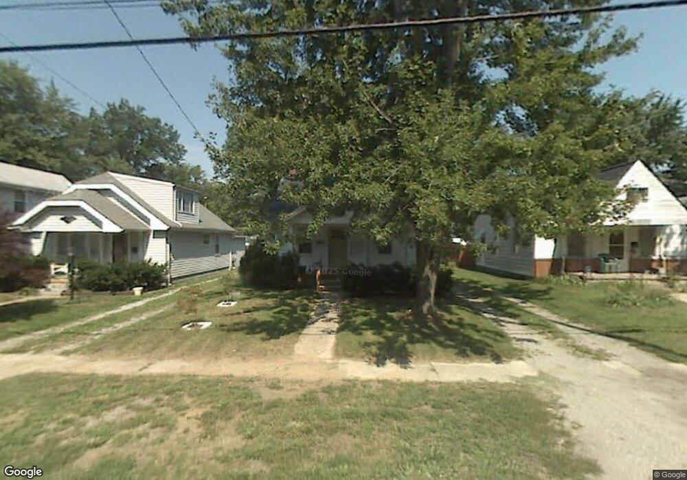
5016 Trellis Way Sylvania, OH 43560
Estimated Value: $93,000 - $141,000
2
Beds
1
Bath
948
Sq Ft
$129/Sq Ft
Est. Value
About This Home
This home is located at 5016 Trellis Way, Sylvania, OH 43560 and is currently estimated at $121,942, approximately $128 per square foot. 5016 Trellis Way is a home located in Lucas County with nearby schools including Hill View Elementary School, Sylvania Arbor Hills Junior High School, and Sylvania Northview High School.
Ownership History
Date
Name
Owned For
Owner Type
Purchase Details
Closed on
Oct 19, 2004
Sold by
Bennett Judith A and Bennett Judith A Friess
Bought by
Gallant Richard W
Current Estimated Value
Home Financials for this Owner
Home Financials are based on the most recent Mortgage that was taken out on this home.
Original Mortgage
$56,500
Outstanding Balance
$28,038
Interest Rate
5.8%
Mortgage Type
Purchase Money Mortgage
Estimated Equity
$93,904
Purchase Details
Closed on
Jan 27, 1999
Sold by
Estate Of Alice B Friess
Bought by
Bennett Judith A
Purchase Details
Closed on
Nov 12, 1998
Sold by
Estate Of Chelsea E Friess Jr
Bought by
Friess Alice B
Create a Home Valuation Report for This Property
The Home Valuation Report is an in-depth analysis detailing your home's value as well as a comparison with similar homes in the area
Home Values in the Area
Average Home Value in this Area
Purchase History
| Date | Buyer | Sale Price | Title Company |
|---|---|---|---|
| Gallant Richard W | $56,500 | Louisville Title Agency For | |
| Bennett Judith A | -- | -- | |
| Friess Alice B | -- | -- |
Source: Public Records
Mortgage History
| Date | Status | Borrower | Loan Amount |
|---|---|---|---|
| Open | Gallant Richard W | $56,500 |
Source: Public Records
Tax History Compared to Growth
Tax History
| Year | Tax Paid | Tax Assessment Tax Assessment Total Assessment is a certain percentage of the fair market value that is determined by local assessors to be the total taxable value of land and additions on the property. | Land | Improvement |
|---|---|---|---|---|
| 2024 | $943 | $28,560 | $8,120 | $20,440 |
| 2023 | $2,377 | $29,330 | $8,295 | $21,035 |
| 2022 | $2,373 | $29,330 | $8,295 | $21,035 |
| 2021 | $2,427 | $29,330 | $8,295 | $21,035 |
| 2020 | $2,303 | $24,535 | $7,000 | $17,535 |
| 2019 | $2,224 | $24,535 | $7,000 | $17,535 |
| 2018 | $1,974 | $24,535 | $7,000 | $17,535 |
| 2017 | $1,854 | $18,305 | $6,650 | $11,655 |
| 2016 | $1,822 | $52,300 | $19,000 | $33,300 |
| 2015 | $1,728 | $52,300 | $19,000 | $33,300 |
| 2014 | $1,481 | $17,610 | $6,410 | $11,200 |
| 2013 | $1,481 | $17,610 | $6,410 | $11,200 |
Source: Public Records
Map
Nearby Homes
- 5266 Whiteford Rd
- 5202 Arbor Way
- 4816 Sunwood Dr
- 4733 High Oaks Blvd
- 4810 Forest Hill Dr
- 4943 Flanders Rd
- 5679 Monroe St
- 4824 Skelly Rd
- 5689 Corey Cove Unit 5689
- 5004 Hunters Green Dr
- 4944 Hunters Green Dr
- 4832 Alexis Rd
- 4504 Sulgrave Dr
- 5731 Corey Cove
- 5664 Stewart Rd
- 4557 Sadalia Rd
- 4941 Gorham Place
- 5021 Rudgate Blvd
- 5 Riverhills Ln
- 5539 Ginger Tree Ln
- 5012 Trellis Way
- 5020 Trellis Way
- 5024 Trellis Way
- 5008 Trellis Way
- 5028 Trellis Way
- 5004 Trellis Way
- 5015 Arbor Way
- 5011 Arbor Way
- 5007 Arbor Way
- 4964 Trellis Way
- 5032 Trellis Way
- 5027 Arbor Way
- 5003 Arbor Way
- 5015 Trellis Way
- 5019 Trellis Way
- 5011 Trellis Way
- 4960 Trellis Way
- 5023 Trellis Way
- 5027 Trellis Way
- 5003 Trellis Way